
 United Kingdom
 France
 Germany
 Netherlands
 Sweden
 USA
USA
 Italy
Italy
 Spain
Spain
More From Contributor


Wales
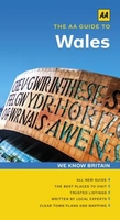
Wales at 1:250, 000 in a series of nine road maps from the AA, with particularly clear presentation of the road network, including speed cameras, and places of interest shown on a plain, unobtrusive base. Street plans of main towns highlight parking facilities.AA's regional road maps are characterised by their plain white base designed to provide an unobtrusive background for the road network and the names of towns and villages. Colouring is used only to show national parks and forest parks. Rivers and lakes are included, but other topographic information is limited to names of selected mountain ranges, peaks and valleys, plus spot heights. Steep roads have gradient signs. As expected from the AA, the road network is shown with considerable attention given to different types of
junctions and interchanges. Primary route destinations are highlighted and detailed information is provided on locations of speed cameras indicating speed limits. Services areas, tolls, etc., are marked and driving distance are given on A and selected B roads. Railway lines are shown with stations and ferry routes are included.The plain base also provides a clear background for a very wide range of symbols highlighting and/or naming numerous places of interest, including National Trust or English Heritage sites and their equivalents in Scotland and Wales, sport and recreational facilities, caravan and campsites, etc.The maps have the British national grid lines. The index is on the reverse and each title also includes indexed street plans of city centres, indicating main traffic
arteries, one way streets and parking facilities.In this title: street plans show the city centres in Aberystwyth, Bristol, Cardiff, Chester, Liverpool, Llandudno, Shrewsbury and Swansea.The current edition of this map was published in 2011.
Product Description
Reviews/Comments
Add New
Intelligent Comparison
Archived Product
Wales Stanfords
£11.19
Archived Product
Wales Stanfords
£10.39
Archived Product
Wales Stanfords
£16.95
Archived Product

Wales Stanfords
£16.99
Archived Product
Wales Stanfords
£17.99
Archived Product
Wales Stanfords
£12.99
Archived Product
Walls Stanfords
£14.99
Archived Product
Whale Stanfords
£110.00
Vouchers
No voucher codes found.
Do you know a voucher code for this product or supplier? Add it to Insights for others to use.
Do you know a voucher code for this product or supplier? Add it to Insights for others to use.
 Denmark