
 United Kingdom
 France
 Germany
 Netherlands
 Sweden
 USA
USA
 Italy
Italy
 Spain
Spain
More From Contributor


Waldhessen
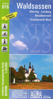
One of the titles in a series of topographic hiking maps covering the whole of the state of Hesse. All the maps have cartography identical to the standard topographic survey of Germany, with extensive overprint highlighting local footpaths, long-distance paths and cycling routes, indicating their waymarking. A wide range of symbols show various types of accommodation (campsites, youth hostels, etc), sport and recreational facilities, and places of interest. Most titles have a UTM grid. Map legend includes English.All of the titles either come with an accompanying brochure or have on the reverse illustrated descriptions, in German only, of various places of interest and contact details.
Product Description
Reviews/Comments
Add New
Intelligent Comparison
Archived Product
Waldsassen Stanfords
£11.50
Archived Product

Walden Stanfords
£6.99
Archived Product

Walden Stanfords
£6.99
Archived Product

Walden Stanfords
£6.99
Archived Product

Walden Stanfords
£8.99
Archived Product
Walcheren Stanfords
£8.99
Vouchers
No voucher codes found.
Do you know a voucher code for this product or supplier? Add it to Insights for others to use.
Do you know a voucher code for this product or supplier? Add it to Insights for others to use.
 Denmark