More From Contributor
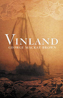
£3.99
This lovely reusable gift wrapping cloth by Ever Green Wraps is a new & fun idea to wrap presents. This is a unique wrapping featuring a big orange sun with the names of wine varieties & indigo striped rolling hills. No need for sticky tape or scissors, all you have to do is make a bow to fit the present & it will not end in the bin. It can be reused, transformed into a bag, a scarf or anything the imagination suggests! made from 100% cotton & machine washable, it comes in one size measuring Approx. 71x 72cm. This wrap is practical & a present on its own! ...
Archived Product
£15.95
A detailed, colour survey map from the Portuguese Military Survey's M782 series. Each map in this series has contours at 20m intervals with supplementary contours at 10m intervals. One major advantage the military mapping has over the civilian equivalent is that the legend is in English as well as Portuguese. This legend

Includes::
roads, railways, buildings, spot heights, vegetation type, fluvial information, scree, dunes, churches, ruins, etc. Latitude & longitude ticks are show at 10' intervals. Recently revised sheets also have a UTM grid at 100m intervals. Vertical Datum: Mean Sea Level at Cascais Harbour Projection: Transverse Mercator

...
Archived Product
£17.99
Topographic survey of Portugal at 1:50, 000 from the Instituto Geográfico do Exército, the country’s military survey organisation. The maps have contours at 20m intervals & in addition to the standard features shown on topographic mapping at this scale also indicate various types of terrain or vegetation (s&, terraces, rocks, woodlands, vineyards, etc). Each sheet covers an area of 32 x 20km (20 x 12.5 miles approx). The maps have a 1-km UTM grid plus latitude & longitude coordinates for the map corners. Map legend & a glossary of terms used on the maps include English.EDITION DATES: most titles in this series date from 1990s or later. To see all the titles in this series please click on the series link. ...
Archived Product
£17.99
Topographic survey of Portugal at 1:50, 000 from the Instituto Geográfico Português, the country’s civilian survey organisation. The maps have contours at 25m intervals & in addition to the standard features shown on topographic mapping at this scale also indicate various types of vegetation (vineyards, olive groves, etc). Each sheet covers an area of 32 x 20km (20 x 12.5miles approx). The maps have latitude & longitude margin ticks at 1’ intervals & UTM coordinates for the map corners – each sheet also shows conversion details from BBLx (Bessel-Bonnie system, Datum Lisbon) to UTM. Map legend is in Portuguese only.EDITION DATES: most titles in this series have now been updated in the 1990s or later. To see all the titles in this series please click on the series link. ...
Archived Product
£17.99
Topographic survey of Portugal at 1:100, 000 from the Instituto Geográfico Português, the country’s civilian survey organisation. The maps have contours at 50m intervals & in addition to the standard features shown on topographic mapping at this scale also indicate various types of vegetation (vineyards, olive groves, etc). Each sheet covers an area of 64 x 40km (40 x 25 miles approx). The maps have latitude & longitude margin ticks at 1’ intervals, plus show UTM coordinates for the map corners. Map legend is in Portuguese only.PLEASE NOTE
- EDITION DATES: some sheets at this scale date back to the 1950s or 1960s. For more recent editions please see IGP’s 1:25, 000 series where each 50K map is divided into four quarters. To see all the titles in the 1:100, 000 series please click on the series link.
...
Archived Product
£5.99
Administrative provinces of the Ukraine on indexed road maps at 1:250, 000, each with a town centre street plan of its capital city. All place names are in Cyrillic only, but the map legend

Includes::
English. Coverage of the larger provinces is divided between the two sides of the map. Road network is presented in great detail, from international roads, shown with their E numbers, to dirt roads & country paths. Driving distances are marked on main, secondary & selected local roads; the maps also show border crossings, fuel stations, car service stations, & traffic patrol service points. Railway lines are shown with stations & local airports are marked. The maps also show boundaries of districts into which each region (oblast) is subdivided, & indicate their administrative headquarters. Topography is indicated by spot height, plus boundaries of national parks & other protected areas, & colouring and/or graphics for forests, orchards, vineyards, swamps & salt marshes. The maps have latitude & longitude lines at 10’ & 15’ respectively, & are indexed. Map legend

Includes::
English. Each title also

Includes::
a local table of driving distances & a street plan of the region’s administrative capital annotated with locations of selected hotels, car parks & petrol stations, museums & monuments, etc. In some titles more street plans are included.IMPORTANT
- PLEASE NOTE: supplies of all maps published by the Kartografija in Kiev are irregular & we cannot guarantee a definite delivery time for titles currently not in stock. To see the list of other titles in this series please click on the series link.


...
Archived Product
£12.99
” For centuries a bastion of tradition & the jewel in the crown of French viticulture, Bordeaux has in recent years become dogged by controversy, particularly regarding the 2012 classification of the wines of St.-Emilion, the most prestigious appellation of Bordeaux`s right bank. St.-Emilion is an area increasingly dominated by big international investors, especially from China, who are keen to speculate on the area`s wines & l&, some of whose value has increased tenfold in the last decade alone. In the controversial 2012 classification, certain chateaux were promoted to a more prestigious class because of insider deals that altered the scoring system for the classification of wines into premier crus & grand crus. This system now takes into account the facilities of each chateau`s tasting room, the size of its warehouse, & even the extent of its parking lot. The quality of the wine counts for just 30% of the total score for the wines of the top ranking, those deemed premier grand cru classe A. In Vino Business, Saporta shows how back-room deals with wine distributors, multinational investors like the luxury company LVMH, & even wine critics, have fundamentally changed this ancient business. Saporta also investigates issues of wine labelling & the use of pesticides, & draws comparisons to Champagne, Burgundy & the rest of the wine world. Based on two years of research & reporting, Vino Business draws back the curtain on the secret world of Bordeaux, a land ever more in thrall to the grapes of wealth.” ...
Archived Product
£19.99
The new Supertrail Maps show the best singletrails in Europe’s hottest mountain bike spots. These unique topographic maps make the knowledge of locals available to other mountain bikers. Consistent difficulty rating & useful additional information prevent the user from critical situations on the trails. The best singletrails in the best mountain bike spots throughout Europe
- this is the convincing formula of the brand new Supertrail Maps. For the first time ever, these unique topographic maps make the knowledge of locals available to others. All the trails on a map have been biked & rated in five difficulty levels for up- & downhill separately by specially trained authors. This consistent rating facilitates tour planning & spares a user from getting into sketchy situations on the trails. In addition to the difficulty rating, extraordinary nice trails are marked with a «highlight»-pictogram. The maps in a scale of 1:50 000 show all information required for tour planning & orienting oneself on the trails, such as: difficulty, highlight-trails, mountain railways with mountain bike transport, mountain bike shuttles, dangerous falls, restaurants, bike shops, emergency numbers & touristic infopoints. Thanks to the especially chosen map section, one map covers the whole area. The Supertrail Maps are printed on tear- & waterproof foil which makes them very sturdy. On the back of any map, additional information about the area & the use of a Supertrail Map are presented in two languages. Folded

Dimensions of 10x 15cm allow the map to fit into any pocket without squeezing.


...
Archived Product
£10.99
Elegant, yet whimsical, playful & practical, these labels are perfect for adding characters to your luggage, correspondence, scrapbooks, journals & everyday embellishments. The package contains 24 sheets measuring 10x 13.5cm & containing assorted vintage map extracts stickers. Packaged in a tin this collection makes a unique & great gift idea. ...
Archived Product

Vinland

This book takes the reader on a journey from Orkney, over to Norway, into Iceland and Ireland, recreating with historical accuracy the customs and landscapes of the time while bringing the age to life through a large cast of engaging characters. Through the telling of Ranald`s story, Mackay Brown displays abundant knowledge about many facets of early Orkney life, of seamanship, marriage customs, beliefs and traditions and his portrayal of this age extends to the routine of the Norwegian Royal court. Traditional poetry is scattered throughout Mackay Brown`s prose adding a richness and depth to the tale he tells. Lore and legend, the elemental pull of the sea and the land, the sweetness of the early religion and the darker, more ancient rites, weave through this exquisite
celebration of Orcadian history and the inexorable seasons of life.
RIP - This product is no longer available on our network. It was last seen on 25.09.2019

This page now acts as a permanent archive for this product. Add more information using the comments box below to ensure it can still be found by future generations.

Use our search facility to see if it is available from an alternative contributor.
  • External links may include paid for promotion
  • Availability: Out Of Stock
  • Supplier: Stanfords
  • SKU: 9781904598336
Availability: In Stock
£7.99

Product Description

This book takes the reader on a journey from Orkney, over to Norway, into Iceland & Irel&, recreating with historical accuracy the customs & landscapes of the time while bringing the age to life through a large cast of engaging characters. Through the telling of Ranald`s story, Mackay Brown displays abundant knowledge about many facets of early Orkney life, of seamanship, marriage customs, beliefs & traditions & his portrayal of this age extends to the routine of the Norwegian Royal court. Traditional poetry is scattered throughout Mackay Brown`s prose adding a richness & depth to the tale he tells. Lore & legend, the elemental pull of the sea & the l&, the sweetness of the early religion & the darker, more ancient rites, weave through this exquisite celebration of Orcadian history & the inexorable seasons of life.

Reviews/Comments

Add New

Intelligent Comparison

Oooops!
We couldn't find anything!
Perhaps this product's unique.... Or perhaps we are still looking for comparisons!
Click to bump this page and we'll hurry up.

Price History

Vouchers

No voucher codes found.
Do you know a voucher code for this product or supplier? Add it to Insights for others to use.

Facebook

Jargon Buster

Brown - A colour, commonly associated with earth or soil
History - Anything that happens in the past. An acedemic subject.
Large - something that takes up more space than normal.
Traditional - Something that has become the same through a period of time and thus repeated.
Traditional - Something that has been around for a while and is repeated regularly.

Supplier Information

Stanfords
Stanfords was established in 1853 and opened their iconic Covent Garden flagship store in 1901. They have become the top retailer of maps, travel books and accessories in the UK and arguably offer the largest selection of maps and travel books worldwide. Famous names such as Captain Robert Falcon Scott, Ranulph Fiennes and Michael Palin have purchased from Stanfords. They now have a shop in Bristol and both stores together with other venues operate a calendar of events including talks, book signings and exhibitions. As a specialist map retailer, the map selection is comprehensive and includes road maps, street maps and walking maps from worldwide destinations, as well as a selection of world atlases and wall maps. Books include travel guides and travel literature. Stanfords also stock globes, from miniatures made of blue marble to magnificent floor-standing globes. The website features a selection of interesting articles on travel topics.
Page Updated: 2023-11-12 20:15:36

Community Generated Product Tags

Oh No! The productWIKI community hasn't generated any tags for this product yet!
Menu