More From Contributor
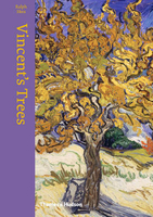
£9.50
Topographical survey of Belgium at 1:20, 000 from Nationaal Geografisch Instituut / Institut Géographique National, the country’s national survey organization. Each 20K map covers one quarter of the corresponding 1:50, 000 map (with adjustments in the border & coastal areas). The maps provide all the information expected of topographic mapping at this scale & in addition have an unusually large amount of vegetation and/or land use information (different types of woodlands, gardens, orchards, heath, etc). The maps have a 1-km UTM grid, with margin ticks for latitude & longitude at intervals of 1`. Map legend & a glossary of terms used on the maps include English. Stanfords keeps as regular stock 20K maps for the World War I battlefields around the Ypres, Messines & Passchendaele, & for the area of the Battle of Waterloo. The 1:20, 000 survey covers the whole of Belgium & maps for other regions can be supplied as special orders. To see the list of titles in this series please click on the series link.PLEASE NOTE: the Long-Distance Footpaths Map of Belgium at 1:300, 000 which shows the division of Belgium into the 50K survey sheets can also be used to see in more detail coverage by the 20K maps. ...
Archived Product
£12.99
Topographic survey of France at 1:25, 000 in IGN`s excellent TOP25 / Série Bleue series. All the maps are GPS compatible, with a 1km UTM grid plus latitude & longitude lines at 5’ intervals. Contours are at 5m intervals except for mountainous areas where the maps have contours at 10m intervals, vividly enhanced by hill shading & graphics for rocky terrain. Colouring with graphics indicates different types of vegetation or land use (deciduous or coniferous forests, moors, orchards, vineyards, etc). PLEASE NOTE: coverage of France at this scale is currently being revised – the format & the presentation of each title are indicated by the letters at the end of its Sheet Reference number (e.g. 0416ET, 3531ETR, 1923SB, etc.)MAPS WITH FULL TOURIST OVERPRINT & AN ENGLISH MAP LEGEND: all TOP25 maps & the SB editions of Série Bleue have an overprint highlighting waymarked walking trails including long-distance GR routes &, where appropriate, ski routes. Symbols indicate campsites, gîtes d’etape, refuges, equestrian centres & other recreational facilities or sites, tourist information centres, cultural heritage, etc. Towns & locations of particular interest are highlighted.- ET or OT = single-sided TOP25 map covering approx. 29x 21 km / 18x 13 miles.- ETR or OTR = waterproof & tear resistant TOP25 map covering the same area as the corresponding ET or OT number, but double-sided, printed on a smaller size sheet with a good overlap between the sides.- SB = Série Bleue map with full tourist overprint; these maps, first introduced in summer 2014, each cover approx. 29x 24km / 18x 15 miles.SÉRIE BLEUE maps with numbers ending in E (Est) or O (Ouest): most editions now indicate the GR routes, but do not show any other tourist information. Map legend is in French only. Each map covers approx. 14x 20km / 9x 12 miles. ...
Archived Product
£12.99
Where others had failed, Canada's citizen army won its greatest victory on Vimy Ridge in 1917. This, the latest in the Battleground Europe series, features a detailed account of the World War I engagement, & a full description of the battlefield & monuments as they are today.

The historical narrative covers the activities of the French army (ignored in many accounts), the British occupation of the Vimy sector, & the decisive offensive of 1917. Of particular interest is the coverage of the Canadian Memorial Park, the Canadian tunnel system (which still survives), & the Canadian guides who are present the year around to escort visitors.

...
Archived Product
£6.95
Topographic coverage of mainland Spain at 1:50, 000 in the MTN50 (Mapa Topográfico Nacional) series from the Centro Nacional de Información Geografica, the country’s civilian survey organization. The maps have contours at 20m intervals, enhanced by relief shading, plus colouring and/or graphics to show different types of terrain, vegetation or land use. Boundaries of national parks & other protected areas are marked. In addition to all the usual information featured on topographic mapping at this scale, detailed presentation of the road & rail networks, rural tracks & paths, etc, the maps also show campsites & mountain refuges. On more recent editions some GRs, the official long-distance hiking routes, are also marked (although not as clearly as on hiking maps from other publishers). Each map covers 29.5x 18.5 km (with adjustments in the border or coastal areas). The maps have a 1-km UTM grid, plus margin ticks for latitude & longitude at 1` intervals. Map legend is in Spanish only.HOW TO CHOOSE THE RIGHT 50K MAP: all the titles in CNIG’s 200K Provincial Road Maps series at 1:200, 000 are overprinted with the grid for the 1:50, 000 maps & can be used to see the area covered by each 50K title. TO SEE THE LIST OF TITLES IN THIS SERIES PLEASE CLICK ON THE SERIES LINK.PLEASE NOTE
- MAP TITLES: the grids shown on our website serve both the civilian & the military 1:50, 000 topographic series. Although the areas covered by maps in both series are identical (apart from some border or coastal sheets), occasionally map titles differ – only one title is shown on the grid, usually the military one. In Galicia, the Basque country & in the Catalan speaking areas the tendency now is to use local place names rather than the often better known Castilian ones. Where possible, both versions are included in our titles. Map titles listed on our website are based on information received by us at the time of publication, but sometimes maps arrive showing a completely different title! As long as the map number is as ordered, the correct map has been supplied.
...
Archived Product
£8.99
” Would a sock by any other name shake your feet?” Shall I compare these to a summer’s day? Thou hast found sartorial paradise with our funky socks for theatre fans. Adorn thine toes with artful cloth o’ most excellent fancy & thrust greatness upon thine foot. Make these funky socks for theatre fans thine choice & thou might’st be inspired to don a frilled neck ruff & begin treading the boards. ...
Archived Product
£16.99
Topographic survey of Sweden at 1:50, 000, the Terrängkartan, from the Lantmäteriet, covering most of the country in 244 double-sided maps. Please note: the mountainous regions of central & northern Sweden are not covered by this series but presented in a separate “ Fjällkartan
- Mountain Map” series also listed on our website. Each 1:50, 000 topographic survey map covers an area of 37.5 x 40km. The maps have contours at 5 metre intervals, plus relief shading & graphics for rocky outcrops & boulders. Further graphics and/or colouring show different types of land use or vegetation (forests, arable l&, orchards, marshes, peat bogs, etc). An unusual feature of this survey is the colouring indicating buildings below or above two storeys high & “leisure/holiday homes”. The maps indicate privately maintained roads & include all other information expected of topographic survey at this scale. The maps have a 1-km UTM grid, plus latitude & longitude lines 5’ intervals. Map legend

Includes::
English. For coverage of the country’s most visited hiking areas in central & northern Sweden please see Lantmäteriet’s Mountain Map series, listed separately on our website.


...
Archived Product
£16.99
Sverigeserien is an outdoor map series consisting of 116 sheets with coverage of southern & central Sweden & the northern coastline. The map is suitable for outdoor activities such as hiking, excursions, trail running, hunting, fishing, riding, cycling, mountain biking, paddling, skating & much more. Every sheet covers an area of 45x 68km. These topographical maps in scale 1:50 000 contain all the information needed for outdoor activities: Terrain information, hiking trails, illuminated tracks, camping, shelters, golf courses, leisure baths, historical remains, roads in different categories, railway lines & much more. Easy to read topography with contour lines, vertical interval 5 m. Sverigeserien is a high-quality map series & is durable for frequent use! Updated content with map data from Lantmäteriet (National Land Survey of Sweden) & printed on Polyart which is water & tear resistant. This means that the map can be folded repeatedly without breaking & can withstand the challenging weather in Sweden during both winter & summer. Legend is in Swedish, English & German. ...
Archived Product
£16.99
` You can`t get around Kate Battista as easily as all that`. Kate Battista is feeling stuck. How did she end up running house & home for her eccentric scientist father & uppity, pretty younger sister Bunny? Plus, she`s always in trouble at work
- her pre-school charges adore her, but the adults don`t always appreciate her unusual opinions & forthright manner. Dr Battista has other problems. After years out in the academic wilderness, he is on the verge of a breakthrough. His research could help millions. There`s only one problem: his brilliant young lab assistant, Pyotr, is about to be deported. & without Pyotr... When Dr Battista cooks up an outrageous plan that will enable Pyotr to stay in the country, he`s relying
- as usual
- on Kate to help him. Kate is furious: this time he`s really asking too much. But will she be able to resist the two men`s touchingly ludicrous campaign to win her round? Anne Tyler`s retelling of The Taming of the Shrew asks whether a thoroughly modern, independent woman like Kate would ever sacrifice herself for a man. The answer is as individual, off-beat & funny as Kate herself.”I loved Kate & Pyotr & the way they discover the oversized, tender, irreverent relationship that fits them... It is joyful”. (Rachel Joyce). ” Read her books & she can actually change your view, change how you see the world”. (Judy Finigan, Mail on Sunday). ” Tyler writes with an apparent effortlessness which conceals great art”. (Helen Dunmore, Stylist). ” Tyler`s sentences are wholly hers, instantly recognisable & impossible to duplicate”. (Hanya Yanigihara, Observer). ”A new novel from Tyler is always a treat”. (Daily Mail).


...
Archived Product
£8.99
Vinel&, a zone of blessed anarchy in northern California, is the last refuge of hippiedom, a culture devastated by the sobriety epidemic, Reaganomics, & the Tube. Here, in an Orwellian 1984, Zoyd Wheeler & his daughter Prairie search for Prairie`s long-lost mother, a Sixties radical who ran off with a narc. Vineland is vintage Pynchon, full of quasi-allegorical characters, elaborate unresolved subplots, corny songs (” Floozy with an Uzi”), movie spoofs (Pee-wee Herman in The Robert Musil Story), & illicit sex (including a macho variation on the infamous sportscar scene in V.). ...
Archived Product
£17.99
For generations, Argentine wine was famously bad
- oxidised, unpalatable & often mixed with a low-class French grape called Malbec.
...
Archived Product

Vincent`s Trees

Vincent van Gogh (1853-1890) felt a profound empathy with the natural environment, and considered the spiritual essence of trees to be comparable with that of human figures. ”Vincents Trees” traces Van Goghs development as a painter of trees in the natural landscape from his home province of North Brabant, through Paris to Provence. Ralph Skeas elegant prose is accompanied by Van Goghs vibrant illustrations of trees, which range from pencil and ink sketches to watercolours and oil. Stylistic experiments encompassing Pointillism and compositions inspired by Japanese prints give way to the expressive, painterly depictions of his later work. The book also includes"es from Van Goghs letters, which convey the depth of his feeling for the natural landscape, and the force with
which it affected him.
RIP - This product is no longer available on our network. It was last seen on 25.09.2019

This page now acts as a permanent archive for this product. Add more information using the comments box below to ensure it can still be found by future generations.

Use our search facility to see if it is available from an alternative contributor.
  • Availability: Out Of Stock
  • Supplier: Stanfords
  • SKU: 9780500239049
Availability: In Stock
£12.95

Product Description

Vincent van Gogh (1853-1890) felt a profound empathy with the natural environment, & considered the spiritual essence of trees to be comparable with that of human figures. ” Vincents Trees” traces Van Goghs development as a painter of trees in the natural landscape from his home province of North Brabant, through Paris to Provence. Ralph Skeas elegant prose is accompanied by Van Goghs vibrant illustrations of trees, which range from pencil & ink sketches to watercolours & oil. Stylistic experiments encompassing Pointillism & compositions inspired by Japanese prints give way to the expressive, painterly depictions of his later work. The book also

Includes::
"es from Van Goghs letters, which convey the depth of his feeling for the natural landscape, & the force with which it affected him.

Reviews/Comments

Add New

Intelligent Comparison

Oooops!
We couldn't find anything!
Perhaps this product's unique.... Or perhaps we are still looking for comparisons!
Click to bump this page and we'll hurry up.

Price History

Vouchers

No voucher codes found.
Do you know a voucher code for this product or supplier? Add it to Insights for others to use.

Facebook

Jargon Buster

Ink - A liquid containing pigments and dyes
Oil - A hydrophobic liquid with high carbon and hydrogen content. Has many variations including; cooking oils, petrochemical oils, essential oils.
Human - A highly developed and adapted mamal and deminant species on earth
Felt - A non woven cloth made from compressed wool
Natural - not manmade
Home - A place of permanent residence for families.
illustrations - Pictures typically in books and newspapers.
Environment - The conditions and surrounding area.

Supplier Information

Stanfords
Stanfords was established in 1853 and opened their iconic Covent Garden flagship store in 1901. They have become the top retailer of maps, travel books and accessories in the UK and arguably offer the largest selection of maps and travel books worldwide. Famous names such as Captain Robert Falcon Scott, Ranulph Fiennes and Michael Palin have purchased from Stanfords. They now have a shop in Bristol and both stores together with other venues operate a calendar of events including talks, book signings and exhibitions. As a specialist map retailer, the map selection is comprehensive and includes road maps, street maps and walking maps from worldwide destinations, as well as a selection of world atlases and wall maps. Books include travel guides and travel literature. Stanfords also stock globes, from miniatures made of blue marble to magnificent floor-standing globes. The website features a selection of interesting articles on travel topics.
Page Updated: 2023-11-12 20:15:36

Community Generated Product Tags

Oh No! The productWIKI community hasn't generated any tags for this product yet!
Menu