More From Contributor

£15.99
Vienna Woods (Wienerwald) Hiking Atlas from Freytag & Berndt, combining their series of walking maps into a pocket-size atlas with hiking suggestions & descriptions of places of interest. * Map legend

Includes::
English but all the text is in German only.*

...
Archived Product
£13.95
Vienna Woods (Wienerwald) Hiking Atlas from Freytag & Berndt, combining their series of walking maps into a pocket-size atlas with hiking suggestions & descriptions of places of interest. Map legend

Includes::
English but all the text is in German only.

...
Archived Product
£12.99
The Vienna Woods (Wienerwald) at 1:35, 000 on a GPS compatible, double-sided map from Kümmerly+ Frey printed on sturdy, waterproof & tear-resistant synthetic paper; contoured, with hiking, cycling & ski routes, accommodation facilities, locations for other recreational activities, etc. Maps in the K+F recreational series covering the Austrian Alps are either at 1:50, 000 or 1:35, 000. Contour interval is 40m, enhanced by relief shading & finely drawn additional graphic relief to provide an excellent representation of the terrain. The maps have plenty of names of peaks, valleys, etc, plus colouring/graphics indicating different types of vegetation, & show boundaries of national parks or other protected areas. An overprint, graded according to the difficulty of the route, highlights local hiking trails & long-distance paths indicating, where appropriate, their numbers or names. Also marked are local & long-distance cycle routes, plus a selection of mountain-bike trails, cross-country & alpine ski routes & horse-riding paths. Symbols mark locations for other outdoor activities (climbing, paragliding), different types of accommodations including alpine huts, campsites & youth hostels, sites of botanical or cultural interest, etc. The maps have a 1- km UTM grid. Map legend

Includes::
English. Each title also provides a small road map of the region around the area covered by it. To see the complete list of all the titles please click on the series link.

...
Archived Product
£14.99
640km of cycling routes in the Vienna Woods, Vienna’s “ Green Lungs”, at 1:75, 000 by Verlag Esterbauer with essential information on accommodation, repair facilities, etc. All the text is in GERMAN only but extensive map legend

Includes::
English, as shown on our sample image. Esterbauer’s Bikeline guides in this series can be used without any knowledge of German, particularly in the absence of similar products in English from other publishers. Each atlas

Includes::
a selection of local cycling routes & tours, presented on clear, easy to follow maps. The overprint highlighting the routes indicates road surface & density of motorized traffic. Gradients, intermediate distances, danger points & roads closed to cyclists are marked, & route profiles show the degree of difficulty for each cycle path. A wide range of symbols indicate everything from covered & lockable bicycle stands, repair workshops & bike rentals to viewpoints, nature parks, leisure & sport centres, local shopping facilities, emergency services, etc. The guides also give opening hours of museums & other local places of interest. A separate section at the end of each guide lists accommodation addresses with phone numbers. To see other titles in this series please click on the series link.


...
Archived Product
£9.99
The Vienna Woods at 1:50, 000 in a series of contoured & GPS compatible outdoor leisure map from Freytag & Berndt with hiking & cycling routes, mountain huts, campsites & youth hostels, local bus stops, plus other tourist information. To see the list of currently available titles in this series please click on the series link. Freytag & Berndt’s outdoor leisure maps cover the whole of Austria at 1:50, 000, with selected popular areas also presented with 50K cartography enlarged to 1:35, 000 for larger print & clearer legibility. The maps have contours at 100m intervals in the mountainous areas & 50m elsewhere, enhanced by shading, graphic relief & colouring for woodlands. The overprint highlighting waymarked hiking trails is graded into three types: easy walks, mountain paths, & more difficult alpine sections. Waymarked trails including long-distance routes are annotated with their numbers and/or signs. The maps also highlight cycling & mountain biking routes, cross-country ski tracks, & Nordic walking tracks. Symbols indicate mountain huts, youth hostels, campsites & countryside hotels/inns, bus stops on local roads, car parks plus various facilities & places of interest. The maps have a 2-km UTM grid, plus latitude & longitude margin ticks at 5’ intervals. Selected titles also have in the accompanying booklet (see below) an additional list of GPS waypoints indicated on the map. Map legend

Includes::
English.IMPORTANT, PLEASE READ BEFORE ORDERING: most titles come with booklets in GERMAN containing extensive additional information including an index of main locations, suggestions for walks (often accompanied by route profiles) & other recreational activities, lists of mountain huts & other recommended accommodation, etc. Unless specified in the title’s individual description, all the information is in German only & no English language version of the booklet is available. Some titles carry similar information on the reverse.

...
Archived Product
£13.99
You can count on Rick Steves to tell you what you really need to know when traveling in Vienna. With this guide, you`ll explore elegant Vienna--the epicenter of opera, coffee, Art Nouveau, & waltz music. Meander through Habsburg palaces & nibble a Sacher torte in a velvet-lined cafe. In the evening, catch a classical concert, or sip wine with the locals in a traditional Heuriger garden. Beyond Vienna, stroll the Baroque street of Salzburg, home to Mozart & The Sound of Music. For a taste of the Alpine living, head to the snowy peaks & green valleys of Tirol. Rick`s candid, humorous advice will guide you to good-value hotels & restaurants. He`ll help you plan where to go & what to see, depending on the length of your trip. You`ll get up-to-date recommendations about what is worth your time & money. More than just reviews & directions, a Rick Steves guidebook is a tour guide in your pocket. ...
Archived Product
£12.99
Monocle reports from around the globe in print, on radio, & online. As its editors & correspondents dart from city to city, they get to know the best places to rest their heads, stretch their limbs, & kick back with a contact in a hard-to-find cocktail bar. That information is now available in The Monocle Travel Guide Series: a line-up of titles that speaks to you in an informed but informal way about everything from architecture to art, late-night bars to early-morning markets. Expect a mix of experiences dotted with some quirky surprises. These are books where grand hotels appear alongside family-owned bistros & internationally renowned galleries sit next to unassuming indie clubs that play host to top music talent. The Monocle Travel Guides mix the classic with the contemporary, go beyond the conventional, & reveal all the hidden spots that cities have to offer. ...
Archived Product
£11.50
Topographic survey of France at 1:25, 000 in IGN`s excellent TOP25 / Série Bleue series. All the maps are GPS compatible, with a 1km UTM grid plus latitude & longitude lines at 5’ intervals. Contours are at 5m intervals except for mountainous areas where the maps have contours at 10m intervals, vividly enhanced by hill shading & graphics for rocky terrain. Colouring with graphics indicates different types of vegetation or land use (deciduous or coniferous forests, moors, orchards, vineyards, etc). PLEASE NOTE: coverage of France at this scale is currently being revised – the format & the presentation of each title are indicated by the letters at the end of its Sheet Reference number (e.g. 0416ET, 3531ETR, 1923SB, etc.)MAPS WITH FULL TOURIST OVERPRINT & AN ENGLISH MAP LEGEND: all TOP25 maps & the SB editions of Série Bleue have an overprint highlighting waymarked walking trails including long-distance GR routes &, where appropriate, ski routes. Symbols indicate campsites, gîtes d’etape, refuges, equestrian centres & other recreational facilities or sites, tourist information centres, cultural heritage, etc. Towns & locations of particular interest are highlighted.- ET or OT = single-sided TOP25 map covering approx. 29x 21 km / 18x 13 miles.- ETR or OTR = waterproof & tear resistant TOP25 map covering the same area as the corresponding ET or OT number, but double-sided, printed on a smaller size sheet with a good overlap between the sides.- SB = Série Bleue map with full tourist overprint; these maps, first introduced in summer 2014, each cover approx. 29x 24km / 18x 15 miles.SÉRIE BLEUE maps with numbers ending in E (Est) or O (Ouest): most editions now indicate the GR routes, but do not show any other tourist information. Map legend is in French only. Each map covers approx. 14x 20km / 9x 12 miles. ...
Archived Product
£24.99
This beautiful book, based on the original notebook & recipe journal of a 1900s ” Viennese Baroness”, takes readers on a journey through fin de siecle Viennese high society. With over 100 original recipes, all of which have been tested & brought up to date for the modern cook, it is not only a beautiful collection of recipes but is also a fascinating look at the life of a turn-of-the-century family. Filled with anecdotes & personal stories to bring the recipes to life, this book will be a charming insight into a bygone era. The classic recipes will cover a range of dishes both savoury & sweet, with a strong emphasis on the desserts & pastries for which Vienna is famed. It

Includes::
chapters such as Starters, Soups, Meat Dishes, Side Dishes, Biscuits & Cookies, Sweet Pastries, Cakes & Gateaux, Tortes & Puddings. In addition there are beautiful photographs of Vienna throughout the book, capturing the architecture, cafe culture & beauty of this elegant city.

...
Archived Product
£12.99
Topographic survey of France at 1:25, 000 in IGN`s excellent TOP25 / Série Bleue series. All the maps are GPS compatible, with a 1km UTM grid plus latitude & longitude lines at 5’ intervals. Contours are at 5m intervals except for mountainous areas where the maps have contours at 10m intervals, vividly enhanced by hill shading & graphics for rocky terrain. Colouring with graphics indicates different types of vegetation or land use (deciduous or coniferous forests, moors, orchards, vineyards, etc). PLEASE NOTE: coverage of France at this scale is currently being revised – the format & the presentation of each title are indicated by the letters at the end of its Sheet Reference number (e.g. 0416ET, 3531ETR, 1923SB, etc.)MAPS WITH FULL TOURIST OVERPRINT & AN ENGLISH MAP LEGEND: all TOP25 maps & the SB editions of Série Bleue have an overprint highlighting waymarked walking trails including long-distance GR routes &, where appropriate, ski routes. Symbols indicate campsites, gîtes d’etape, refuges, equestrian centres & other recreational facilities or sites, tourist information centres, cultural heritage, etc. Towns & locations of particular interest are highlighted.- ET or OT = single-sided TOP25 map covering approx. 29x 21 km / 18x 13 miles.- ETR or OTR = waterproof & tear resistant TOP25 map covering the same area as the corresponding ET or OT number, but double-sided, printed on a smaller size sheet with a good overlap between the sides.- SB = Série Bleue map with full tourist overprint; these maps, first introduced in summer 2014, each cover approx. 29x 24km / 18x 15 miles.SÉRIE BLEUE maps with numbers ending in E (Est) or O (Ouest): most editions now indicate the GR routes, but do not show any other tourist information. Map legend is in French only. Each map covers approx. 14x 20km / 9x 12 miles. ...
Archived Product

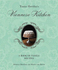
Vienna, Prague, Budapest

This title features dynamic two-colour layout for easy navigation. It contains brand new colour section that gives a photographic overview of the region, together with special features of the region, tailored itineraries and lists of the best things to do. It includes full-colour touring maps of the whole region. It offers extensive listings of hotels and restaurants - all personally recommended for a really local flavour. It provides `Top Don`t Miss` sights for each regional chapter, plus `Author Choices` of personal favourite places to stay and eat. It explores these three fairytale capitals, peppered with domes and spiked with spires. Vienna, Prague and Budapest have lived through tumultuous histories but thrive today at the heart of modern Europe. This title examines Art Nouveau
art and architecture in Vienna, soaring Gothic churches in Prague and Budapest`s stately boulevards and vistas. It details 16th-century Turkish baths in Budapest, the opera in Vienna, and the romantic gardens of Prague`s Mala Strana.It also offers detailed coverage of the best places to eat and sleep including a Viennese aristocratic palace adorned with crystal and velvet, and the atmospheric beer halls of Prague.
RIP - This product is no longer available on our network. It was last seen on 25.09.2019

This page now acts as a permanent archive for this product. Add more information using the comments box below to ensure it can still be found by future generations.

Use our search facility to see if it is available from an alternative contributor.
  • External links may include paid for promotion
  • Availability: Out Of Stock
  • Supplier: Stanfords
  • SKU: 9781860114359
Availability: In Stock
£12.99

Product Description

This title features dynamic two-colour layout for easy navigation. It contains brand new colour section that gives a photographic overview of the region, together with special features of the region, tailored itineraries & lists of the best things to do. It

Includes::
full-colour touring maps of the whole region. It offers extensive listings of hotels & restaurants
- all personally recommended for a really local flavour. It provides ` Top Don`t Miss` sights for each regional chapter, plus ` Author Choices` of personal favourite places to stay & eat. It explores these three fairytale capitals, peppered with domes & spiked with spires. Vienna, Prague & Budapest have lived through tumultuous histories but thrive today at the heart of modern Europe. This title examines Art Nouveau art & architecture in Vienna, soaring Gothic churches in Prague & Budapest`s stately boulevards & vistas. It details 16th-century Turkish baths in Budapest, the opera in Vienna, & the romantic gardens of Prague`s Mala Strana. It also offers detailed coverage of the best places to eat & sleep including a Viennese aristocratic palace adorned with crystal & velvet, & the atmospheric beer halls of Prague.

Reviews/Comments

Add New

Intelligent Comparison

Oooops!
We couldn't find anything!
Perhaps this product's unique.... Or perhaps we are still looking for comparisons!
Click to bump this page and we'll hurry up.

Price History

Vouchers

No voucher codes found.
Do you know a voucher code for this product or supplier? Add it to Insights for others to use.

Facebook

Jargon Buster

Colour - The categorised spectrum of light visable to humans
Heart - An organ that pumps blood around the body. Usually related to love.
Velvet - A soft fabric with a small pile.
Flavour - The taste of a food product.
Crystal - A solid substance that has symmetrically carved plane faces and can be regularly found in jewellery.
Crystal - A solid clear substance with many surfaces that glisten, commonly used in jewellery
Personal - Something that belongs more to an individual due to it affecting them more by relating to them.
Regional - An adjective to describe a set geographic area.
Crystal - A solid substance with symmetrically arranged planes, commonly found in jewellery.

Supplier Information

Stanfords
Stanfords was established in 1853 and opened their iconic Covent Garden flagship store in 1901. They have become the top retailer of maps, travel books and accessories in the UK and arguably offer the largest selection of maps and travel books worldwide. Famous names such as Captain Robert Falcon Scott, Ranulph Fiennes and Michael Palin have purchased from Stanfords. They now have a shop in Bristol and both stores together with other venues operate a calendar of events including talks, book signings and exhibitions. As a specialist map retailer, the map selection is comprehensive and includes road maps, street maps and walking maps from worldwide destinations, as well as a selection of world atlases and wall maps. Books include travel guides and travel literature. Stanfords also stock globes, from miniatures made of blue marble to magnificent floor-standing globes. The website features a selection of interesting articles on travel topics.
Page Updated: 2023-11-12 20:15:36

Community Generated Product Tags

Oh No! The productWIKI community hasn't generated any tags for this product yet!
Menu