
 United Kingdom
 France
 Germany
 Netherlands
 Sweden
 USA
USA
 Italy
Italy
 Spain
Spain
More From Contributor

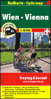
Vienna Cycle Map F&B RKW
Vienna Cycle Map at 1:30, 000 with the city centre at 1:17, 500 from Austria’s leading map publishers Freytag and Berndt, on a light, waterproof and tear resistant paper with cycle paths, Citybike stations, etc. The map is double-sided to cover the city within its administrative boundary so that its outer suburbs are included. A very generous overlap between the two sides means that the central districts are conveniently shown on both sides of the map. Colouring of the overprint indicates if the cycle routes are along separate designated paths or on roads with motorized traffic. Stretches of long-distance cycle paths within the city, such as the EuroVelo 6 Danube Cycle Path, are highlighted and mountain bike routes are indicated. Symbols mark dangerous crossings and locations of
cycle hire or repair facilities. Locations of public Citybike stations are marked, including near the Schönbrunn Palace and the Prater. The city’s central districts within the Gürtel ring are shown in greater detail on an inset at 1:17, 500. The base map indicates main traffic routes and shows tram and bus lines with stops and route numbers as well as U-Bahn, S-Bahn and railway stations. Map legend includes English.To see the list of F&B cycling maps of Austria please click on the series link.
cycle hire or repair facilities. Locations of public Citybike stations are marked, including near the Schönbrunn Palace and the Prater. The city’s central districts within the Gürtel ring are shown in greater detail on an inset at 1:17, 500. The base map indicates main traffic routes and shows tram and bus lines with stops and route numbers as well as U-Bahn, S-Bahn and railway stations. Map legend includes English.To see the list of F&B cycling maps of Austria please click on the series link.

Product Description
Reviews/Comments
Add New
Vouchers
No voucher codes found.
Do you know a voucher code for this product or supplier? Add it to Insights for others to use.
Do you know a voucher code for this product or supplier? Add it to Insights for others to use.
 Denmark