More From Contributor

£8.99
Volcanoes continue to grab our imagination
- & Vesuvius is the most famous of them all. There have been nearly thirty major eruptions
...
Archived Product
£4.99
Veszprém in a series of street plans of Hungary’s main towns from Cartographia in Budapest. The plans cover the whole town with its outer suburbs &, where appropriate, have an enlargement for the central area. All the plans have a street index. Map legend varies; in plans of larger towns or popular tourist destinations it usually

Includes::
English. Many plans also include additional

Features:
insets with plans of larger satellite developments or villages, lists of sights and/or various municipal offices & facilities, etc. Some titles include on the reverse a road map of the town’s environs or the administrative province.


...
Archived Product
£9.99
Are You Ready for the Challenge? So you really love animals...what would it really be like to be a vet & work with animals every day? Let`s find out if you have what it takes... Start learning the basics required to become a vet with this unique activity book. Vet Academy

Includes::
sections about the three main different types of vet you might become
- Pet Vet, Zoo Vet or Farm Vet. A wide range of topics are covered, from learning about baby animals & everything they need to grow strong & healthy to finding out about vaccinations & diets for different animals. You will also learn about animal body language, exercise, & keeping animals happy & healthy! Key skills are practised with a variety of fun activities, including observation, speed & accuracy tasks, & matching & finding games Entertaining, educational, & engaging, Vet Academy makes veterinary science fun & accessible for kids who love animals.


...
Archived Product
£16.99
Sverigeserien is an outdoor map series consisting of 116 sheets with coverage of southern & central Sweden & the northern coastline. The map is suitable for outdoor activities such as hiking, excursions, trail running, hunting, fishing, riding, cycling, mountain biking, paddling, skating & much more. Every sheet covers an area of 45x 68km. These topographical maps in scale 1:50 000 contain all the information needed for outdoor activities: Terrain information, hiking trails, illuminated tracks, camping, shelters, golf courses, leisure baths, historical remains, roads in different categories, railway lines & much more. Easy to read topography with contour lines, vertical interval 5 m. Sverigeserien is a high-quality map series & is durable for frequent use! Updated content with map data from Lantmäteriet (National Land Survey of Sweden) & printed on Polyart which is water & tear resistant. This means that the map can be folded repeatedly without breaking & can withstand the challenging weather in Sweden during both winter & summer. Legend is in Swedish, English & German. ...
Archived Product
£11.99
Topographical survey of Belgium at 1:20, 000 from Nationaal Geografisch Instituut / Institut Géographique National, the country’s national survey organization. Each 20K map covers one quarter of the corresponding 1:50, 000 map (with adjustments in the border & coastal areas). The maps provide all the information expected of topographic mapping at this scale & in addition have an unusually large amount of vegetation and/or land use information (different types of woodlands, gardens, orchards, heath, etc). The maps have a 1-km UTM grid, with margin ticks for latitude & longitude at intervals of 1`. Map legend & a glossary of terms used on the maps include English. Stanfords keeps as regular stock 20K maps for the World War I battlefields around the Ypres, Messines & Passchendaele, & for the area of the Battle of Waterloo. The 1:20, 000 survey covers the whole of Belgium & maps for other regions can be supplied as special orders. To see the list of titles in this series please click on the series link.PLEASE NOTE: the Long-Distance Footpaths Map of Belgium at 1:300, 000 which shows the division of Belgium into the 50K survey sheets can also be used to see in more detail coverage by the 20K maps. ...
Archived Product
£12.99
Topographic survey of France at 1:25, 000 in IGN`s excellent TOP25 / Série Bleue series. All the maps are GPS compatible, with a 1km UTM grid plus latitude & longitude lines at 5’ intervals. Contours are at 5m intervals except for mountainous areas where the maps have contours at 10m intervals, vividly enhanced by hill shading & graphics for rocky terrain. Colouring with graphics indicates different types of vegetation or land use (deciduous or coniferous forests, moors, orchards, vineyards, etc). PLEASE NOTE: coverage of France at this scale is currently being revised – the format & the presentation of each title are indicated by the letters at the end of its Sheet Reference number (e.g. 0416ET, 3531ETR, 1923SB, etc.)MAPS WITH FULL TOURIST OVERPRINT & AN ENGLISH MAP LEGEND: all TOP25 maps & the SB editions of Série Bleue have an overprint highlighting waymarked walking trails including long-distance GR routes &, where appropriate, ski routes. Symbols indicate campsites, gîtes d’etape, refuges, equestrian centres & other recreational facilities or sites, tourist information centres, cultural heritage, etc. Towns & locations of particular interest are highlighted.- ET or OT = single-sided TOP25 map covering approx. 29x 21 km / 18x 13 miles.- ETR or OTR = waterproof & tear resistant TOP25 map covering the same area as the corresponding ET or OT number, but double-sided, printed on a smaller size sheet with a good overlap between the sides.- SB = Série Bleue map with full tourist overprint; these maps, first introduced in summer 2014, each cover approx. 29x 24km / 18x 15 miles.SÉRIE BLEUE maps with numbers ending in E (Est) or O (Ouest): most editions now indicate the GR routes, but do not show any other tourist information. Map legend is in French only. Each map covers approx. 14x 20km / 9x 12 miles. ...
Archived Product
£11.50
Topographic survey of France at 1:25, 000 in IGN`s excellent TOP25 / Série Bleue series. All the maps are GPS compatible, with a 1km UTM grid plus latitude & longitude lines at 5’ intervals. Contours are at 5m intervals except for mountainous areas where the maps have contours at 10m intervals, vividly enhanced by hill shading & graphics for rocky terrain. Colouring with graphics indicates different types of vegetation or land use (deciduous or coniferous forests, moors, orchards, vineyards, etc). PLEASE NOTE: coverage of France at this scale is currently being revised – the format & the presentation of each title are indicated by the letters at the end of its Sheet Reference number (e.g. 0416ET, 3531ETR, 1923SB, etc.)MAPS WITH FULL TOURIST OVERPRINT & AN ENGLISH MAP LEGEND: all TOP25 maps & the SB editions of Série Bleue have an overprint highlighting waymarked walking trails including long-distance GR routes &, where appropriate, ski routes. Symbols indicate campsites, gîtes d’etape, refuges, equestrian centres & other recreational facilities or sites, tourist information centres, cultural heritage, etc. Towns & locations of particular interest are highlighted.- ET or OT = single-sided TOP25 map covering approx. 29x 21 km / 18x 13 miles.- ETR or OTR = waterproof & tear resistant TOP25 map covering the same area as the corresponding ET or OT number, but double-sided, printed on a smaller size sheet with a good overlap between the sides.- SB = Série Bleue map with full tourist overprint; these maps, first introduced in summer 2014, each cover approx. 29x 24km / 18x 15 miles.SÉRIE BLEUE maps with numbers ending in E (Est) or O (Ouest): most editions now indicate the GR routes, but do not show any other tourist information. Map legend is in French only. Each map covers approx. 14x 20km / 9x 12 miles. ...
Archived Product
£11.99
Obtain your radio license & operate a VHF radio set on your yacht or motorboat. This book explains how to use a VHF radio on your boat. It covers licensing the boat & the operator, then takes you through each type of call, & its `standard procedure`. You can also call using Digital Selective Calling (DSC) & the book has photo sequences of how to do this. Each procedure is illustrated using the story of the yacht Sierra making various passages & communicating with other vessels, the Coastguard & other VHF operators such as yacht clubs. Probably the most important section is sending a Mayday
- the nautical call for help. This 3rd edition contains all relevant updates including the latest technology developments, & VHF protocols.* Recommended for the Short Range Certificate* Helps you pass the exam* Excellent reference book to keep on board* Fully illustrated step-by-step guides to every VHF procedure* Fun animations to describe new topics & concepts* Covers DSC, SARTS, EPIRBs, NAVTEX & CG66
...
Archived Product
£7.99
VHF Companion 2nd Edition features 24 splash proof cards covering every type of radio call
- from Mayday to calling another boat
...
Archived Product
£12.99
Via Alpina across Slovenia at 1:50, 000 from Kartografija in Ljubljana, covering the route northwards from the Slovenian Istria to the Julian Alps & then eastwards from Triglav to Jezerski Peak. Accommodation for hikers is included. The route from Krvavi Potok to the Austrian border just north of Kranjska Gora in the Julian Alps is 220km long (estimated time 7 days), & the trail from Triglav to Jezerski Vrh covers 120km (estimated time 7 days). This title is a set of two separate maps, one for each route, presenting it on panels with detailed, countoured (20m intervals) mapping at 1:50, 000 overprinted with the route & the accommodation facilities along it. Nearby towns & villages also show accommodation, restaurants, places of interest, recreational facilities, petrol stations, etc. Each panel has latitude & longitude lines at intervals of 2’30’. Each map

Includes::
a list of hotels along its route specializing in accommodation for hikers, giving contact details & GPS coordinates. Map legend & all relevant text include English.

...
Archived Product

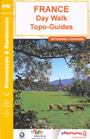
Vexin Le - PNR Du Vexin Francais A Pied 33PR

Le Parc naturel régional du Vexin français à pied, FFRP topo-guide Ref. No.PN14, with 32 day walks of varying length and difficulty in the area north-west of Paris. Each walk is presented on a separate colour extract from IGN’s topographic survey of France at 1:25, 000, with its description cross-referenced to the map. Current edition of this title was published in April 2014.To see the list of other FFRP guides with day walks please click on the series link.ABOUT THE FFRP (Fédération française de la randonnée pédestre) TOPOGUIDES: published in a handy A5 paperback format, the guides are the best companions for hiking in France. In addition to their topo-guides to the long-distance GR routes FFRP also publish an extensive range of guides with local day walks. Each walk in
presented on a colour extract from IGN`s 1:50, 000 or 1:25, 000 topographic survey mapping overprinted with the route, with important points cross-referenced to the accompanying text, in French only, placed on the adjoining page. For each walk the guides also indicate the degree of difficulty and provide information on length, time and change in altitude, waymarking signs, access by road and parking facilities. An “info practiques” section of the guide indicates where shops, restaurants and accommodation can be found. The guides are published on high quality paper and include descriptions of the most interesting aspects of the surrounding region: historical and cultural sites, local specialties, fauna and flora, etc, all illustrated with colour photos.
RIP - This product is no longer available on our network. It was last seen on 25.09.2019

This page now acts as a permanent archive for this product. Add more information using the comments box below to ensure it can still be found by future generations.

Use our search facility to see if it is available from an alternative contributor.
  • Availability: Out Of Stock
  • Supplier: Stanfords
  • SKU: 9782751409646
Availability: In Stock
£20.50

Product Description

Le Parc naturel régional du Vexin français à pied, FFRP topo-guide Ref. No.PN14, with 32 day walks of varying length & difficulty in the area north-west of Paris. Each walk is presented on a separate colour extract from IGN’s topographic survey of France at 1:25, 000, with its description cross-referenced to the map. Current edition of this title was published in April 2014. To see the list of other FFRP guides with day walks please click on the series link.ABOUT THE FFRP (Fédération française de la randonnée pédestre) TOPOGUIDES: published in a handy A5 paperback format, the guides are the best companions for hiking in France. In addition to their topo-guides to the long-distance GR routes FFRP also publish an extensive range of guides with local day walks. Each walk in presented on a colour extract from IGN`s 1:50, 000 or 1:25, 000 topographic survey mapping overprinted with the route, with important points cross-referenced to the accompanying text, in French only, placed on the adjoining page. For each walk the guides also indicate the degree of difficulty & provide information on length, time & change in altitude, waymarking signs, access by road & parking facilities. An “info practiques” section of the guide indicates where shops, restaurants & accommodation can be found. The guides are published on high quality paper & include descriptions of the most interesting aspects of the surrounding region: historical & cultural sites, local specialties, fauna & flora, etc, all illustrated with colour photos.

Reviews/Comments

Add New

Intelligent Comparison

Oooops!
We couldn't find anything!
Perhaps this product's unique.... Or perhaps we are still looking for comparisons!
Click to bump this page and we'll hurry up.

Price History

Vouchers

No voucher codes found.
Do you know a voucher code for this product or supplier? Add it to Insights for others to use.

Facebook

Jargon Buster

Paper - A thin sheet mainly used for writing. Available in a variety of colours. Made mainly from wood pulp.
Hiking - An outdoor activity envolving walking in nature
France - A state situated in Western Europe with several overseas territories.
Colour - The categorised spectrum of light visable to humans
Day - The time it takes a planet or other space objects to complete one rotation.
Quality - An object that has quality is superior in function and finish than a less quality object.
Road - a manmade lane or a path that is used to speed up travel.
Altitude - Something that can be quite high in relation to sea or ground level.
Accommodation - A room in which someone can live in, for example in a hotel
Degree - An angle measurement, also can be the measurement of an extent that something happens, can also relate to an university academic measurement.
degree - The extremity of something or the angle. Can also relate to a university achievement.

Supplier Information

Stanfords
Stanfords was established in 1853 and opened their iconic Covent Garden flagship store in 1901. They have become the top retailer of maps, travel books and accessories in the UK and arguably offer the largest selection of maps and travel books worldwide. Famous names such as Captain Robert Falcon Scott, Ranulph Fiennes and Michael Palin have purchased from Stanfords. They now have a shop in Bristol and both stores together with other venues operate a calendar of events including talks, book signings and exhibitions. As a specialist map retailer, the map selection is comprehensive and includes road maps, street maps and walking maps from worldwide destinations, as well as a selection of world atlases and wall maps. Books include travel guides and travel literature. Stanfords also stock globes, from miniatures made of blue marble to magnificent floor-standing globes. The website features a selection of interesting articles on travel topics.
Page Updated: 2023-11-12 20:15:36

Community Generated Product Tags

Oh No! The productWIKI community hasn't generated any tags for this product yet!
Menu