More From Contributor

£7.99
” Do you think it`s possible to live again, Monsieur?.. .I mean.. .is it possible to die & then.. .live again in someone else?” You`re no longer in the police, but when an old friend asks you to look after his wife as a favour, how can you refuse? She`sbeen behaving strangely, mysteriously
- but she`s dazzling. & so Flavieres begins to scour the streets of Paris in search of an answer
- in search of a woman who belongs to no one, not even to herself. Soon intrigue is replaced by obsession, & dreams by nightmares, as the boundaries between the living & the dead begin to blur. This is the story of a desperate man. A man who ended up compromising his own morality beyond all measure, while the Second World War raged outside his front door. A man tormented by his search for the truth, & ultimately destroyed by a dark, terrible secret.

...
Archived Product
£11.50
Topographic survey of France at 1:25, 000 in IGN`s excellent TOP25 / Série Bleue series. All the maps are GPS compatible, with a 1km UTM grid plus latitude & longitude lines at 5’ intervals. Contours are at 5m intervals except for mountainous areas where the maps have contours at 10m intervals, vividly enhanced by hill shading & graphics for rocky terrain. Colouring with graphics indicates different types of vegetation or land use (deciduous or coniferous forests, moors, orchards, vineyards, etc). PLEASE NOTE: coverage of France at this scale is currently being revised – the format & the presentation of each title are indicated by the letters at the end of its Sheet Reference number (e.g. 0416ET, 3531ETR, 1923SB, etc.)MAPS WITH FULL TOURIST OVERPRINT & AN ENGLISH MAP LEGEND: all TOP25 maps & the SB editions of Série Bleue have an overprint highlighting waymarked walking trails including long-distance GR routes &, where appropriate, ski routes. Symbols indicate campsites, gîtes d’etape, refuges, equestrian centres & other recreational facilities or sites, tourist information centres, cultural heritage, etc. Towns & locations of particular interest are highlighted.- ET or OT = single-sided TOP25 map covering approx. 29x 21 km / 18x 13 miles.- ETR or OTR = waterproof & tear resistant TOP25 map covering the same area as the corresponding ET or OT number, but double-sided, printed on a smaller size sheet with a good overlap between the sides.- SB = Série Bleue map with full tourist overprint; these maps, first introduced in summer 2014, each cover approx. 29x 24km / 18x 15 miles.SÉRIE BLEUE maps with numbers ending in E (Est) or O (Ouest): most editions now indicate the GR routes, but do not show any other tourist information. Map legend is in French only. Each map covers approx. 14x 20km / 9x 12 miles. ...
Archived Product
£11.99
Verwallgruppe area of the Alps in a hiking edition at 1:50, 000 from a series of detailed, GPS compatible maps published by the DAV
- Deutscher Alpenverein & produced by the German & Austrian Alpine Clubs using cartography from their respective survey organizations. Maps in this series have topography vividly presented by contours at 20 metres intervals, enhanced by shading & finely drawn graphic relief. An overprint highlights hiking paths and/or ski routes (please see the note below), campsites & various types of mountain huts & refuges. The area covered by each map varies according to the scale; for 1:25, 000 maps it is Approx. 25x 18 km (15 x 11 miles). The maps have a 1-km UTM grid, plus margin ticks with latitude & longitude at intervals of 1`. Map legend is in German only.PLEASE NOTE – THE OVERPRINT FOR HIKING and/or SKI ROUTES: all Sheet Ref. numbers shown on the accompanying grid are available with an overprint highlighting hiking trails, indicating sections with fixed climbing ropes &, where appropriate, the waymarking route numbers. Several titles are now published with both hiking & ski routes on them. Other areas are covered by two separate maps: a hiking edition plus a ski edition. The type of the overprint is indicated in our title of each map. To see the list of titles in this series please click on the series link.
...
Archived Product
£11.99
Verwallgruppe Central area of the Alps in a hiking edition at 1:25, 000 from a series of detailed, GPS compatible maps published by the DAV
- Deutscher Alpenverein & produced by the German & Austrian Alpine Clubs using cartography from their respective survey organizations. Maps in this series have topography vividly presented by contours at 20 metres intervals, enhanced by shading & finely drawn graphic relief. An overprint highlights hiking paths and/or ski routes (please see the note below), campsites & various types of mountain huts & refuges. The area covered by each map varies according to the scale; for 1:25, 000 maps it is Approx. 25x 18 km (15 x 11 miles). The maps have a 1-km UTM grid, plus margin ticks with latitude & longitude at intervals of 1`. Map legend is in German only.PLEASE NOTE – THE OVERPRINT FOR HIKING and/or SKI ROUTES: all Sheet Ref. numbers shown on the accompanying grid are available with an overprint highlighting hiking trails, indicating sections with fixed climbing ropes &, where appropriate, the waymarking route numbers. Several titles are now published with both hiking & ski routes on them. Other areas are covered by two separate maps: a hiking edition plus a ski edition. The type of the overprint is indicated in our title of each map. To see the list of titles in this series please click on the series link.
...
Archived Product
£12.99
Find out how awkwardly British you really are with the fun-filled Very British Problems card game! Based on Channel 4`s hit TV show, your friends & family can delight in the hilarious hypothetical posers contained within! All will be revealed as you deal the cards & sit around drinking milky tea, awkwardly discussing your inner Britishness by playing Very British Problems! ...
Archived Product
£12.99
The much-imitated but never bettered Very British Problems is back, with a br&-new & very funny collection of the awkward moments, cultural peculiarities & odd fixations that define our nation. From the horrors of the daily commute, to the hidden messages in your email exchanges, & from bizarre British pub names to the history of tea (and the definitive answer to the age-old milk in first/second question), Very British Problems: Volume 3, will be the essential humour book this Christmas. ...
Archived Product
£8.99
There`s an epidemic sweeping the nation Symptoms include: acute embarrassment at the mere notion of `making a fuss`, extreme awkwardness when faced with any social greeting beyond a brisk handshake, an unhealthy preoccupation with meteorology Doctors have also reported several cases of unnecessary apologising, an obsessive interest in correct queuing etiquette & dramatic sighing in the presence of loud teenagers on public transport. Rob Temple`s hilarious new book reveals all the ways in which we are a nation of socially awkward but well-meaning oddballs, struggling to make it through every day without apologising to an inanimate object. Take comfort in misfortunes of others. You are not alone. ...
Archived Product
£5.50
Have you ever wondered...BL What the Earth looks like from space? BL How many continents there are? BL Where Mount Everest is? Find out in your very first atlas! The Oxford Very First Atlas is a stimulating first atlas for young children. It introduces young learners to maps & develops early atlas skills, encouraging them to talk about local & distant places & to find key places on maps. It
Includes:: BL An introduction to the globe & places around the world BL stunning images of the Earth from space BL Clear & colourful maps of the world BL Maps of all the continents plus the British Isles BL Fascinating facts about places & people. Based on the popular Oxford Infant Atlas, this new atlas uses colourful artwork-style maps, photographs & satellite images to create an exciting first atlas for all 3-6 year olds. Also available accompanying the Oxford Very First Atlas: Activity Book, Teacher's Handbook, & Interactive CD-ROM.
...
Archived Product
£7.99
A look-&-talk book for very young children, with simple, bright illustrations & lots to see & spot on every page. Children can spot starfish at the beach & shells under the sea, as well as a whole host of robots, cars, flowers & friendly animals. Perfect for sharing with little children & will help them learn new words & develop vital pre-reading skills. ...
Archived Product

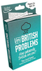
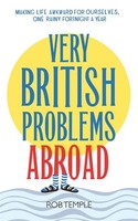
Very British Problems Abroad

In his new mildly-amusing-if-you-like-that-sort-of-thing book, Rob Temple tackles classic `Brits abroad` dilemmas, including the impossibility of finding decent cup of tea, queuing anarchy at popular tourist spots and the awfulness of a middle-aged British man in socks and sandals. With witty illustrations, quizzes and plenty of Rob`s trademark observations on the peculiarities of the British, this is bound to be another huge success.* *Steady on.
RIP - This product is no longer available on our network. It was last seen on 25.09.2019

This page now acts as a permanent archive for this product. Add more information using the comments box below to ensure it can still be found by future generations.

Use our search facility to see if it is available from an alternative contributor.
  • External links may include paid for promotion
  • Availability: Out Of Stock
  • Supplier: Stanfords
  • SKU: 9780751558494
Availability: In Stock
£12.99

Product Description

In his new mildly-amusing-if-you-like-that-sort-of-thing book, Rob Temple tackles classic ` Brits abroad` dilemmas, including the impossibility of finding decent cup of tea, queuing anarchy at popular tourist spots & the awfulness of a middle-aged British man in socks & sandals. With witty illustrations, quizzes & plenty of Rob`s trademark observations on the peculiarities of the British, this is bound to be another huge success.* * Steady on.

Reviews/Comments

Add New

Intelligent Comparison

Oooops!
We couldn't find anything!
Perhaps this product's unique.... Or perhaps we are still looking for comparisons!
Click to bump this page and we'll hurry up.

Price History

Vouchers

No voucher codes found.
Do you know a voucher code for this product or supplier? Add it to Insights for others to use.

Facebook

Jargon Buster

Socks - A garment worn on the feet
Tea - A hot beverage made from the leaves of a tea plant
illustrations - Pictures typically in books and newspapers.
Popular - Something that is admired and liked by many people.
Classic - Something that is still like it was originally a high quality standard.

Supplier Information

Stanfords
Stanfords was established in 1853 and opened their iconic Covent Garden flagship store in 1901. They have become the top retailer of maps, travel books and accessories in the UK and arguably offer the largest selection of maps and travel books worldwide. Famous names such as Captain Robert Falcon Scott, Ranulph Fiennes and Michael Palin have purchased from Stanfords. They now have a shop in Bristol and both stores together with other venues operate a calendar of events including talks, book signings and exhibitions. As a specialist map retailer, the map selection is comprehensive and includes road maps, street maps and walking maps from worldwide destinations, as well as a selection of world atlases and wall maps. Books include travel guides and travel literature. Stanfords also stock globes, from miniatures made of blue marble to magnificent floor-standing globes. The website features a selection of interesting articles on travel topics.
Page Updated: 2023-11-12 20:15:36

Community Generated Product Tags

Oh No! The productWIKI community hasn't generated any tags for this product yet!
Menu