
 United Kingdom
 France
 Germany
 Netherlands
 Sweden
 USA
USA
 Italy
Italy
 Spain
Spain
More From Contributor


Vanoise
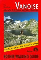
The Rother Walking Guide to the Vanoise alpine region covers the well-known areas around Trois Vallées, Les Arcs and Val d`Isère, as well as the lesser-trodden surrounding regions and the rest of the Vanoise National Park. All of the 52 walks described in the book contain a fact-file of up-to-date information, a detailed route description and a small map marked with the line of the route. The brilliant photos of author and photographer Iris Kürschner provide an excellent impression of every walk and motivate you to go and explore the varied landscape in and around the Vanoise massif.About this series:Rother Walking Guides were first published in 1920- since then Bergverlag Rother have continued to produce these comprehensive guides to “the finest valley and mountain walks”.Each
book has a detailed description of walks, small walking maps and many tips on combining the walks, places of interest, accommodation and public transport; the guides are all in full colour with varying scales and types of cartography - the walks themselves vary from day-long hikes to mountain and valley walks, with varying levels of ease and difficulty indicated.Small enough to fit in your pocket, comprehensive enough to take you everywhere; the books are printed in paperback but with a polytex-laminated cover, making them extremely durable too.
book has a detailed description of walks, small walking maps and many tips on combining the walks, places of interest, accommodation and public transport; the guides are all in full colour with varying scales and types of cartography - the walks themselves vary from day-long hikes to mountain and valley walks, with varying levels of ease and difficulty indicated.Small enough to fit in your pocket, comprehensive enough to take you everywhere; the books are printed in paperback but with a polytex-laminated cover, making them extremely durable too.

Product Description
Reviews/Comments
Add New
Vouchers
No voucher codes found.
Do you know a voucher code for this product or supplier? Add it to Insights for others to use.
Do you know a voucher code for this product or supplier? Add it to Insights for others to use.
 Denmark