More From Contributor
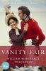
£5.99
` Agatha Christie for kids`
- the third in a detective agency series brimming with mystery & magic by million-copy-selling author,
...
Archived Product
£22.95
With its untamed landscapes & unsurpassed bounty of wildlife, Africa has long fascinated us. Stanley & Livingstone tackled its manifold challenges, Karen Blixen made it her home & wrote about it in Out of Africa, & Ernest Hemingway's African adventures inspired much of his writing. At a time when our earth's fragile balance is in jeopardy, Africa is a more precious natural commodity than ever before. This stunning volume introduces readers to the rich & varied ecosystems of Africa through specially commissioned photographs that depict its diverse wildlife refuges & nature sanctuaries. Spectacular, large-scale colour photographs bring to life the pink flamingos of Nakuru Lake, the hippopotami of the Niger River, & the last remaining virgin forest, in Odzala in Congo, demonstrating the awe-inspiring beauty & inestimable significance of eco-regions across Africa. ...
Archived Product
£30.00
If we consider Europe & Asia as two distinct continents, then there are seven continents in all, scattered across Earth. In fifth place, in size order, is Antarctica. For centuries it went unnoticed; humankind took little note of its existence until the beginning of the 19th century. It had long been Terra Incognita Australis: The Great Unknown Southern L&, situated somewhere in the Western Ocean. It was uninhabited by any native populations; it was visited by very few mariners or explorers. It remind, for the most part, a virgin continent, not corrupted. The Antarctic environment is of extraordinary beauty & biological differentiation: flora & fauna have developed interesting strategies to counteract harsh conditions. It`s a world of extremes, cruel pitiless, where many species have to fight hard to survive. In this volume of heroic reportage, Colin Monteath, a renowned writer, photographer & specialist on Antarctica presents the mysteries of the Forgotten Continent. In an outstanding achievement, Monteath took magnificent photographs in temperatures of -40C, in winds that reached 95 mph (150km/h). ...
Archived Product
£20.00
Ray Mears has travelled the world for much of his life learning & teaching wilderness skills. Now he reflects on his experiences in some of the most remote & beautiful places on Earth along with his own stunning photographs of the landscapes & peoples he`s encountered. Fascinated by photography from an early age, each of Ray`s pictures captures an instant of life, a powerful experience he has compared to hunting
- to releasing the trigger on a rifle. This book reveals our dramatically changing planet & inspires us to look more closely at the changes around us. See our vanishing world through the eyes, ears & camera lens of Ray Mears.
...
Archived Product
£19.95
Published to coincide with the International Polar Year, ” Vanishing World” is an unprecedented visual record of life in the Arctic. Five years in the making, this book is both a celebration of the wildlife that inhabits this harsh & unforgiving climate & a cautionary tale of global warming. Rising temperatures have put areas such as the Artic at risk & the livelihoods of the animals that live there are increasingly threatened. Set against a dramatic landscape of ice floes & ragged mountains, readers will see the polar bears, foxes, seals, walruses & reindeers, who now struggle to live in this vulnerable climate. Images of a polar bear mother as she takes her newborns out for their first hunt, a seal pup only hours old, the spectacle of the polar night & the majesty of the glaciers & pack ice are a reminder of what is at risk. Mireille de la Lez`s stunning photographs are accompanied by text that explains the precarious nature of life in this dramatic climate. No one who sees the images of this vanishing world will be unmoved. ...
Archived Product
£7.99
The classic novel of `villainy, crime, merriment, lovemaking, jilting, laughing, cheating, fighting & dancing`, soon to be a major new ITV series from the producers of Poldark, Victoria & And Then There Were None. William Makepeace Thackeray`s witty literary classic Vanity Fair is set against the backdrop of the Napoleonic Wars, & follows anti-heroine & ruthless social climber Becky Sharp as she attempts to claw her way out of poverty & scale the heights of English Society. Her story takes her all the way to the court of King George IV, via the Battle of Waterloo, breaking heart & fortunes as she goes.ITV`s new adaptation of will be one of the biggest drama series of 2018: its script comes from BAFTA-nominated writer Gwyneth Hughes, the series is co-produced by leading production companies Mammoth Screen & Amazon Studios, & Olivia Cooke
- star of Steven Spielberg`s hit blockbuster Ready Player One
- plays Thackeray`s timeless heroine Becky Sharp. Read the book before you see the series, then devour it all over again.

...
Archived Product
£16.99
Sverigeserien is an outdoor map series consisting of 116 sheets with coverage of southern & central Sweden & the northern coastline. The map is suitable for outdoor activities such as hiking, excursions, trail running, hunting, fishing, riding, cycling, mountain biking, paddling, skating & much more. Every sheet covers an area of 45x 68km. These topographical maps in scale 1:50 000 contain all the information needed for outdoor activities: Terrain information, hiking trails, illuminated tracks, camping, shelters, golf courses, leisure baths, historical remains, roads in different categories, railway lines & much more. Easy to read topography with contour lines, vertical interval 5 m. Sverigeserien is a high-quality map series & is durable for frequent use! Updated content with map data from Lantmäteriet (National Land Survey of Sweden) & printed on Polyart which is water & tear resistant. This means that the map can be folded repeatedly without breaking & can withstand the challenging weather in Sweden during both winter & summer. Legend is in Swedish, English & German. ...
Archived Product
£6.99
Street plan of Vannes at 1:10, 000 in an extensive series of street plans of French towns from Blay-Foldex, the country’s largest, oldest & most experienced publisher of urban mapping. Blay plans include outer suburbs &, where appropriate, adjoining localities forming part of the urban agglomeration & provide brief descriptions of the town’s main sights, contact details for hotels & other places of interest, etc. The plans show one way streets, car parks & pedestrian zones. Important public buildings are clearly marked & identified. Blay street maps are usually double-sided & include an enlargement for the town centre & a street index with separate lists of “edifices publics”: main public buildings, places of worship, schools, sport facilities, stations, etc. Each of the outer suburbs or the adjoining localities, identified with its postcode, has a separate index. Many titles also provide a road map of the environs. All the text is in French only.PLEASE NOTE: to see the list of Blay-Foldex street plans of French towns & cities please click on the series link – the series description also

Includes::
a comparison between Blay & IGN street plans.

...
Archived Product
£12.99
Topographic survey of France at 1:25, 000 in IGN`s excellent TOP25 / Série Bleue series. All the maps are GPS compatible, with a 1km UTM grid plus latitude & longitude lines at 5’ intervals. Contours are at 5m intervals except for mountainous areas where the maps have contours at 10m intervals, vividly enhanced by hill shading & graphics for rocky terrain. Colouring with graphics indicates different types of vegetation or land use (deciduous or coniferous forests, moors, orchards, vineyards, etc). PLEASE NOTE: coverage of France at this scale is currently being revised – the format & the presentation of each title are indicated by the letters at the end of its Sheet Reference number (e.g. 0416ET, 3531ETR, 1923SB, etc.)MAPS WITH FULL TOURIST OVERPRINT & AN ENGLISH MAP LEGEND: all TOP25 maps & the SB editions of Série Bleue have an overprint highlighting waymarked walking trails including long-distance GR routes &, where appropriate, ski routes. Symbols indicate campsites, gîtes d’etape, refuges, equestrian centres & other recreational facilities or sites, tourist information centres, cultural heritage, etc. Towns & locations of particular interest are highlighted.- ET or OT = single-sided TOP25 map covering approx. 29x 21 km / 18x 13 miles.- ETR or OTR = waterproof & tear resistant TOP25 map covering the same area as the corresponding ET or OT number, but double-sided, printed on a smaller size sheet with a good overlap between the sides.- SB = Série Bleue map with full tourist overprint; these maps, first introduced in summer 2014, each cover approx. 29x 24km / 18x 15 miles.SÉRIE BLEUE maps with numbers ending in E (Est) or O (Ouest): most editions now indicate the GR routes, but do not show any other tourist information. Map legend is in French only. Each map covers approx. 14x 20km / 9x 12 miles. ...
Archived Product
£18.99
Topographic survey of France at 1:25, 000 in IGN`s excellent TOP25 / Série Bleue series. All the maps are GPS compatible, with a 1km UTM grid plus latitude & longitude lines at 5’ intervals. Contours are at 5m intervals except for mountainous areas where the maps have contours at 10m intervals, vividly enhanced by hill shading & graphics for rocky terrain. Colouring with graphics indicates different types of vegetation or land use (deciduous or coniferous forests, moors, orchards, vineyards, etc). PLEASE NOTE: coverage of France at this scale is currently being revised – the format & the presentation of each title are indicated by the letters at the end of its Sheet Reference number (e.g. 0416ET, 3531ETR, 1923SB, etc.)MAPS WITH FULL TOURIST OVERPRINT & AN ENGLISH MAP LEGEND: all TOP25 maps & the SB editions of Série Bleue have an overprint highlighting waymarked walking trails including long-distance GR routes &, where appropriate, ski routes. Symbols indicate campsites, gîtes d’etape, refuges, equestrian centres & other recreational facilities or sites, tourist information centres, cultural heritage, etc. Towns & locations of particular interest are highlighted.- ET or OT = single-sided TOP25 map covering approx. 29x 21 km / 18x 13 miles.- ETR or OTR = waterproof & tear resistant TOP25 map covering the same area as the corresponding ET or OT number, but double-sided, printed on a smaller size sheet with a good overlap between the sides.- SB = Série Bleue map with full tourist overprint; these maps, first introduced in summer 2014, each cover approx. 29x 24km / 18x 15 miles.SÉRIE BLEUE maps with numbers ending in E (Est) or O (Ouest): most editions now indicate the GR routes, but do not show any other tourist information. Map legend is in French only. Each map covers approx. 14x 20km / 9x 12 miles. ...
Archived Product

Vanity Fair

Becky Sharp is a poor orphan when she first makes friends with the lovely Amelia Sedley at Miss Pinkerton`s Academy for Young Ladies. She may not have the natural advantages of her companion but she more than makes up for it with her wit, charm, deviousness and determination to make a success of herself whatever the cost. ”Vanity Fair” is the story of Becky`s spectacular rise and fall as she gambles, manipulates and seduces her way through high society and the Napoleonic wars.
RIP - This product is no longer available on our network. It was last seen on 25.09.2019

This page now acts as a permanent archive for this product. Add more information using the comments box below to ensure it can still be found by future generations.

Use our search facility to see if it is available from an alternative contributor.
  • External links may include paid for promotion
  • Availability: Out Of Stock
  • Supplier: Stanfords
  • SKU: 9780099518938
Availability: In Stock
£7.99

Product Description

Becky Sharp is a poor orphan when she first makes friends with the lovely Amelia Sedley at Miss Pinkerton`s Academy for Young Ladies. She may not have the natural advantages of her companion but she more than makes up for it with her wit, charm, deviousness & determination to make a success of herself whatever the cost. ” Vanity Fair” is the story of Becky`s spectacular rise & fall as she gambles, manipulates & seduces her way through high society & the Napoleonic wars.

Reviews/Comments

Add New

Intelligent Comparison

Oooops!
We couldn't find anything!
Perhaps this product's unique.... Or perhaps we are still looking for comparisons!
Click to bump this page and we'll hurry up.

Price History

Vouchers

No voucher codes found.
Do you know a voucher code for this product or supplier? Add it to Insights for others to use.

Facebook

Jargon Buster

Friends - A close associate or a popular US based sitcom about a group of friends
Natural - not manmade
Spectacular - Something that catches that eye due to its eye catchingness.

Supplier Information

Stanfords
Stanfords was established in 1853 and opened their iconic Covent Garden flagship store in 1901. They have become the top retailer of maps, travel books and accessories in the UK and arguably offer the largest selection of maps and travel books worldwide. Famous names such as Captain Robert Falcon Scott, Ranulph Fiennes and Michael Palin have purchased from Stanfords. They now have a shop in Bristol and both stores together with other venues operate a calendar of events including talks, book signings and exhibitions. As a specialist map retailer, the map selection is comprehensive and includes road maps, street maps and walking maps from worldwide destinations, as well as a selection of world atlases and wall maps. Books include travel guides and travel literature. Stanfords also stock globes, from miniatures made of blue marble to magnificent floor-standing globes. The website features a selection of interesting articles on travel topics.
Page Updated: 2023-11-12 20:15:36

Community Generated Product Tags

Oh No! The productWIKI community hasn't generated any tags for this product yet!
Menu