More From Contributor
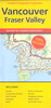
£9.99
Vancouver & The Canadian Rockies in the AA Spiral Guides series; comprising a selection of titles exploring a wide range of cities, regions & countries in a handy, spiral loose-leaf format. Fold-out flaps at the front & back of each title give an overview of the main regions covered, with page numbers so visitors can locate their destination easily. Each guide explores the destination geographically by region or area & provides the essential information for the main sites & attractions in addition to a recommended tour of each area by car. An introductory section - ...
Archived Product
£14.99
Fantastic food, excellent local wine, hip shopping opportunities, boutique hotels, friendly people, world-class skiing in nearby Whistler, & gorgeous terrain for hiking, biking, boating, & beach-going, Vancouver has a bit of everything, & it's all top-notch. Fodor's Vancouver & Victoriais the guide to help you plan your time from the slopes to the surf & everything in between. In-depth coverage

Includes::
stunning Whistler (site of the 2010 winter Olympics), Victoria, Vancouver Isl&, & the Okanagan Valley.
Expanded Coverage:

Includes::
new hotel & restaurant reviews throughout Vancouver & Victoria, as well as in Whistler, the Okanagan Valley, & elsewhere on Vancouver Isl&. Expanded winery coverage in the Okanagan Valley is a boon for exploring some of the best wine country in North America..
Illustrated

Features:
Gorgeous photos throughout, & illustrated lavishly illustrated neighborhood food spotlights bring the city & its experiences into vivid focus.
Indispensable Trip Planning Tools Neighborhood planners with colorful maps & Best Bets for restaurants & hotels make planning your trip easy & fun.
Discerning Recommendations: Fodor's Vancouver & Victoria offers savvy advice & recommendations from local writers to help travelers make the most of their time. Fodor's Choice designates our best picks, from hotels to nightlife. Word of Mouth"es from fellow travelers provide valuable insights.


...
Archived Product
£10.99
Canada resident & avid outdoorsman Andrew Hempstead offers an insider's perspective on dining at the best restaurants & cafes in Vancouver & spotting gray whales & orcas near Victoria. Andrew offers unique trip ideas that cover the best of this remarkable region, including a Vancouver & Victoria Highlights Tour & a Nature Lovers Tour. Packed with information on dining, transportation, & accommodations, Moon Vancouver & Victoria has lots of options for a range of travel budgets. Every Moon guidebook

Includes::
recommendations for must-see sights & many regional, area, & city-centered maps. With guidance on exploring Stanley Park, visiting the Royal British Columbia Museum, & skiing & snowboarding at Whistler, Moon Vancouver & Victoria gives travellers the tools they need to create a more personal & memorable experience. With expert writers, first-rate strategic advice, & an essential dose of humour, Moon Handbooks are the cure for the common trip.

...
Archived Product
£8.99
Vancouver & Whistler in the Frommer's Day By Day series is a pocket-sized guide ideal for short trips, covering a variety of budgets. The best sights of each destination are listed in convenient full-day tours for one, two or three days such as: thematic tours for interests including art, architecture & history are described, allowing you to get the most out of your time; walking tours take you around each destination ...
Archived Product
£9.99
Montreal in the Frommer's Day By Day series is a pocket-sized guide ideal for short trips, covering a variety of budgets. The best sights of each destination are listed in convenient full-day tours for one, two or three days such as: thematic tours for interests including art, architecture & history are described, allowing you to get the most out of your time; walking tours take you around each destination ...
Archived Product
£8.99
Vancouver & the Fraser Valley on a large street plan at 1:38, 100, with an enlargement for downtown Vancouver at 1:25, 000. Coverage by the main plan extends east along the Fraser River to include the Barnston Islands, with insets on the reverse side providing additional coverage of Tsawwassen, White Rock
- Surrey, Maple Ridge
- Langley, Mission, Abotsford, Chilliwack & Hope. In addition to those listed above communities covered by the map also include Anmore, Belcarra, Burnaby, Coquitlam, Delta, Ladner, New Westminster, North Vancouver, Pitt Meadows, Port Coquitlam, Port Moody, Richmond, West Vancouver, White Rock & the University of British Columbia. Street plans from the Map Art / Canadian Cartographics Corporation / JDM Géo publishing group are usually produced at scales around 1:25, 000 to 1:35, 000 with smaller towns often shown at more detailed scales. All plans have street indexes. Plans of larges cities usually include an enlargement for the downtown area. Plans grouping together several smaller towns often have an overview map showing the whole of the relevant region. The plans have colouring to indicate commercial, institutional or industrial use, etc. Main traffic arteries are highlighted & one way streets are marked. A range of symbols shows, as appropriate, parking facilities, bus terminals, metro and/or railway stations, various public facilities & services, places of interest, recreational centres, etc. Map legends for cities & towns in the French speaking part of the country are sometimes in French only. To see the list of currently available Canadian street plans & pocket atlases form the Map Art / Canadian Cartographics Corporation / JDM Géo publishing group, including waterproof & tear-resistant Fast Track titles, please click on the series link.

...
Archived Product
£5.95
Vancouver in the Wallpaper City Guide series, published by Phaidon & encompassing a collection of pocket-size guides dedicated to the best design elements in major cities. Compiled by experts at the Wallpaper magazine, the guides are widely recognized for appealing to design-conscious travellers & are aimed at those interested in art, design & architecture. Each guide identifies the best bars, restaurants, hotels, places to shop, leisure activities & excursions with a unique emphasis on the finest examples of unusual architecture & design. Each Wallpaper City Guide has the same layout, with separate tabs allowing readers & travellers to access individual sections easily. The tabs consist of Landmarks, Hotels, 24 Hours, Urban Life, Architour, Shopping, Sports & Escapes. High quality colour photographs appear alongside brief descriptions of each hotel, bar or attraction, highlighting distinctive & unusual styles of architecture & design. Extra pages are provided at the back of each guide, allowing readers to record their own notes & sketches. ...
Archived Product
£12.99
Pocket size street atlas of the Greater Vancouver area at 1:27, 500. Coverage

Includes::
Anmore, Belcarra,

...
Archived Product
£9.50
Street atlas of the Greater Vancouver area, including Belcarra, Burnaby, Coquitlam, Delta, Langley, Maple Ridge, New Westminster, North Vancouver, Pitt Meadows, Port Coquitlam, Port Moody, Richmond, Tsawwassen, Surrey, West Vancouver & White Rock. The atlas is part of an extensive coverage of Canadian cities & towns from the country ...
Archived Product
£7.99
Vancouver & Victoria in the Eyewitness Top 10 series from Dorling Kindersley is a condensed format guide book featuring dozens of illustrated, top ten lists for the traveller regardless of their disposable budget. To save you time & money a Top 10 Things to Avoid is also included. Top 10 lists are given for things to see & do both in & around town, as well as the top ten features of particular locations or events. Practicalities are not forgotten as Top 10s are also provided for topics such as planning your trip, getting around & shopping. Accommodation lists provide the ten most recommended places to stay for a range of budgets, whilst restaurant top tens feature as the guide works its way through the location in question. Simple, small street plans illustrate the location of the top ten recommends within their neighbourhoods & basic, fold out maps form the inside covers. An additional pull out feature of the guide suggests ideas on how to spend your day. ...
Archived Product

Vancouver (CCC Map)

Double-sided, indexed street plan of Greater Vancouver at 1:40, 000 from the Canadian Cartographics Corporation, with an enlargement of the downtown area, plus a street plan of Whistler, also at 1:40, 000. Communities covered include Anmore, Belcarra, Coquitlam, Delta, Ladner, New Westminster, North Vancouver, Pitts Meadows, Port Coquitlam, , Port Moody, Richmond, Surrey, Tsawwassen, West Vancouver and White Rock, plus Whistler shown on an inset with a separate index. An enlargement presents downtown Vancouver at 1:30, 000 in greater detail.Street plans from the MapArt - Canadian Cartographics Corporation - JDM G
RIP - This product is no longer available on our network. It was last seen on 25.09.2019

This page now acts as a permanent archive for this product. Add more information using the comments box below to ensure it can still be found by future generations.

Use our search facility to see if it is available from an alternative contributor.
  • External links may include paid for promotion
  • Availability: Out Of Stock
  • Supplier: Stanfords
  • SKU: 9781553683070
Availability: In Stock
£6.50

Product Description

Double-sided, indexed street plan of Greater Vancouver at 1:40, 000 from the Canadian Cartographics Corporation, with an enlargement of the downtown area, plus a street plan of Whistler, also at 1:40, 000. Communities covered include Anmore, Belcarra, Coquitlam, Delta, Ladner, New Westminster, North Vancouver, Pitts Meadows, Port Coquitlam, , Port Moody, Richmond, Surrey, Tsawwassen, West Vancouver & White Rock, plus Whistler shown on an inset with a separate index. An enlargement presents downtown Vancouver at 1:30, 000 in greater detail. Street plans from the Map Art
- Canadian Cartographics Corporation
- JDM G

Reviews/Comments

Add New

Intelligent Comparison

Oooops!
We couldn't find anything!
Perhaps this product's unique.... Or perhaps we are still looking for comparisons!
Click to bump this page and we'll hurry up.

Price History

Vouchers

No voucher codes found.
Do you know a voucher code for this product or supplier? Add it to Insights for others to use.

Facebook

Jargon Buster

White - A colour combining all colours

Supplier Information

Stanfords
Stanfords was established in 1853 and opened their iconic Covent Garden flagship store in 1901. They have become the top retailer of maps, travel books and accessories in the UK and arguably offer the largest selection of maps and travel books worldwide. Famous names such as Captain Robert Falcon Scott, Ranulph Fiennes and Michael Palin have purchased from Stanfords. They now have a shop in Bristol and both stores together with other venues operate a calendar of events including talks, book signings and exhibitions. As a specialist map retailer, the map selection is comprehensive and includes road maps, street maps and walking maps from worldwide destinations, as well as a selection of world atlases and wall maps. Books include travel guides and travel literature. Stanfords also stock globes, from miniatures made of blue marble to magnificent floor-standing globes. The website features a selection of interesting articles on travel topics.
Page Updated: 2023-11-12 20:15:36

Community Generated Product Tags

Oh No! The productWIKI community hasn't generated any tags for this product yet!
Menu