More From Contributor

£3.50
Vale of Pickering in 1904 in a series of reproductions of Ordnance Survey’s famous ” Inch to the Mile” maps published in the Alan Godfrey Editions to provide a historical record of England & Wales in the second half of 19th & early 20th century. The map covers anarea from Ampleforth eastward to Thornton Dale, & from Malton northward to Kirkby Moorside. Helmsley, Pickering & New Malton are the principal places on the map; other locations include Aislaby, Amotherby, Appleton le Moor, Appleton le Street, Barton le Street, Beadlam, Brawby, Broughton, Butterwick, Cawthorn, Cawton, Coneysthorpe, Coulton, Crayke, Cropton, Fryton, Ganthorpe, Gilling, Great Edston, Great Habton, Harome, Hildenley, Hovingham, Kirby Misterton, Little Habton, Marton, Middleton, Muscoates, Nawton, Normanby, Norton, Nunnington, Oswaldkirk, Pockley, Rievaulx, Ryton, Salton, Scackleton, Settrington, Sinnington, South Holme, Sproxton, Stonegrave, Swinton, Wath, Welburn, Wombleton & Wrelton. Other features of interest include the railways (many long closed), Rievaulx Abbey, the Howardian Hills, & the River Rye which winds through the map creating Ryedale. On the reverse is a detailed map of Slingsby, together with a directory for the village. About the Alan Godfrey Editions of the OS Inch to the Mile Maps: the maps provide an invaluable overview of a wider area, typically 18 x 12 miles (29 x 19 kms approx.), & offer historical mapping for small towns & villages not covered by the more detailed series for which the Godfrey Editions are better known. On the reverse all the maps have historical notes & most titles also include a more detailed, large scale map of a small town or a village in the area. To see other titles in this series please click on the series link. ...
Archived Product
£3.50
Vale of White Horse in 1893 in a series of reproductions of Ordnance Survey’s famous ” Inch to the Mile” maps published in the Alan Godfrey Editions to provide a historical record of England & Wales in the second half of 19th & early 20th century. The map is centred on Wantage, stretching from Shrivenham eastward to Didcot, & from Hinton Waldrist southward to East Ilsley. Other locations include: in BERKSHIRE Abingdon, Appleford, Ardington, Ashbury, Balking, Buckl&, Charlton, Charney Basset, Childrey, Chilton, Compton Beauchamp, Denchworth, Draycot Moor, Drayton, East Challow, East Hagbourne, East Hanney, East Hendred, East Lockinge, Eaton Hastings, Faringdon, Farnborough, Fawley, Fernham, Fritford, Fyfield, Garford, Goosey, Great Coxwell, Grove, Harwell, Hatford, Kingston Bagpuze, Kingston Lisle, Letcombe Basset, Letcombe Regis, Little Coxwell, Longcot, Longworth, Lyford, Marcham, Milton, Pusey, Shellingford, Sparsholt, Stanford in the Vale, Steventon, Sutton Courtenay, Sutton Wick, Tubney, Uffington, Upton, Watchfield, West Hagbourne, West Hanney, West Hendred, West Ilsley, West Lockinge & Woolstone; in OXFORDSHIRE Culham, Kelmscot & Radcot; plus in WILTSHIRE Bishopstone. On the reverese is an extract from Berkshire Sheet 6.08 showing Faringdon in 1910. About the Alan Godfrey Editions of the OS Inch to the Mile Maps: the maps provide an invaluable overview of a wider area, typically 18 x 12 miles (29 x 19 kms approx.), & offer historical mapping for small towns & villages not covered by the more detailed series for which the Godfrey Editions are better known. On the reverse all the maps have historical notes & most titles also include a more detailed, large scale map of a small town or a village in the area. To see other titles in this series please click on the series link. ...
Archived Product
£11.99
Vale of York & the Yorkshire Wolds in the Pathfinder Guides series, produced in association with Ordnance Survey & published by Crimson; comprising a range of walking guides to popular British destinations. Each Pathfinder guide

Includes::
28 varied walks ranging from easy strolls to exhilarating hikes & is accompanied by 1:25, 000 Ordnance Survey mapping with marked, colour-coded routes. Introductory sections profile the county or region covered, with recommendations on the best time to visit & a brief explanation of GPS. An ‘at-a-glance’ table gives an overview of the walks covered in the guide, with information on the starting point, National Grid reference, distance, time, highest point & general brief comments. Each walk described in the guide has a dedicated information box profiling the walk, with useful information such as the starting point, distance, approximate time, parking, refreshments & the relevant Ordnance Survey map for navigation. Clear & easy to follow directions are provided & are accompanied by practical information about the route, including the location of toilets, refreshment areas & picnic sites, as well as colour photography illustrating some of the highlights of the walk. A Further Information section contains information on walking safety & responsible walking, as well as a list of useful contacts.

...
Archived Product
£12.99
The wide plain of the Vale of York lies at the very heart of the county of Yorkshire with the historic city of York at its centre. The vale is bordered by the Pennnines to the west, the North York Moors to the north-east & the Yorkshire Wolds to the east. While most visitors flock to Yorkshire`s two national parks, the flat plains of the Vale of York & the rolling uplands the Wolds provide a diversity of scenery & walking opportunities that shou, ld not be missed. Highlights of the 28 walks in this title include the coastal drama of Flamborough Head, the deserted medieval village of Wharram Percy & Beverley, with its majestic minster. ...
Archived Product
£17.99
Topographic survey of Portugal at 1:50, 000 from the Instituto Geográfico do Exército, the country’s military survey organisation. The maps have contours at 20m intervals & in addition to the standard features shown on topographic mapping at this scale also indicate various types of terrain or vegetation (s&, terraces, rocks, woodlands, vineyards, etc). Each sheet covers an area of 32 x 20km (20 x 12.5 miles approx). The maps have a 1-km UTM grid plus latitude & longitude coordinates for the map corners. Map legend & a glossary of terms used on the maps include English.EDITION DATES: most titles in this series date from 1990s or later. To see all the titles in this series please click on the series link. ...
Archived Product
£17.99
Topographic survey of Portugal at 1:100, 000 from the Instituto Geográfico Português, the country’s civilian survey organisation. The maps have contours at 50m intervals & in addition to the standard features shown on topographic mapping at this scale also indicate various types of vegetation (vineyards, olive groves, etc). Each sheet covers an area of 64 x 40km (40 x 25 miles approx). The maps have latitude & longitude margin ticks at 1’ intervals, plus show UTM coordinates for the map corners. Map legend is in Portuguese only.PLEASE NOTE
- EDITION DATES: some sheets at this scale date back to the 1950s or 1960s. For more recent editions please see IGP’s 1:25, 000 series where each 50K map is divided into four quarters. To see all the titles in the 1:100, 000 series please click on the series link.
...
Archived Product
£6.99
Street plan of Valence, part of an extensive series covering French cities & towns from Blay-Foldex, the country’s largest, oldest & most experienced publisher of urban mapping. Blay plans include outer suburbs &, where appropriate, adjoining localities forming part of the urban agglomeration & provide brief descriptions of the town’s main sights, contact details for hotels & other places of interest, etc. The plans show one way streets, car parks & pedestrian zones. Important public buildings are clearly marked & identified. Blay street maps are usually double-sided & include an enlargement for the town centre & a street index with separate lists of “edifices publics”: main public buildings, places of worship, schools, sport facilities, stations, etc. Each of the outer suburbs or the adjoining localities, identified with its postcode, has a separate index. Many titles also provide a road map of the environs. All the text is in French only.PLEASE NOTE: to see the list of Blay-Foldex street plans of French towns & cities please click on the series link – the series description also

Includes::
a comparison between Blay & IGN street plans.

...
Archived Product
£11.50
Topographic survey of France at 1:25, 000 in IGN`s excellent TOP25 / Série Bleue series. All the maps are GPS compatible, with a 1km UTM grid plus latitude & longitude lines at 5’ intervals. Contours are at 5m intervals except for mountainous areas where the maps have contours at 10m intervals, vividly enhanced by hill shading & graphics for rocky terrain. Colouring with graphics indicates different types of vegetation or land use (deciduous or coniferous forests, moors, orchards, vineyards, etc). PLEASE NOTE: coverage of France at this scale is currently being revised – the format & the presentation of each title are indicated by the letters at the end of its Sheet Reference number (e.g. 0416ET, 3531ETR, 1923SB, etc.)MAPS WITH FULL TOURIST OVERPRINT & AN ENGLISH MAP LEGEND: all TOP25 maps & the SB editions of Série Bleue have an overprint highlighting waymarked walking trails including long-distance GR routes &, where appropriate, ski routes. Symbols indicate campsites, gîtes d’etape, refuges, equestrian centres & other recreational facilities or sites, tourist information centres, cultural heritage, etc. Towns & locations of particular interest are highlighted.- ET or OT = single-sided TOP25 map covering approx. 29x 21 km / 18x 13 miles.- ETR or OTR = waterproof & tear resistant TOP25 map covering the same area as the corresponding ET or OT number, but double-sided, printed on a smaller size sheet with a good overlap between the sides.- SB = Série Bleue map with full tourist overprint; these maps, first introduced in summer 2014, each cover approx. 29x 24km / 18x 15 miles.SÉRIE BLEUE maps with numbers ending in E (Est) or O (Ouest): most editions now indicate the GR routes, but do not show any other tourist information. Map legend is in French only. Each map covers approx. 14x 20km / 9x 12 miles. ...
Archived Product
£12.99
Topographic survey of France at 1:25, 000 in IGN`s excellent TOP25 / Série Bleue series. All the maps are GPS compatible, with a 1km UTM grid plus latitude & longitude lines at 5’ intervals. Contours are at 5m intervals except for mountainous areas where the maps have contours at 10m intervals, vividly enhanced by hill shading & graphics for rocky terrain. Colouring with graphics indicates different types of vegetation or land use (deciduous or coniferous forests, moors, orchards, vineyards, etc). PLEASE NOTE: coverage of France at this scale is currently being revised – the format & the presentation of each title are indicated by the letters at the end of its Sheet Reference number (e.g. 0416ET, 3531ETR, 1923SB, etc.)MAPS WITH FULL TOURIST OVERPRINT & AN ENGLISH MAP LEGEND: all TOP25 maps & the SB editions of Série Bleue have an overprint highlighting waymarked walking trails including long-distance GR routes &, where appropriate, ski routes. Symbols indicate campsites, gîtes d’etape, refuges, equestrian centres & other recreational facilities or sites, tourist information centres, cultural heritage, etc. Towns & locations of particular interest are highlighted.- ET or OT = single-sided TOP25 map covering approx. 29x 21 km / 18x 13 miles.- ETR or OTR = waterproof & tear resistant TOP25 map covering the same area as the corresponding ET or OT number, but double-sided, printed on a smaller size sheet with a good overlap between the sides.- SB = Série Bleue map with full tourist overprint; these maps, first introduced in summer 2014, each cover approx. 29x 24km / 18x 15 miles.SÉRIE BLEUE maps with numbers ending in E (Est) or O (Ouest): most editions now indicate the GR routes, but do not show any other tourist information. Map legend is in French only. Each map covers approx. 14x 20km / 9x 12 miles. ...
Archived Product
£7.50
Street plan of Valance at 1:10, 000 from the Institut Géographique National, the country’s national survey organization. IGN street plans include outer suburbs &, where appropriate, adjoining localities forming part of the urban agglomeration. The plans prominently highlight principal traffic arteries & show one way streets, car parks & pedestrian zones. Latest editions also indicate 24h petrol stations & streets with separate cycle paths. Many streets are annotated with selected house for easier identification of addresses. Important public buildings are named & symbols mark locations of tourist information centres & other facilities. Street index, arranged by an administrative area, is next to the map. Map legend

Includes::
English.PLEASE NOTE: to see the list of IGN street plans of French towns & cities please click on the series link – the series description also

Includes::
a comparison between IGN & Blay-Foldex street plans.


...
Archived Product

Valenca

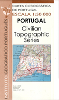
Topographic survey of Portugal at 1:50, 000 from the Instituto Geográfico Português, the country’s civilian survey organisation. The maps have contours at 25m intervals and in addition to the standard features shown on topographic mapping at this scale also indicate various types of vegetation (vineyards, olive groves, etc). Each sheet covers an area of 32 x 20km (20 x 12.5miles approx). The maps have latitude and longitude margin ticks at 1’ intervals and UTM coordinates for the map corners – each sheet also shows conversion details from BBLx (Bessel-Bonnie system, Datum Lisbon) to UTM. Map legend is in Portuguese only.EDITION DATES: most titles in this series have now been updated in the 1990s or later.To see all the titles in this series please click on the series link.
RIP - This product is no longer available on our network. It was last seen on 25.09.2019

This page now acts as a permanent archive for this product. Add more information using the comments box below to ensure it can still be found by future generations.

Use our search facility to see if it is available from an alternative contributor.
  • Availability: Out Of Stock
  • Supplier: Stanfords
  • SKU: 9789728867720
Availability: In Stock
£17.99

Product Description

Topographic survey of Portugal at 1:50, 000 from the Instituto Geográfico Português, the country’s civilian survey organisation. The maps have contours at 25m intervals & in addition to the standard features shown on topographic mapping at this scale also indicate various types of vegetation (vineyards, olive groves, etc). Each sheet covers an area of 32 x 20km (20 x 12.5miles approx). The maps have latitude & longitude margin ticks at 1’ intervals & UTM coordinates for the map corners – each sheet also shows conversion details from BBLx (Bessel-Bonnie system, Datum Lisbon) to UTM. Map legend is in Portuguese only.EDITION DATES: most titles in this series have now been updated in the 1990s or later. To see all the titles in this series please click on the series link.

Reviews/Comments

Add New

Intelligent Comparison

Oooops!
We couldn't find anything!
Perhaps this product's unique.... Or perhaps we are still looking for comparisons!
Click to bump this page and we'll hurry up.

Price History

Vouchers

No voucher codes found.
Do you know a voucher code for this product or supplier? Add it to Insights for others to use.

Facebook

Jargon Buster

Lisbon - The capital city of Portugal

Supplier Information

Stanfords
Stanfords was established in 1853 and opened their iconic Covent Garden flagship store in 1901. They have become the top retailer of maps, travel books and accessories in the UK and arguably offer the largest selection of maps and travel books worldwide. Famous names such as Captain Robert Falcon Scott, Ranulph Fiennes and Michael Palin have purchased from Stanfords. They now have a shop in Bristol and both stores together with other venues operate a calendar of events including talks, book signings and exhibitions. As a specialist map retailer, the map selection is comprehensive and includes road maps, street maps and walking maps from worldwide destinations, as well as a selection of world atlases and wall maps. Books include travel guides and travel literature. Stanfords also stock globes, from miniatures made of blue marble to magnificent floor-standing globes. The website features a selection of interesting articles on travel topics.
Page Updated: 2023-11-12 20:15:36

Community Generated Product Tags

Oh No! The productWIKI community hasn't generated any tags for this product yet!
Menu