
 United Kingdom
 France
 Germany
 Netherlands
 Sweden
 USA
USA
 Italy
Italy
 Spain
Spain
More From Contributor


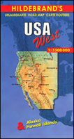
USA West Map
USA West from Insight, on a tour oriented road map of the whole region at a scale of 1:2, 000, 000 and with extensive tourist information on the legend and a detailed index booklet arranged alphabetically, with the facility to search by place name or point of interest, including national parks. Road network shown covers highways, trunk roads, main, secondary and track roads, with distance markers are provided on major routes and elevated passes indicated. Particularly scenic routes have been annotated. International/national airports and rail lines are shown.Places of interest, urban, cultural or natural are differentiated, with national parks and reserves and wildlife refuges, as well as restricted area zones and Indian reservations are demarcated. The map includes province,
undefined and time zone boundaries and indicates individual state capitals. Spot heights are given, and wells, rivers, lakes and volcanoes are indicated.
undefined and time zone boundaries and indicates individual state capitals. Spot heights are given, and wells, rivers, lakes and volcanoes are indicated.
Product Description
Reviews/Comments
Add New
Intelligent Comparison
Archived Product
USA West Stanfords
£10.95
Archived Product
USA West Stanfords
£8.99
Vouchers
No voucher codes found.
Do you know a voucher code for this product or supplier? Add it to Insights for others to use.
Do you know a voucher code for this product or supplier? Add it to Insights for others to use.
 Denmark