
 United Kingdom
 France
 Germany
 Netherlands
 Sweden
 USA
USA
 Italy
Italy
 Spain
Spain
More From Contributor


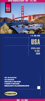
USA Reise Know-How
United States on an overview map at 1:4, 700, 000 for long-distance travel or route planning, published by Reise Know-How on light, waterproof and tear-resistant synthetic paper, with its index proving a separate list of places of interest, plus a driving distances/driving times map of country. Alaska and Hawaii are presented on insets at less detailed scales.Pleasant pastel background colouring shows the division of the country into states. The landscape is indicated by plenty of names of mountain ranges, deserts, peaks, passes, etc. National Parks and many other protected areas, as well as Indian Reservations are highlighted. Road network emphasises interstate highways, showing in miles driving distances on main and selected state routes. Numerous places of interest are
highlighted and listed on the reverse together with the main index. Latitude and longitude lines are drawn at 2° intervals. Map legend includes English.The reverse side also provides a diagrammatic map showing driving times and driving distances between selected larger cities.
highlighted and listed on the reverse together with the main index. Latitude and longitude lines are drawn at 2° intervals. Map legend includes English.The reverse side also provides a diagrammatic map showing driving times and driving distances between selected larger cities.

Product Description
Reviews/Comments
Add New
Vouchers
No voucher codes found.
Do you know a voucher code for this product or supplier? Add it to Insights for others to use.
Do you know a voucher code for this product or supplier? Add it to Insights for others to use.
 Denmark