
 United Kingdom
 France
 Germany
 Netherlands
 Sweden
 USA
USA
 Italy
Italy
 Spain
Spain
More From Contributor


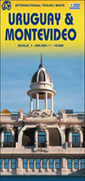
Uruguay & Montevideo ITMB
Uruguay and Montevideo on a double-sided map from ITMB combining a road map at 1:800, 000 with a street plan of the capital’s central districts, plus a enlargement of its environs and street plans of central Colonia del Sacramento and Punta del Este.On one side is an indexed road map of Uruguay at 1:800, 000 with coverage extending across the Rio de la Plata to show Buenos Aires and Tigre with the ferry connections to Colonia del Sacramento. Altitude colouring shows the topography, with graphics showing swamps and highlighting palm groves. Road network includes rough tracks and indicates distances on main routes. Railway lines are shown with stations. Symbols mark various places of interest, including campsites, beaches, etc. Also shown are internal administrative boundaries with
names of the provinces. The map has latitude and longitude lines at intervals of 30’. The reverse side presents and clear, indexed street plan of the central districts of Montevideo at 1:10, 000 highlighting numerous hotels, places of interest and facilities, all with names. Also provided is an enlargement of the city’s environs, plus street plans of central Colonia del Sacramento and Punta del Este, both annotated with accommodation and places of interest and showing access to terminals for ferry connections to Buenos Aires.
names of the provinces. The map has latitude and longitude lines at intervals of 30’. The reverse side presents and clear, indexed street plan of the central districts of Montevideo at 1:10, 000 highlighting numerous hotels, places of interest and facilities, all with names. Also provided is an enlargement of the city’s environs, plus street plans of central Colonia del Sacramento and Punta del Este, both annotated with accommodation and places of interest and showing access to terminals for ferry connections to Buenos Aires.

Product Description
Reviews/Comments
Add New
Vouchers
No voucher codes found.
Do you know a voucher code for this product or supplier? Add it to Insights for others to use.
Do you know a voucher code for this product or supplier? Add it to Insights for others to use.
 Denmark