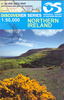
More From Contributor
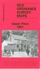
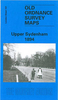
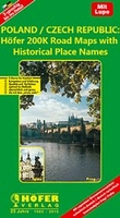
£6.50
Upper Lough Erne, map No. 27 in the Discoverer series from the Ordnance Survey of Northern Ireland presenting the country on detailed topographic maps at 1:50, 000 with waymarked hiking trails, Sustrans National Cycle Network & other tourist information. Coverage

Includes::
Lisnaskea, Newtownbutler, & Maguiresbridge. Current edition E; publication date April 2011. Maps in the Discoverer series have contours at 10m intervals, with plenty of spot heights & bold altitude colouring above 150m. Graphics indicate different types of woodlands. In coastal areas the maps show high & low water mark, cliffs, mud/shingle or s&, etc. Road network grades minor roads according to their widths,

Includes::
local tracks & shows gradients on steep routes. Railways are shown with stations & the maps include other details expected of topographic mapping at this scale. An overprint highlights waymarked walking trails as well as cycle routes of the Sustrans National Cycle Network. Boundaries of National Trust land are marked, indicating areas with limited opening. Places of interest are prominently highlighted & a range of symbols provide other tourist information including camping or caravan sites & youth hostels, bus stations, parking, picnic areas, viewpoints, gold courses, etc. Each map covers an area of 40 x 30km (25 x 19 miles approximately) & has a 1km Irish Grid, plus latitude & longitude margin ticks at 1` intervals. Map legend is English, French & German. On the reverse each sheet has an indexed monochrome map showing townland boundaries. To see the list of all the titles in this series please click on the series link.


...
Archived Product
£17.50
Upper Mustang area at 1:100, 000 in the Nepa Maps series which provides extensive coverage of trekking areas of Nepal on detailed contoured maps with trekking routes & hiking trails, huts & camp sites, local places of interest & other tourist information. The map shows trekking routes in the northern part of the Annapurna Conservation Area, from Jomosom & Muktinath to Lo-Manthang, & further north to the Kora La pass on the Tibetan border. Also shown are several spurs eastwards, including the Mustag – Phu trek & the Damodar Kunda trek. Contours are at 40m intervals, with relief shading & vegetation colouring. The index lists places, peaks, passes, lakes & base camps. Margin ticks show latitude & longitude at intervals of 5’. Additional information

Includes::
a plan of the Walled City of Lo-Manthang, a profile of the route, plus tables showing the route in stages with altitudes in metres & feet & trekking times.PLEASE NOTE: the same coverage, extending marginally further south & east, is also provided on the publishers’ map No. NA518, Upper & Lower Mustang at 1:90, 000. Titles in this series have cartography based on the country’s topographic survey, with contours usually at 40m or 50m intervals, enhanced by relief shading, colouring & graphics to show various features of the terrain, including glaciers, forested or cultivated areas, etc. Numerous peaks, with additional spot heights, plus names of glaciers & mountain ranges are prominently shown. The network of rivers, streams & lakes is shown in great detail, with many smaller rivers & lakes named. Overprint highlights main trekking routes & numerous local trails, with symbols indicating various places of interest & tourist facilities. Most maps are indexed & include additional information such as route profiles, glossaries, etc. All the information is in English & heights are given in metres.

...
Archived Product
£11.99
Upper Palatine Forest (Oberpfälzer Wald) in eastern Bavaria in a set of two detailed, contoured & GPS compatible maps at 1:50, 000 from Kompass with local & long-distance footpaths, cycling routes, accommodation, etc.KOMPASS HIKING & RECREATIONAL MAPS: this title is part of an extensive series covering Austria, much of Germany & the Slovenian Alps – TO SEE OTHER TITLES IN THIS SERIES PLEASE CLICK ON THE SERIES LINK. Kompass are Europe’s largest publishers of hiking maps; their mapping of other countries, including expanding coverage of Italy, is listed on our website separately.CARTOGRAPHY: the maps are contoured with additional shading, graphic relief & colouring to provide a more detailed picture of the terrain, vegetation and/or land use. Contour interval varies from 10m in the coastal areas of Northern Germany to 40 or 50 metres in the mountainous regions. All the maps highlight local & long-distance waymarked footpaths, including climbing trails. Most titles also show cycling routes, mountain bike trails, &, the in mountainous areas, ski routes. The maps indicate various types of accommodation (selected inns & hotels, youth hostels, campsites, mountain refuges), as well as recreational facilities, places of interest, etc. Latest editions also show access by public transport with bus stops and/or Park+ Ride facilities.GEOGRAPHICAL COORDINATES: unless indicated to the contrary in the individual description, the maps have a UTM grid for GPS users. MAP LEGEND: most maps now include full English legend, particularly titles covering the Alpine areas. Some maps covering mainly eastern Austria or the less popular parts of Germany may still have a legend in German only.OTHER

Features:
selected titles include on the reverse panorama drawings of their area with names of villages, peaks, valleys, etc. and/or have a booklet with pictures of local wild flowers with their Latin names. Many titles are now published as competitively priced sets of two or more maps, offering a wider coverage.BOOKLETS: PLEASE NOTE BEFORE ORDERING
- many titles come with a booklet describing the area and/or various hiking routes. Unless indicated in the individual description that the booklet

Includes::
English, these booklets are IN GERMAN only. The booklets are not necessary to use the maps since, as stated above, full English language map legend is provided.


...
Archived Product
£9.99
Map No. 192, Oberpfälzer Wald North, in a series of hiking maps from Kompass providing extensive coverage of Austria & Germany plus the Slovenian Alps, with hiking routes on a topographic base, various types of accommodation, recreational facilities, places of interest, etc. Many titles are now published as competitively priced sets of two or more maps, offering a wider coverage. Kompass are Europe’s largest publishers of walking maps, with extensive coverage of hiking areas in other countries, all listed on our website. * Cartography:* all the maps are contoured with additional shading & graphic relief to provide a more detailed picture of the terrain, vegetation and/or land use. Contour interval varies from 10 metres in the coastal areas of Northern Germany to 40 or 50 metres in the mountainous parts of the two countries. All the maps highlight local & long-distance waymarked footpaths, including climbing trails. Most titles also show cycling routes, mountain bike trails, &, the in mountainous areas, ski routes. The maps indicate various types of accommodation (selected inns & hotels, youth hostels, campsites, mountain refuges), as well as recreational facilities, places of interest, etc. New editions also show access by public transport with bus stops and/or Park+ Ride facilities.* Geographical coordinates:* unless indicated to the contrary in the individual description, the maps have a UTM grid for GPS users. * Map legend:* most maps now include full English legend, particularly titles covering the Alpine areas. Some maps covering mainly eastern Austria or the less popular parts of Germany may still have a legend in German only.* Other
Features:* some titles now include on the reverse panorama drawings of their area with names of villages, peaks, valleys, etc. and/or have booklets with pictures of local wild flowers with their Latin names.*PLEASE NOTE BEFORE ORDERING!* * Booklets:* many titles come with booklets describing the area and/or various hiking routes. These booklets are in * German only*, apart from a handful of titles where an English language booklet is specifically indicated in the individual description. So, unless English language booklet is actually mentioned, the map can only be supplied with a German booklet. These booklets are not necessary to use the maps since, as stated above, most titles now include * full English language map legend.*
...
Archived Product
£3.50
Upper Penn in 1901 in a fascinating series of reproductions of old Ordnance Survey plans in the Alan Godfrey Editions, ideal for anyone interested in the history of their neighbourhood or family. The map covers the southern part of Wolverhampton around Goldthorn Hill, extending southward to Sedgley Park & south-west to Upper Penn. Features include St Philip`s church, Coalway Farm, Upper Penn village, Muchall Hall, Muchall Grove, Manor House, Penn Court, Colton Hills, Penn Brick Works, Muchall Farm, Goldthorn Hill area, Penn Fields area, reservoirs, Goldthorn House, Sedgley Park Farm, etc. On the reverse are directories for Penn & Penn Fields, with street directory entries for Chequer Street, Coalway Lane, Eagle Street & Penn Road. * About the Alan Godfrey Editions of the 25” OS Series: Selected towns in Great Britain & Ireland are covered by maps showing the extent of urban development in the last decades of the 19th & early 20th century. The plans have been taken from the Ordnance Survey mapping & reprinted at about 15 inches to one mile (1:4, 340). On the reverse most maps have historical notes & many also include extracts from contemporary directories. Most maps cover about one mile (1.6kms) north/south, one & a half miles (2.4kms) across; adjoining sheets can be combined to provide wider coverage.FOR MORE INFORMATION & A COMPLETE LIST OF ALL AVAILABLE TITLES PLEASE CLICK ON THE SERIES LINK. ...
Archived Product
£12.99
Upper Somme Valley & Estuary: Abbeville
- Saint-Valery-sur-Somme area in a series of cycling maps from Sportoena covering Belgium
...
Archived Product
£3.50
Upper Sydenham in 1894 in a fascinating series of reproductions of old Ordnance Survey plans in the Alan Godfrey Editions, ideal for anyone interested in the history of their neighbourhood or family. Two versions cover this area, extending from Clive Road eastward to Kirkdale, & from Crescent Wood Road southward to Crystal Palace High Level station. Features include Gipsy Hill, Sydenham Hill & Upper Sydenham stations, West Hill, Alleyn Park, Kingswood House, Westwood House, High Street, Charleville Circus. The 1894 map also

Includes::
part of Crystal Palace Park with The Maze. The 1914 map has the area of Kent left blank so does not cover the Park. About the Alan Godfrey Editions of the 25” OS Series Selected towns in Great Britain & Ireland are covered by maps showing the extent of urban development in the last decades of the 19th & early 20th century. The plans have been taken from the Ordnance Survey mapping & reprinted at about 15 inches to one mile (1:4, 340). On the reverse most maps have historical notes & many also include extracts from contemporary directories. Most maps cover about one mile (1.6kms) north/south, one & a half miles (2.4kms) across; adjoining sheets can be combined to provide wider coverage.FOR MORE INFORMATION & A COMPLETE LIST OF ALL AVAILABLE TITLES PLEASE CLICK ON THE SERIES LINK.

...
Archived Product
£3.50
Upper Sydenham in 1914 in a fascinating series of reproductions of old Ordnance Survey plans in the Alan Godfrey Editions, ideal for anyone interested in the history of their neighbourhood or family. Two versions cover this area, extending from Clive Road eastward to Kirkdale, & from Crescent Wood Road southward to Crystal Palace High Level station. Features include Gipsy Hill, Sydenham Hill & Upper Sydenham stations, West Hill, Alleyn Park, Kingswood House, Westwood House, High Street, Charleville Circus. The 1894 map also

Includes::
part of Crystal Palace Park with The Maze. The 1914 map has the area of Kent left blank so does not cover the Park. About the Alan Godfrey Editions of the 25” OS Series Selected towns in Great Britain & Ireland are covered by maps showing the extent of urban development in the last decades of the 19th & early 20th century. The plans have been taken from the Ordnance Survey mapping & reprinted at about 15 inches to one mile (1:4, 340). On the reverse most maps have historical notes & many also include extracts from contemporary directories. Most maps cover about one mile (1.6kms) north/south, one & a half miles (2.4kms) across; adjoining sheets can be combined to provide wider coverage.FOR MORE INFORMATION & A COMPLETE LIST OF ALL AVAILABLE TITLES PLEASE CLICK ON THE SERIES LINK.

...
Archived Product
£19.99
Upper Valais: Visp
- Sierre
- Saas Fee area in Kümmerly + Frey’s series of cycling maps published in co-operation with the Association

...
Archived Product
£8.25
Upper Valley of the Main: Coburg
- Bamberg, map no. 50-3, in a series of special GPS compatible recreational editions of the
...
Archived Product

Upper Silesia

Upper Silesia at 1:200, 000 from Höfer Verlag in a series of road maps of areas which used to be part of Germany or the Austro-Hungarian Empire, showing both current and the old German place names. In many places former settlements which now no longer exist are also named. Present road and rail networks are supplemented by historical information, e.g. former railway lines. There is no relief detail apart from spot heights. Forests, nature reserves, national park boundaries and locations of interest are marked, and symbols indicate campsites, historical sites, etc. The maps have no geographical coordinates. *Map legend includes English.*As the maps have dual place names, the print is rather small, but each title comes with a special magnifying lens attached to the map cover. Also
included is a booklet with separate, cross-referenced indexes for each set of names and a street plan of the central part of the area’s main city, showing both old and current street layout.*In this title:* a street plan of central Opole/Oppeln.
RIP - This product is no longer available on our network. It was last seen on 25.09.2019

This page now acts as a permanent archive for this product. Add more information using the comments box below to ensure it can still be found by future generations.

Use our search facility to see if it is available from an alternative contributor.
  • External links may include paid for promotion
  • Availability: Out Of Stock
  • Supplier: Stanfords
  • SKU: 9783931103903
Availability: In Stock
£15.99

Product Description

Upper Silesia at 1:200, 000 from Höfer Verlag in a series of road maps of areas which used to be part of Germany or the Austro-Hungarian Empire, showing both current & the old German place names. In many places former settlements which now no longer exist are also named. Present road & rail networks are supplemented by historical information, e.g. former railway lines. There is no relief detail apart from spot heights. Forests, nature reserves, national park boundaries & locations of interest are marked, & symbols indicate campsites, historical sites, etc. The maps have no geographical coordinates. * Map legend

Includes::
English.* As the maps have dual place names, the print is rather small, but each title comes with a special magnifying lens attached to the map cover. Also included is a booklet with separate, cross-referenced indexes for each set of names & a street plan of the central part of the area’s main city, showing both old & current street layout.* In this title:* a street plan of central Opole/ Oppeln.

Reviews/Comments

Add New

Intelligent Comparison

Oooops!
We couldn't find anything!
Perhaps this product's unique.... Or perhaps we are still looking for comparisons!
Click to bump this page and we'll hurry up.

Price History

Vouchers

No voucher codes found.
Do you know a voucher code for this product or supplier? Add it to Insights for others to use.

Facebook

Jargon Buster

LENS - An optical element which converges or diverges light
Germany - A country in Central Europe.
Set - a group of items usually related to one another. Some objects cannot function without the complete set of items.
Small - something that takes up less space than normal.
Road - a manmade lane or a path that is used to speed up travel.
Print - A mechanical process of putting text onto paper. It can also relate to a pattern on an item.

Supplier Information

Stanfords
Stanfords was established in 1853 and opened their iconic Covent Garden flagship store in 1901. They have become the top retailer of maps, travel books and accessories in the UK and arguably offer the largest selection of maps and travel books worldwide. Famous names such as Captain Robert Falcon Scott, Ranulph Fiennes and Michael Palin have purchased from Stanfords. They now have a shop in Bristol and both stores together with other venues operate a calendar of events including talks, book signings and exhibitions. As a specialist map retailer, the map selection is comprehensive and includes road maps, street maps and walking maps from worldwide destinations, as well as a selection of world atlases and wall maps. Books include travel guides and travel literature. Stanfords also stock globes, from miniatures made of blue marble to magnificent floor-standing globes. The website features a selection of interesting articles on travel topics.
Page Updated: 2023-11-12 20:15:36

Community Generated Product Tags

Oh No! The productWIKI community hasn't generated any tags for this product yet!
Menu