
 United Kingdom
 France
 Germany
 Netherlands
 Sweden
 USA
USA
 Italy
Italy
 Spain
Spain
More From Contributor


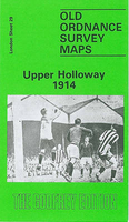
Upper Holloway 1914
Upper Holloway in 1914 in a fascinating series of reproductions of old Ordnance Survey plans in the Alan Godfrey Editions, ideal for anyone interested in the history of their neighbourhood or family. Three versions cover this area, stretching from Holloway Prison eastward to Green Lanes and Highbury New Park, and from Finsbury Park station southward to Aberdeen Park and Holloway station. The GNR main line runs north-south through the map, with many sidings, and part of the Canonbury Branch; Finsbury Park and Holloway stations are included, and the 1914 map has Drayton Park station. Railway information is detailed, with tracks, signal posts, air shafts etc. West of the railway is much of Holloway, including Holloway Road, the prison (left blank), Seven Sisters Road, Hornsey
Road, St Mary`s Workhouse Schools, West London Union Workhouse. East of the railway is part of Highbury around Highbury House and Highbury Park, while north of this is a detached part of Hornsey, South Hornsey, including Brownswood Park; the 1869 map has part of the New River here. Gillespie Road and Arsenal football ground are on the later map.About the Alan Godfrey Editions of the 25” OS Series:Selected towns in Great Britain and Ireland are covered by maps showing the extent of urban development in the last decades of the 19th and early 20th century. The plans have been taken from the Ordnance Survey mapping and reprinted at about 15 inches to one mile (1:4, 340). On the reverse most maps have historical notes and many also include extracts from contemporary directories. Most
maps cover about one mile (1.6kms) north/south, one and a half miles (2.4kms) across; adjoining sheets can be combined to provide wider coverage.FOR MORE INFORMATION AND A COMPLETE LIST OF ALL AVAILABLE TITLES PLEASE CLICK ON THE SERIES LINK.

Product Description
Reviews/Comments
Add New
Intelligent Comparison
Archived Product

Upper Holloway 1894 Stanfords
£3.50
Archived Product

Upper Holloway 1869 Stanfords
£3.50
Vouchers
No voucher codes found.
Do you know a voucher code for this product or supplier? Add it to Insights for others to use.
Do you know a voucher code for this product or supplier? Add it to Insights for others to use.
 Denmark