More From Contributor
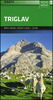
£10.99
Trieste on an indexed street plan at 1:10, 000 from Litografia Artistica Cartografica in their Globalmap imprint, with an enlargement presenting city’s historic centre in greater detail & clarity at 1:6, 000. 48 important buildings are prominently highlighted. The plan also indicates car parks within the city’s central area. Litografia Artistica Cartografica (LAC) are Italy’s leading publishers of street plans with an extensive range of titles. Where appropriate, the plans include an enlargement showing the historic centre in greater detail. On each plan monuments including historic buildings & churches, archaeological sites, cultural or educational institutions, & important municipal buildings or facilities are numbered & listed next to the plan. Unless indicated to the contrary in the individual description, one way streets are not marked. Street index is on the reverse. ...
Archived Product
£9.99
Jan Morris (then James) first visited Trieste as a soldier at the end of the Second World War. Since then, the city has come to represent her own life, with all its hopes, disillusionments, loves & memories. Here, her thoughts on a host of subjects
- ships, cities, cats, sex, nationalism, Jewishness, civility & kindness
- are inspired by the presence of Trieste, & recorded in or between the lines of this book. Evoking the whole of its modern history, from its explosive growth to wealth & fame under the Habsburgs, through the years of Fascist rule to the miserable years of the Cold War, when rivalries among the great powers prevented its creation as a free city under United Nations auspices, Trieste & the Meaning of Nowhere is neither a history nor a travel book; like the place, it is one of a kind. Jan Morris`s collection of travel writing & reportage spans over five decades &

Includes::
such titles as Venice, Coronation Everest, Hong Kong, Spain, Manhattan `45, A Writer`s World & the Pax Britannica Trilogy. Hav, her novel, was shortlisted for the Booker Prize & the Arthur C. Clarke Award.


...
Archived Product
£8.99
Literary legend James Bond returns to his 1950s heyday in this exhilarating thriller by Sunday Times bestselling author Anthony Horowitz. It`s 1957 & James Bond (agent 007) has only just survived his showdown with Auric Goldfinger at Fort Knox. By his side is Pussy Galore, who was with him at the end. Unknown to either of them, the USSR & the West are in a deadly struggle for technological superiority. & SMERSH is back. The Soviet counter-intelligence agency plans to sabotage a Grand Prix race at the most dangerous track in Europe. But it`s Bond who finds himself in the driving seat & events take an unexpected turn when he observes a suspicious meeting between SMERSH`s driver & a sinister Korean millionaire, Jai Seong Sin. Soon Bond is pitched into an entirely different race uncovering a plan that could bring the West to its knees. Welcoming back familiar faces, including M & Miss Moneypenny, international bestselling author Anthony Horowitz ticks all the boxes: speed, danger, strong women & fiendish villains, to reinvent the golden age of Bond in this brilliantly gripping adventure. Trigger Mortis is also the first James Bond novel to feature previously unseen Ian Fleming material. This is James Bond as Fleming imagined him. ...
Archived Product
£6.99
Concise & Abridged Edition In this blistering polemic, veteran journalist Mick Hume presents an uncompromising defence of freedom of expression, which he argues is threatened in the West, not by jackbooted censorship but by a creeping culture of conformism & You-Can`t-Say-That. In a fierce defence of free speech
- in all its forms
- Mick Hume`s blistering polemic exposes the new threats facing us today in the historic fight for freedom of expression. In 2015, the cold-blooded attacks in Paris on the Charlie Hebdo cartoonists united the free-thinking world in proclaiming ` Je suis Charlie`. But it wasn`t long before many were arguing that the massacres showed the need to restrict the right to be offensive. Meanwhile sensitive students are sheltered from potentially offensive material & Twitter vigilantes police those expressing the `wrong` opinion. But the basic right being supressed
- to be offensive, despite the problems it creates
- is not only acceptable but vital to society. Without a total freedom of expression, other liberties will not be possible.


...
Archived Product
£8.99
In Trigger Warning, global phenomenon & Sunday Times bestselling author Neil Gaiman returns to dazzle, captivate, haunt, & entertain with this third collection of short fiction, which

Includes::
a Doctor Who adventure, the David Bowie-inspired The Return of the Thin White Duke & a never-before published American Gods story, Black Dog. The Truth is a Cave in the Black Mountains was serialised on BBC Radio 4`s Book at Bedtime in November 2015. ` We are all wearing masks. That is what makes us interesting. These are stories about those masks, & the people we are underneath them.` Neil Gaiman, writing from a cabin in the dark woods. Make sure you secure your own mask before reading. Before being transported to worlds filled with witches, watchers & big black bees, with deathless Kin & pirate girls, with things that prowl in the darkness beyond the circle fire, to find the Shadder lurking at your journey`s end. But then what happens? There`s always something waiting for you. There`s always more. Just keep turning the pages.` We each have our little triggers.` Literary alchemy from `a writer of rare perception & endless imagination` (William Gibson), TRIGGER WARNING is a cornucopia of storytelling: horror & ghost stories, science fiction & fairy tales, fabulism & poetry. It will open your eyes to the inexhaustible supply of darkness around you, the magic & the monsters, the myths & the miracles, & to finding truths in the most extraordinary of places.

...
Archived Product
£9.99
Triglav
- Kranjska Gora
- Bohinj area of the Triglav National Park in the Julian Alps at 1:25, 000 on a double-sided, contoured

...
Archived Product
£9.95
Triglav National Park at 1:50, 000 in a series of contoured GPS compatible walking & cycling maps covering the rest of Slovenia (including alternative coverage of the Julian Alps) at 1:75, 000 from Kartografija in Ljubljana. This title is not shown on the accompanying series grid. It covers a slightly smaller area than sheet No.1 (Julian Alps West), extending roughly from Bovec in the west to Bled in the east, & from Kranjska Gora in the north to just short of Tolmin in the south. On the reverse are bilingual descriptions of the region ...
Archived Product
£7.95
A clear map highlighting walking routes, covering much of the Triglav NP, excluding the southern & eastern extremities. The cartography used is an enlarged version of an original 1:50, 000 map. Coverage extends from Bohinjska Bistrica in the south east corner to Ratece in the north & the westernmost extremity of the park. A small inset displays the environs of Bled & Gorje, a little further to the east of the main map area. The area shown is thus smaller than that in the Julian Alps (WK141) map at 1:50, 000 by the same publisher. Relief is shown by contours at 20m intervals, spot heights & hill-shading. Communication detail

Includes::
bridle paths, railways, funiculars, cable cars, ski lifts. Highlighted walking routes distinguish waymarked paths, partially marked routes & difficult routes. Symbols depict such details as campsites, bus stops, mountain cabins, car parks & various other landmarks. Map legend

Includes::
English. An accompanying index booklet provides notes on mountain huts, suggested walks & places of interest, in German only.


...
Archived Product
£11.99
Triglav National Park at 1:50, 000 on a contoured & GPS compatible walking & cycling map from Kartografija in Ljubljana, waterproof & tear-resistant version, with on the reverse descriptions of the area’s best sights. Coverage extends from Bovec in the west to Bled in the east, & from Kranjska Gora in the north to just short of Tolmin in the south. On the reverse are bilingual descriptions of the region’s places of interest, including special notes on the World War I Isonzo Front, plus list of mountain huts & campsites with contact details. Maps in this series have contours at 20m intervals, enhanced by relief shading, with plenty of spot heights & names of peaks, mountain chains, etc. Local hiking routes are highlighted, indicating difficult passages. Also marked are recommended cycling routes. Symbols indicate various types of accommodation including mountain huts, campsites, inns with lodgings, tourist farms or apartments, hotels & motels, as well as recreational facilities (golf, horse riding, swimming pools, etc), vineries, cultural & historical sites, etc. Road network indicates locations of petrol stations. Railway lines are shown with stations & various types of mountain transport (gondolas, chair lifts, etc) are marked. The maps have a latitude & longitude grid at intervals of 2’’. Map legend & all the text include English. To see the list of titles in this series, including alternative coverage of the Triglav National Park, please click on the series. ...
Archived Product
£8.99
The central area of the Triglav National Park around the peak of Triglav at 1:25, 000 on a contoured, GPS compatible pocket map from Kartografija, with hiking trails, including brief descriptions of eight recommended routes, mountain huts, interesting natural sites, etc. Along the lower slopes a few cycling routes are also highlighted. Kartografija’s pocket hiking maps at 1:25, 000 show walking trails & cycling routes, along with numerous tourist facilities & recreational sites. Topography is shown by contours at 20m intervals enhanced by relief shading & graphic relief to show exposed rocky areas, plus colouring for woodlands. Hiking trails & cycling routes are prominently highlighted, & symbols indicate locations of various accommodation options including campsites & mountain huts, sport & recreational sites & facilities, natural features of particular interest, etc. The maps have a grid with latitude & longitude lines at 1’ intervals. Map legend

Includes::
English. On the reverse each map has extensive bilingual Slovenian/ English text with more tourist information, illustrated with colour photos. To see the list of all the titles in this series please click on the series link.

...
Archived Product

Triglav (25K)

The central part of the Triglav National Park on a light, waterproof and tear-resistant, contoured and GPS compatible map at 1:25, 000 from Kartografija, with on the reverse details of local mountain shelters with photos and QR codes. The map is centered on the peak of Triglav and coverage extends north to Kranjska Gora, south to the Bohinj Lake, west to Trenta, and east to Bohinjska Bistrica in the south-eastern corner of the map.Contours at 10m intervals with shading and graphics relief, plus plenty of spot heights provide and excellent presentation of the topography. An overprint highlights waymarked hiking trails, indicating difficult sections. 32 mountain shelters are cross-referenced to the information on the reverse, with more symbols highlighting locations of other tourist
accommodation (including campsites, farms with lodgings, etc), inns, climbing sites, viewpoints, interesting natural or cultural sites, etc. Road network shows car parks and petrol stations. The map has latitude and longitude lines at 1’ intervals plus UTM crosshairs at 1km intervals. On the reverse an overview map highlights eight access routes to the peak of Triglav. 25 shelters are presented with photos, contact details, GPS coordinates and QR codes for further information; also listed are seven more huts highlighted on the map. Bilingual descriptions cover the region’s best sights. Map legend and all the text include English.To see the list of titles in this series please click on the series link.
RIP - This product is no longer available on our network. It was last seen on 25.09.2019

This page now acts as a permanent archive for this product. Add more information using the comments box below to ensure it can still be found by future generations.

Use our search facility to see if it is available from an alternative contributor.
  • External links may include paid for promotion
  • Availability: Out Of Stock
  • Supplier: Stanfords
  • SKU: 3830048523677
Availability: In Stock
£11.99

Product Description

The central part of the Triglav National Park on a light, waterproof & tear-resistant, contoured & GPS compatible map at 1:25, 000 from Kartografija, with on the reverse details of local mountain shelters with photos & QR codes. The map is centered on the peak of Triglav & coverage extends north to Kranjska Gora, south to the Bohinj Lake, west to Trenta, & east to Bohinjska Bistrica in the south-eastern corner of the map. Contours at 10m intervals with shading & graphics relief, plus plenty of spot heights provide & excellent presentation of the topography. An overprint highlights waymarked hiking trails, indicating difficult sections. 32 mountain shelters are cross-referenced to the information on the reverse, with more symbols highlighting locations of other tourist accommodation (including campsites, farms with lodgings, etc), inns, climbing sites, viewpoints, interesting natural or cultural sites, etc. Road network shows car parks & petrol stations. The map has latitude & longitude lines at 1’ intervals plus UTM crosshairs at 1km intervals. On the reverse an overview map highlights eight access routes to the peak of Triglav. 25 shelters are presented with photos, contact details, GPS coordinates & QR codes for further information; also listed are seven more huts highlighted on the map. Bilingual descriptions cover the region’s best sights. Map legend & all the text include English. To see the list of titles in this series please click on the series link.

Reviews/Comments

Add New

Intelligent Comparison

Oooops!
We couldn't find anything!
Perhaps this product's unique.... Or perhaps we are still looking for comparisons!
Click to bump this page and we'll hurry up.

Price History

Vouchers

No voucher codes found.
Do you know a voucher code for this product or supplier? Add it to Insights for others to use.

Facebook

Jargon Buster

GPS - Global Positioning System - Global position using satellites
Hiking - An outdoor activity envolving walking in nature
Graphics - A general term for visual aspects of an item/display
Waterproof - Resistant to water, usualy specified by depth in metres
Car - A machine used for transport which runs on roads
Natural - not manmade
Network - A link and communication between things. Often computers or people.
Road - a manmade lane or a path that is used to speed up travel.
Resistant - Something that can repel against something.
Accommodation - A room in which someone can live in, for example in a hotel

Supplier Information

Stanfords
Stanfords was established in 1853 and opened their iconic Covent Garden flagship store in 1901. They have become the top retailer of maps, travel books and accessories in the UK and arguably offer the largest selection of maps and travel books worldwide. Famous names such as Captain Robert Falcon Scott, Ranulph Fiennes and Michael Palin have purchased from Stanfords. They now have a shop in Bristol and both stores together with other venues operate a calendar of events including talks, book signings and exhibitions. As a specialist map retailer, the map selection is comprehensive and includes road maps, street maps and walking maps from worldwide destinations, as well as a selection of world atlases and wall maps. Books include travel guides and travel literature. Stanfords also stock globes, from miniatures made of blue marble to magnificent floor-standing globes. The website features a selection of interesting articles on travel topics.
Page Updated: 2023-11-12 20:15:36

Community Generated Product Tags

Oh No! The productWIKI community hasn't generated any tags for this product yet!
Menu