More From Contributor

£9.99
Fran Sandham’s ” Traversa” is a part travelogue, part history & entirely awe-inspiring account of one man’s grit, determination & sheer obsession with the continent of Africa. Walking 3, 000 miles across Africa, from the Skeleton Coast to the Indian Ocean, Sandham was inspired by the great explorers, leaving behind the daily grind of London to undertake an extraordinary adventure & see for himself whether any trace of the Africa of Victorian times exists in the Africa of today. Along the way he befriends a donkey called ‘ Where You Get Stuck’; risks muggings & potentially much worse whilst sleeping beneath a vast canopy of Africa stars; encounters all manner of creatures from scorpions & snakes to tsetse flies & voracious mosquitoes. Interwoven with his experiences are tales of battles & conquests, cannibalism & madness from the original expeditions of Livingstone, Stanley & Grogan. ...
Archived Product
£9.99
Redmond O' Hanlon helps decimate the oceans by joining a deep-sea trawler crew on one of their gut-wrenching, roller-coaster forays into the north atlantic. A rarely documented way of life & its privations & hazards is vividly brought to the reader as the author mucks in with the crew & shares his fascination with the bizarre fish brought to the surface. ...
Archived Product
£16.99
Topographic survey of Sweden at 1:50, 000, the Terrängkartan, from the Lantmäteriet, covering most of the country in 244 double-sided maps. Please note: the mountainous regions of central & northern Sweden are not covered by this series but presented in a separate “ Fjällkartan
- Mountain Map” series also listed on our website. Each 1:50, 000 topographic survey map covers an area of 37.5 x 40km. The maps have contours at 5 metre intervals, plus relief shading & graphics for rocky outcrops & boulders. Further graphics and/or colouring show different types of land use or vegetation (forests, arable l&, orchards, marshes, peat bogs, etc). An unusual feature of this survey is the colouring indicating buildings below or above two storeys high & “leisure/holiday homes”. The maps indicate privately maintained roads & include all other information expected of topographic survey at this scale. The maps have a 1-km UTM grid, plus latitude & longitude lines 5’ intervals. Map legend

Includes::
English. For coverage of the country’s most visited hiking areas in central & northern Sweden please see Lantmäteriet’s Mountain Map series, listed separately on our website.


...
Archived Product
£11.50
Topographic survey of France at 1:25, 000 in IGN`s excellent TOP25 / Série Bleue series. All the maps are GPS compatible, with a 1km UTM grid plus latitude & longitude lines at 5’ intervals. Contours are at 5m intervals except for mountainous areas where the maps have contours at 10m intervals, vividly enhanced by hill shading & graphics for rocky terrain. Colouring with graphics indicates different types of vegetation or land use (deciduous or coniferous forests, moors, orchards, vineyards, etc). PLEASE NOTE: coverage of France at this scale is currently being revised – the format & the presentation of each title are indicated by the letters at the end of its Sheet Reference number (e.g. 0416ET, 3531ETR, 1923SB, etc.)MAPS WITH FULL TOURIST OVERPRINT & AN ENGLISH MAP LEGEND: all TOP25 maps & the SB editions of Série Bleue have an overprint highlighting waymarked walking trails including long-distance GR routes &, where appropriate, ski routes. Symbols indicate campsites, gîtes d’etape, refuges, equestrian centres & other recreational facilities or sites, tourist information centres, cultural heritage, etc. Towns & locations of particular interest are highlighted.- ET or OT = single-sided TOP25 map covering approx. 29x 21 km / 18x 13 miles.- ETR or OTR = waterproof & tear resistant TOP25 map covering the same area as the corresponding ET or OT number, but double-sided, printed on a smaller size sheet with a good overlap between the sides.- SB = Série Bleue map with full tourist overprint; these maps, first introduced in summer 2014, each cover approx. 29x 24km / 18x 15 miles.SÉRIE BLEUE maps with numbers ending in E (Est) or O (Ouest): most editions now indicate the GR routes, but do not show any other tourist information. Map legend is in French only. Each map covers approx. 14x 20km / 9x 12 miles. ...
Archived Product
£23.99
Trøgstad area in Norway in a series of GPS compatible recreational maps at 1:50, 000 with cartography from Norway’s topographic survey & additional tourist information. Contours lines are drawn at 20m intervals. The overprint varies from title to title, but

Includes::
local footpaths, in some cases distinguishing between easy & more difficult trails, as well as mountain huts & campsites. Many titles also indicate cycle or ski routes, other accommodation possibilities, sport & recreational facilities, including alpine skiing slopes, places of interest, etc. The maps have a UTM grid & margin ticks giving latitude & longitude. Map legend

Includes::
English. Several titles have on the reverse additional tourist information, although in most cases in Norwegian only. To see the list of Turkart maps at 1:50, 000 & links to Turkart series at 25K, 100K & Hiking Sets please click on the series link above.


...
Archived Product
£17.99
One of the titles in the topographic survey of the Svalbard group published in a colour version, available for the western coast, central & southern part of Spitzbergen, plus two small islands of Svenskøya & Kongsøya. The map has contours at 25-metre intervals, bold relief shading & spot heights, & shows settlements, roads & tracks, working & disused mines, airfields, lighthouses & radio beacons, etc. A grid gives UTM co-ordinates plus latitude in steps of 10` & longitude in 20’. The rest of Spitzbergen, Nordaustlandet, Edgeøya & other small islands are covered by black & white maps with contours only. Most of these maps show no geographical names, as indicated in the individual descriptions of each title. ...
Archived Product
£13.99
Weather, water, & climate. How we feel, how productive we are, even our sheer existence, depends on these three things. The United States` economic activity varies annually by 1.7% due to weather--that is more than $500 billion dollars each year! Weather applications on mobile devices are the second most popular `apps`
- more popular than social networking, maps, music, & news. In Treading on Thin Air, Dr. Elizabeth Austin, a world-renowned atmospheric physicist, reveals how the climate is intimately tied to our daily lives. The effects & impacts of weather on humans, society & the planet are changing with the times. Dr. Austin will demystify climate change, revealing what is really happening with our climate & why, whether it is El Nino, tornadoes, floods or hurricanes. Weather & society are at its most fascinating at extremes, & as Dr. Austin is one of a handful of forensic meteorologists around the globe. She has been called upon to investigate plane crashes, murders, wildfires, avalanches, even bombing cases. Drawing upon her rich experiences, Austin`s Treading on Thin Air promises to be an enlightening & informative journey through the wild word of weather.
...
Archived Product
£8.99
Patrick O` Brian`s Aubrey-Maturin tales are widely acknowledged to be the greatest series of historical novels ever written. To commemorate the 40th anniversary of their beginning, with Master & Commander, these evocative stories are being re-issued in paperback with smart new livery. This is the ninth book in the series. Uniquely among authors of naval fiction, Patrick O` Brian allows his characters to develop with experience. The Jack Aubrey of Treason`s Harbour has a record of successes equal to that of the most brilliant of Nelson`s band of brothers, & he is no less formidable or decisive in action or strategy. But he is wiser, kinder, gentler too. Much of the plot of Treason`s Harbour depends on intelligence & counter-intelligence, a field in which Aubrey`s friend Stephen Maturin excels. Through him we get a clearer insight into the life & habits of the sea officers of Nelson`s time than we would ever obtain seeing things through their own eyes. There is plenty of action & excitement in this novel, but it is the atmosphere of a Malta crowded with senior officers waiting for news of what the French are up to, & wondering whether the war will end before their turn comes for prize money & for fame, that is here so freshly & vividly conveyed. ...
Archived Product
£30.00
In 1987, Beesley Gibbons Ltd gained permission from both St James's Palace & the Treasure Houses Group to produce a series of hardback books reflecting the glory of the great estates of Britain. Photographers gained access to the various houses & castles which form an important part of Britain's heritage, not only taking the reader on a guided tour of these great estates, but also going behind the scenes to areas seldom visited by the public. ...
Archived Product
£11.99
Join Alice Melvin on this very special treasure hunt. You must search high & low to find the objects & stick them into your book to complete the pages. Can you find some feathers to complete the beautiful bird`s tail? Can you find a shiny coin, or a bright button? What about some sequins & glitter to create a butterfly? Only when all the pages are finished will the treasure hunt be complete! A beautiful craft activity book to entertain children of all ages. This book will provide hours of fun & also leave a book of memories that will last a lifetime. ...
Archived Product

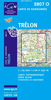
Tre Cime Di Lavaredo/Drei Zinnen

Map No. 047, Tre Cime di Lavaredo/Drei Zinnen - with a panorama map on the reverse, from Kompass in a series providing detailed coverage of the Dolomites and Lake Garda area and supplementing their main series of walking maps of Italy at 1:50, 000. Maps in this series have a more detailed base and smaller contour interval than coverage at 1:50, 000.Cartography: maps at 1:25, 000 have contours at 25-m intervals. An overprint shows local and long-distance footpaths, including all the high level routes (Alte Vie). The maps also show the via ferrata paths along the iron rails and ladders fitted into the rock faces. Other information includes various types of accommodation (campsites, alpine huts and refuges, etc.), recreational facilities, places of interest, local bus stops, etc.
Many titles also have mountain bike trails or ski routes. Selected titles include on the reverse panorama drawings of the area, as indicated in the individual descriptions.Geographical coordinates: most maps are now GPS compatible - titles without geographical coordinates are annotated to that effect in their individual description.Map legend includes English.PLEASE NOTE BEFORE ORDERING! Booklets: many titles come with booklets describing the area and/or various hiking routes. These booklets are in Italian and German only, apart from a handful of titles where an English language booklet is specifically indicated in the individual description. So, unless English language booklet is actually mentioned, the map can only be supplied with an Italian/German booklet. These booklets are not
necessary to use the maps since, as stated above, full English language map legend is provided.
RIP - This product is no longer available on our network. It was last seen on 25.09.2019

This page now acts as a permanent archive for this product. Add more information using the comments box below to ensure it can still be found by future generations.

Use our search facility to see if it is available from an alternative contributor.
  • Availability: Out Of Stock
  • Supplier: Stanfords
  • SKU: 9783854913986
Availability: In Stock
£8.95

Product Description

Map No. 047, Tre Cime di Lavaredo/ Drei Zinnen
- with a panorama map on the reverse, from Kompass in a series providing detailed coverage of the Dolomites & Lake Garda area & supplementing their main series of walking maps of Italy at 1:50, 000. Maps in this series have a more detailed base & smaller contour interval than coverage at 1:50, 000. Cartography: maps at 1:25, 000 have contours at 25-m intervals. An overprint shows local & long-distance footpaths, including all the high level routes (Alte Vie). The maps also show the via ferrata paths along the iron rails & ladders fitted into the rock faces. Other information

Includes::
various types of accommodation (campsites, alpine huts & refuges, etc.), recreational facilities, places of interest, local bus stops, etc. Many titles also have mountain bike trails or ski routes. Selected titles include on the reverse panorama drawings of the area, as indicated in the individual descriptions. Geographical coordinates: most maps are now GPS compatible
- titles without geographical coordinates are annotated to that effect in their individual description. Map legend

Includes::
English.PLEASE NOTE BEFORE ORDERING! Booklets: many titles come with booklets describing the area and/or various hiking routes. These booklets are in Italian & German only, apart from a handful of titles where an English language booklet is specifically indicated in the individual description. So, unless English language booklet is actually mentioned, the map can only be supplied with an Italian/ German booklet. These booklets are not necessary to use the maps since, as stated above, full English language map legend is provided.

Reviews/Comments

Add New

Intelligent Comparison

Oooops!
We couldn't find anything!
Perhaps this product's unique.... Or perhaps we are still looking for comparisons!
Click to bump this page and we'll hurry up.

Price History

Vouchers

No voucher codes found.
Do you know a voucher code for this product or supplier? Add it to Insights for others to use.

Facebook

Jargon Buster

GPS - Global Positioning System - Global position using satellites
Hiking - An outdoor activity envolving walking in nature
Italian - A word used ot descibe something from Italy
iron - An electrical deviced used for removing creases from fabrics
iron - A chemical element (FE). The most common element on earth
Italy - a country in Europe.
Language - the method of communication used in different areas. Humans and computers have many different languages.
Accommodation - A room in which someone can live in, for example in a hotel
Individual - A single separate item or person.
Language - The way humans communicate either written and spoken.

Supplier Information

Stanfords
Stanfords was established in 1853 and opened their iconic Covent Garden flagship store in 1901. They have become the top retailer of maps, travel books and accessories in the UK and arguably offer the largest selection of maps and travel books worldwide. Famous names such as Captain Robert Falcon Scott, Ranulph Fiennes and Michael Palin have purchased from Stanfords. They now have a shop in Bristol and both stores together with other venues operate a calendar of events including talks, book signings and exhibitions. As a specialist map retailer, the map selection is comprehensive and includes road maps, street maps and walking maps from worldwide destinations, as well as a selection of world atlases and wall maps. Books include travel guides and travel literature. Stanfords also stock globes, from miniatures made of blue marble to magnificent floor-standing globes. The website features a selection of interesting articles on travel topics.
Page Updated: 2023-11-12 20:15:36

Community Generated Product Tags

Oh No! The productWIKI community hasn't generated any tags for this product yet!
Menu