More From Contributor

£3.50
Tranmere & Oxton in 1909 in a fascinating series of reproductions of old Ordnance Survey plans in the Alan Godfrey Editions, ideal for anyone interested in the history of their neighbourhood or family. The map covers the southern area of Birkenhead around Tranmere, Devonshire Park & east Oxton. Coverage stretches from Oxton Hall & Talbot Road eastward to Old Chester Road, & from Grange Mount southward to Tranmere Hall & Prenton Road East. Features include football ground, Devonshire Park, tramways, Mersey Park, Arno Hill, Southgrove Nursery, Birkenhead Workhouse, Apple Grove, Oxton Hill Nursery, St Mark`s church, St Saviour`s church (at western edge of map), Clifton Park, many villas to the west & terraces further east, Holt House, St Luke`s church, engine shed, Central station, etc. On the reverse are selections from a street directory, including Borough Road, Church Road, Derby Road, Derby Street & Willmer Road. About the Alan Godfrey Editions of the 25” OS Series: Selected towns in Great Britain & Ireland are covered by maps showing the extent of urban development in the last decades of the 19th & early 20th century. The plans have been taken from the Ordnance Survey mapping & reprinted at about 15 inches to one mile (1:4, 340). On the reverse most maps have historical notes & many also include extracts from contemporary directories. Most maps cover about one mile (1.6kms) north/south, one & a half miles (2.4kms) across; adjoining sheets can be combined to provide wider coverage.FOR MORE INFORMATION & A COMPLETE LIST OF ALL AVAILABLE TITLES PLEASE CLICK ON THE SERIES LINK. ...
Archived Product
£5.95
Double-sided, waterproof & tear-resistant map of the central part of the Trans Pennine Trail at 1:50, 000, ideal for walkers, cyclists & horse riders. The map covers the north/south section from between Leeds, Sheffield & Chesterfield, including a section of the west/east trail near Barnsley. The trail is shown in sections, with colours & symbols clearly showing routes for cyclists, walkers, & horses. Danger points & pedestrian crossings are marked. Symbols indicate various facilities on or near the route (accommodation, pubs & cafes, food shops, banks, etc). Nearby railway & metro stations are marked, & several stretches across urban areas are shown in greater detail on enlargements. Topography is indicated by gradient markings on steep roads. The map has geographical coordinates for those using GPS. The map

Includes::
an introduction to the trail, information on access by public transport & other useful information. The eastern & western sections of the route are covered by two separate maps.

...
Archived Product
£5.95
Double-sided, waterproof & tear-resistant map of the western part of the Trans Pennine Trail at 1:50, 000, ideal for walkers, cyclists & horse riders. The map covers the section from Southport, across Liverpool, Warrington, Stockport & the northern part of the Peak District, to Broomhill east of Barnsley. The trail is shown in six sections, with colours & symbols clearly showing routes for cyclists, walkers, & horses. Danger points & pedestrian crossings are marked. Symbols indicate various facilities on or near the route (accommodation, pubs & cafes, food shops, banks, etc). Nearby railway & metro stations are marked, & several stretches across urban areas are shown in greater detail on enlargements. Topography is indicated by gradient markings on steep roads. The map has geographical coordinates for those using GPS. The map

Includes::
an introduction to the trail, information on access by public transport & other useful information. The eastern section of the route is covered by a separate map. Also published is a map of a north/south variant between Leeds & Sheffield / Chesterfield.

...
Archived Product
£5.95
Double-sided, waterproof & tear-resistant map of the eastern part of the Trans Pennine Trail at 1:50, 000, ideal for walkers, cyclists & horse riders. The map covers the eastern section of the route, from Broomhill east of Barnsley, across Doncaster & Hull, to Hornsea on the coast, with a spur from Selby to York. The trail is shown in sections, with colours & symbols clearly showing routes for cyclists, walkers, & horses. Danger points & pedestrian crossings are marked. Symbols indicate various facilities on or near the route (accommodation, pubs & cafes, food shops, banks, etc). Nearby railway & metro stations are marked, & several stretches across urban areas are shown in greater detail on enlargements. Topography is indicated by gradient markings on steep roads. The map has geographical coordinates for those using GPS. The map

Includes::
an introduction to the trail, information on access by public transport & other useful information. The western section of the route is covered by a separate map; also published is a map of the north/south variant between Leeds & Sheffield/ Chesterfield.

...
Archived Product
£9.99
The 184km long Transalpine Route from the German Alps across the Austrian Tyrol to the Dolomites on a waterproof & tear-resistant, contoured & GPS compatible concertina map from Kompass presenting the route on 13 panels, each 17.5x 20cm, plus accommodations recommendations & street plans. Leading from Gmund on lake Tegernsee in Bavaria, the route winds its way across Tyrol via Achensee, Jenbach, Mayrhofen & the Zillertal valley, before crossing to Vipiteno/ Sterzing in the Italian South Tyrol. The route is highlighted on maps at 1:50, 000 & is annotated with 5km markers. Topography is shown by contours at 40m intervals, enhanced by relief shading & spot heights, with colouring and/or graphics to indicate scree, woodlands, vineyards & hop fields, etc. Symbols show various accommodation options including campsites & youth hostels, sport & recreational facilities, & places of interest. Road network, presented in detail including forest tracks & country paths, indicates locations of car parks. Railway lines & mountain transport facilities (cable car lines, chair lifts) are also marked. Each panel has a 2-km UTM grid. Street plans cover Tegernsee, Achenkirch, Mayrhofen & Vipiteno/ Sterzing. A route profile shows the changes in altitude along the trail. Also provided is a list of recommended accommodation facilities for the whole course of the route, plus a list of ‘ Mittagseinkehrmöglichkeiten’ (lunch refreshments possibilities). Map legend

Includes::
English; all other text is in German only.

...
Archived Product
£16.99
`A scathing, lively & timely look at the ” European city”, from one of our most provocative voices on culture & architecture today` Owen Jones A searching, timely account of the condition of contemporary Europe, told through the landscapes of its cities Over the past twenty years European cities have become the envy of the world: a Kraftwerk Utopia of historic centres, supermodernist concert halls, imaginative public spaces & futuristic egalitarian housing estates which, interconnected by high-speed trains traversing open borders, have a combination of order & pleasure which is exceptionally unusual elsewhere. In Trans-Europe Express, Owen Hatherley sets out to explore the European city across the entire continent, to see what exactly makes it so different to the Anglo-Saxon norm
- the unplanned, car-centred, developer-oriented spaces common to the US, Irel&, UK & Australia. Attempting to define the European city, Hatherley finds a continent divided both within the EU & outside it. ` The latest heir to Ruskin.`
- Boyd Tonkin, Independent ` Hatherley is the most informed, opinionated & acerbic guide you could wish for.`
- Hugh Pearman, Sunday Times ` Can one talk yet of vintage Hatherley? Yes, one can. Here are all the properties that have made him one of the most distinctive writers in England
- not just `architectural writers`, but writers full stop: acuity, contrariness, observational rigour, frankness & beautifully wrought prose.`
- Jonathan Meades


...
Archived Product
£4.99
This is no ordinary experience. On the Trans-Siberian, the train itself becomes its own fascinating world. Nowadays, it's a lot easier to stop off at some of the intriguing & historic towns along the way, including Yekaterinburg, Irkutsk, Ulan Ude & the Mongolian capital, Ulaanbaatar. But for many travellers, the special pleasure of the Trans-Siberian is simply being on board this legendary train & watching the vast emptiness of Siberia pass by from the window. ...
Archived Product
£15.99
The definitive guide to the World`s Greatest Rail Journey: a trip across Siberia on the longest continuous railway track in the world is undoubtedly the journey of a lifetime. It`s also a convenient way to reach China, Mongolia or Japan. Tickets are not expensive or difficult to arrange. Siberia is now wide open to visitors – for the first time in Russia`s history you can now travel almost anywhere you want in Siberia: Trailblazer tells you how to arrange a trip, where to buy tickets & where to go. Featuring a detailed kilometre-by-kilometre route guide covering the entire routes of the Trans-Siberian, Trans-Manchurian, Trans-Mongolian & BAM railways detailing all points of interest along the way. With over 40 rail maps in English, Russian & Chinese: see where you are as you travel. The Trailblazer Tran-Siberian Handbook details the history of Siberia & the railway, the construction & running of the railway. It features city guide pages with the best sights, places to stay & restaurants for all budgets: Moscow, St Petersburg, Ulan Bator, Harbin, Beijing & 35 towns in Siberia & including city maps; plus Lake Baikal Guide This 9th edition has been revised (all routes were retravelled) & expanded &

Includes::
90 maps, Russian, Mongolian & Chinese phrases, rail fares & timetables, 16pp colour introduction, including ` Best of Trans-Siberian`, added colour sections on Moscow & Lake Baikal. Trailblazer Rail Guides series; highly practical, informative & portable guides designed specifically for those wanting to discover a country by train. Each title in the series explores its destination with reference to seeing & experiencing countries such as Japan, Australia & Canada using their extensive rail networks. Designed with practicality in mind, each guide describes the entire railway system in clearly defined stages & regions, allowing visitors to plan their journey or journeys accordingly. Strong on both practical content & cultural & historical background, Trailblazer Rail Guides provide extensive kilometre by kilometre route guide description, exploring the country’s history, culture, food & local customs in addition to giving practical advice on accessing site of interest when travelling by train. Dedicated town & city guides are included throughout the guide, with advice for travellers on all budgets of recommended places to stay, places to eat & drink & what to see & do. Uniquely, there are also extensive railway timetables for all routes that are described in the guide, allowing travellers flexibility when embarking upon their railway trip.

...
Archived Product
£14.99
The Trans-Siberian Handbook in the Trailblazer Rail Guides series; highly practical, informative & portable guides designed specifically for those wanting to discover a country by train. Each title in the series explores its destination with reference to seeing & experiencing countries such as Japan, Australia & Canada using their extensive rail networks. Designed with practicality in mind, each guide describes the entire railway system in clearly defined stages & regions, allowing visitors to plan their journey or journeys accordingly. Strong on both practical content & cultural & historical background, Trailblazer Rail Guides provide extensive kilometre by kilometre route guide description, exploring the country ...
Archived Product
£13.99
The Trans Siberian is one of the great railway trips of all time, crossing vast areas of steppe land & tundra as it wends its way from Moscow to Vladivostok. There are actually two routes for much of the western portion, & branch off lines to Mongolia & northern China in the east, as well as a very unusual route across the top of Lake Baikal called Amur, or BAM, line. The entire route, with an extra page for those starting in St. Petersburg is covered nicely, with inset pages showing St. Petersburg, Moscow, & the heritage cities of Sergiev Posad & Suzdal. Both branches of the Trans-Siberian are shown & most of the Baikal-Amur (BAM) line. This type of map has never been attempted before, so we are anxious to receive feedback. ...
Archived Product

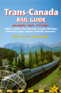
Trans-Canada Rail Guide

Trans-Canada in the Trailblazer Rail Guides series covering the entire route from coast to coast, mile-by-mile route guides, and city guides to 10 major stops including Quebec City, Montreal, Toronto, Winnipeg, Jasper and Vancouver. Trailblazer Rail Guides series are highly practical, informative and portable guides designed specifically for those wanting to discover a country by train. Each title in the series explores its destination with reference to seeing and experiencing countries such as Japan, Australia and Canada using their extensive rail networks. Designed with practicality in mind, each guide describes the entire railway system in clearly defined stages and regions, allowing visitors to plan their journey or journeys accordingly. Strong on both practical content and
cultural and historical background, Trailblazer Rail Guides provide extensive kilometre by kilometre route guide description, exploring the country’s history, culture, food and local customs in addition to giving practical advice on accessing site of interest when travelling by train. Dedicated town and city guides are included throughout the guide, with advice for travellers on all budgets of recommended places to stay, places to eat and drink and what to see and do. Uniquely, there are also extensive railway timetables for all routes that are described in the guide, allowing travellers flexibility when embarking upon their railway trip.
RIP - This product is no longer available on our network. It was last seen on 25.09.2019

This page now acts as a permanent archive for this product. Add more information using the comments box below to ensure it can still be found by future generations.

Use our search facility to see if it is available from an alternative contributor.
  • External links may include paid for promotion
  • Availability: Out Of Stock
  • Supplier: Stanfords
  • SKU: 9781905864331
Availability: In Stock
£12.99

Product Description

Trans-Canada in the Trailblazer Rail Guides series covering the entire route from coast to coast, mile-by-mile route guides, & city guides to 10 major stops including Quebec City, Montreal, Toronto, Winnipeg, Jasper & Vancouver. Trailblazer Rail Guides series are highly practical, informative & portable guides designed specifically for those wanting to discover a country by train. Each title in the series explores its destination with reference to seeing & experiencing countries such as Japan, Australia & Canada using their extensive rail networks. Designed with practicality in mind, each guide describes the entire railway system in clearly defined stages & regions, allowing visitors to plan their journey or journeys accordingly. Strong on both practical content & cultural & historical background, Trailblazer Rail Guides provide extensive kilometre by kilometre route guide description, exploring the country’s history, culture, food & local customs in addition to giving practical advice on accessing site of interest when travelling by train. Dedicated town & city guides are included throughout the guide, with advice for travellers on all budgets of recommended places to stay, places to eat & drink & what to see & do. Uniquely, there are also extensive railway timetables for all routes that are described in the guide, allowing travellers flexibility when embarking upon their railway trip.

Reviews/Comments

Add New

Price History

Vouchers

No voucher codes found.
Do you know a voucher code for this product or supplier? Add it to Insights for others to use.

Facebook

Jargon Buster

Japan - An island in east Asia
strong - A descriptive word for an item that has physical strength
History - Anything that happens in the past. An acedemic subject.
Practical - Weather a task is easy to carry out and realistically succeed.
Reference - To prove evidence with a back up source.

Supplier Information

Stanfords
Stanfords was established in 1853 and opened their iconic Covent Garden flagship store in 1901. They have become the top retailer of maps, travel books and accessories in the UK and arguably offer the largest selection of maps and travel books worldwide. Famous names such as Captain Robert Falcon Scott, Ranulph Fiennes and Michael Palin have purchased from Stanfords. They now have a shop in Bristol and both stores together with other venues operate a calendar of events including talks, book signings and exhibitions. As a specialist map retailer, the map selection is comprehensive and includes road maps, street maps and walking maps from worldwide destinations, as well as a selection of world atlases and wall maps. Books include travel guides and travel literature. Stanfords also stock globes, from miniatures made of blue marble to magnificent floor-standing globes. The website features a selection of interesting articles on travel topics.
Page Updated: 2023-11-12 20:15:36

Community Generated Product Tags

Oh No! The productWIKI community hasn't generated any tags for this product yet!
Menu