More From Contributor

£14.95
Map No. K-11D in the TPC series: military topographic survey mapping covering the world's land masses & significant islands at 1:500, 000. The maps are useful as general topographical coverage where nothing else is available, although they are designed primarily as flying charts for military aircraft. TPC stands for Tactical Pilotage Chart. Relief is portrayed by a combination of contours (basic interval 500ft, intermediate contours shown where appropriate), elevation tinting & relief shading, plus spot heights. Towns, villages, major roads, railways & airports are shown but please note that many of the smaller settlements are not named & the road information is not necessarily up to date, as compilation & revision dates vary. Some air navigation information also appears on the map, such as radio beacons & restricted flying zones. Each TPC chart has both UTM & latitude/longitude grids overprinted on it, with additional margin ticks. IMPORTANT
- PLEASE NOTE: The series is gradually being withdrawn from sale to the general public & some sheets may no longer be available when ordered by us. Due to the nature of the map projection assembling these sheets to make a larger map is not recommended. in addition, colours used for relief are not constant throughout the series. In some areas of central Africa & South America the maps have blank spaces, reflecting localized deficiencies or inconsistencies in the survey data.
...
Archived Product
£14.95
Map No. L-12C in the TPC series: military topographic survey mapping covering the world's land masses & significant islands at 1:500, 000. The maps are useful as general topographical coverage where nothing else is available, although they are designed primarily as flying charts for military aircraft. TPC stands for Tactical Pilotage Chart. Relief is portrayed by a combination of contours (basic interval 500ft, intermediate contours shown where appropriate), elevation tinting & relief shading, plus spot heights. Towns, villages, major roads, railways & airports are shown but please note that many of the smaller settlements are not named & the road information is not necessarily up to date, as compilation & revision dates vary. Some air navigation information also appears on the map, such as radio beacons & restricted flying zones. Each TPC chart has both UTM & latitude/longitude grids overprinted on it, with additional margin ticks. IMPORTANT
- PLEASE NOTE: The series is gradually being withdrawn from sale to the general public & some sheets may no longer be available when ordered by us. Due to the nature of the map projection assembling these sheets to make a larger map is not recommended. in addition, colours used for relief are not constant throughout the series. In some areas of central Africa & South America the maps have blank spaces, reflecting localized deficiencies or inconsistencies in the survey data.
...
Archived Product
£14.95
Map No. M-10A in the TPC series: military topographic survey mapping covering the world's land masses & significant islands at 1:500, 000. The maps are useful as general topographical coverage where nothing else is available, although they are designed primarily as flying charts for military aircraft. TPC stands for Tactical Pilotage Chart. Relief is portrayed by a combination of contours (basic interval 500ft, intermediate contours shown where appropriate), elevation tinting & relief shading, plus spot heights. Towns, villages, major roads, railways & airports are shown but please note that many of the smaller settlements are not named & the road information is not necessarily up to date, as compilation & revision dates vary. Some air navigation information also appears on the map, such as radio beacons & restricted flying zones. Each TPC chart has both UTM & latitude/longitude grids overprinted on it, with additional margin ticks. IMPORTANT
- PLEASE NOTE: The series is gradually being withdrawn from sale to the general public & some sheets may no longer be available when ordered by us. Due to the nature of the map projection assembling these sheets to make a larger map is not recommended. in addition, colours used for relief are not constant throughout the series. In some areas of central Africa & South America the maps have blank spaces, reflecting localized deficiencies or inconsistencies in the survey data.
...
Archived Product
£14.95
Map No. M-12D in the TPC series: military topographic survey mapping covering the world's land masses & significant islands at 1:500, 000. The maps are useful as general topographical coverage where nothing else is available, although they are designed primarily as flying charts for military aircraft. TPC stands for Tactical Pilotage Chart. Relief is portrayed by a combination of contours (basic interval 500ft, intermediate contours shown where appropriate), elevation tinting & relief shading, plus spot heights. Towns, villages, major roads, railways & airports are shown but please note that many of the smaller settlements are not named & the road information is not necessarily up to date, as compilation & revision dates vary. Some air navigation information also appears on the map, such as radio beacons & restricted flying zones. Each TPC chart has both UTM & latitude/longitude grids overprinted on it, with additional margin ticks. IMPORTANT
- PLEASE NOTE: The series is gradually being withdrawn from sale to the general public & some sheets may no longer be available when ordered by us. Due to the nature of the map projection assembling these sheets to make a larger map is not recommended. in addition, colours used for relief are not constant throughout the series. In some areas of central Africa & South America the maps have blank spaces, reflecting localized deficiencies or inconsistencies in the survey data.
...
Archived Product
£14.95
Map No. S-13D in the TPC series: military topographic survey mapping covering the world's land masses & significant islands at 1:500, 000. The maps are useful as general topographical coverage where nothing else is available, although they are designed primarily as flying charts for military aircraft. TPC stands for Tactical Pilotage Chart. Relief is portrayed by a combination of contours (basic interval 500ft, intermediate contours shown where appropriate), elevation tinting & relief shading, plus spot heights. Towns, villages, major roads, railways & airports are shown but please note that many of the smaller settlements are not named & the road information is not necessarily up to date, as compilation & revision dates vary. Some air navigation information also appears on the map, such as radio beacons & restricted flying zones. Each TPC chart has both UTM & latitude/longitude grids overprinted on it, with additional margin ticks. IMPORTANT
- PLEASE NOTE: The series is gradually being withdrawn from sale to the general public & some sheets may no longer be available when ordered by us. Due to the nature of the map projection assembling these sheets to make a larger map is not recommended. in addition, colours used for relief are not constant throughout the series. In some areas of central Africa & South America the maps have blank spaces, reflecting localized deficiencies or inconsistencies in the survey data.
...
Archived Product
£6.99
Trace the Trail: Through the Town is an exciting day out in town that you can follow with your finger! This interactive book for toddlers lets them explore the world by tracing a tactile pathway. Each spread will feature a vehicle on its way through the city travelling through ups & downs & contrasts. A train will over the bridge & under the ground, a car will go up & down the street. Craig Shuttlewood`s bold illustrations make this a dynamic & graphic cityscape. ...
Archived Product
£18.99
For five millennia, the peoples & cultures of East & West have met & mingled in Central Asia. For explorers & travellers it is a promised l&, a region of white spaces on the map, forgotten cities & archaeological treasures. Christoph Baumer has spent a lifetime travelling through the countries of Central Asia, making extraordinary discoveries along the way. ” Traces in the Desert” follows in his intrepid footsteps as he finds evidence of Indo-Europeans in the steppes of Western Mongolia, discovers lost oasis cities in the Taklamakan & unearths art treasures in Tibet. He embarks on a quest to find Genghis Khan`s long-lost tomb & has numerous, occasionally hair-raising, encounters with shamans, Iranian politicians & armed Tibetan bandits. Enlightening & full of adventure, ” Traces in the Desert” uniquely illuminates the hidden parts of Central Asia that have not just disappeared beneath the shifting sands, but also from the horizon of our memory. ...
Archived Product
£12.99
London is a key site for family historians. Many researchers, seeking to trace their ancestry back through the generations, will find their trail leads to London or through it. Yet, despite the burgeoning interest in genealogy & the importance of London in so many life stories, few previous books have explored the city`s history or provided guidance on the research resources family historians can use to discover the life of a London ancestor. This is the purpose of Jonathan Oates`s invaluable handbook. In a series of short, information-packed chapters he describes the principal record offices, archives, libraries & other sources researchers can go to, & shows how Londoners can be tracked through censuses, registers & directories over the last 500 years. Then he explores key aspects of London`s history from a family historian`s point of view. Crime, religion & education
- & the body of evidence associated with them
- are covered, as is the historical trail left by taxation, health, welfare, work & business. He looks also at the military & wartime records available in the city, & at the records of immigrant communities who have had such a notable impact on the development of the capital. Each section introduces the reader to the relevant sources, indicates where they can be found, & offers essential advice on how this information can be used to piece together the lives of distant & not-so-distant relatives.

...
Archived Product
£24.95
The Trackatlas of Mainland Britain from Trackmaps provides a remarkably comprehensive picture of the entire rail network with numerous detailed enlargements for the more complex junctions or urban areas. Based on industry sources, the atlas shows passenger & freight routes with their track formations including connections, crossovers & primary sidings. All stations appear with most signal boxes, junctions & tunnels including their names & railway mileages; most level crossings are included together with information describing their type. Throughout the atlas more complex parts of the network, including mainline stations in London, are shown enlarged to provide much greater detail. The atlas is indexed & contains an introductory section on the history & significance of railway mileages, plus a conversion chart from chains to yards & kilometres. ...
Archived Product
£24.95
The Trackatlas of Mainland Britain from Platform 5 Publishing provides a remarkably comprehensive picture of the entire rail network with numerous detailed enlargements for the more complex junctions or urban areas. Based on industry sources, the atlas shows passenger & freight routes with their track formations including connections, crossovers & primary sidings. All stations appear with most signal boxes, junctions & tunnels including their names & railway mileages; most level crossings are included together with information describing their type. Throughout the atlas more complex parts of the network, including mainline stations in London, are shown enlarged to provide much greater detail. The atlas is indexed & contains an introductory section on the history & significance of railway mileages, plus a conversion chart from chains to yards & kilometres. This revised second edition of the atlas published in 2012

Includes::
for the first time 44 heritage lines & among them several narrow gauge tracks.

...
Archived Product

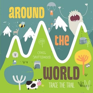
Trace The Trail: Around The World

Trace the Trail: Around the World is the world tour you can, literally, follow with your finger! Trace the book`s raised trails from the desert to craggy mountains to the wonderful underwater world of the ocean. This interactive book for toddlers lets them explore the world by tracing a tactile pathway. Each spread will feature an animal that is leaping mountains, swimming oceans or zigzagging through the desert. Craig Shuttlewood`s bold illustrations make these landscapes dynamic and colourful.
RIP - This product is no longer available on our network. It was last seen on 25.09.2019

This page now acts as a permanent archive for this product. Add more information using the comments box below to ensure it can still be found by future generations.

Use our search facility to see if it is available from an alternative contributor.
  • Availability: Out Of Stock
  • Supplier: Stanfords
  • SKU: 9781783701773
Availability: In Stock
£6.99

Product Description

Trace the Trail: Around the World is the world tour you can, literally, follow with your finger! Trace the book`s raised trails from the desert to craggy mountains to the wonderful underwater world of the ocean. This interactive book for toddlers lets them explore the world by tracing a tactile pathway. Each spread will feature an animal that is leaping mountains, swimming oceans or zigzagging through the desert. Craig Shuttlewood`s bold illustrations make these landscapes dynamic & colourful.

Reviews/Comments

Add New

Intelligent Comparison

Oooops!
We couldn't find anything!
Perhaps this product's unique.... Or perhaps we are still looking for comparisons!
Click to bump this page and we'll hurry up.

Price History

Vouchers

No voucher codes found.
Do you know a voucher code for this product or supplier? Add it to Insights for others to use.

Facebook

Jargon Buster

Interactive - Interaction can take place between a person and a device
World - A physical grouping, commonly used to describe earth and everything associated with ti
illustrations - Pictures typically in books and newspapers.
Feature - An attribute that makes something stand out.
Wonderful - Another word for describing something that is extremely good, marvellous.

Supplier Information

Stanfords
Stanfords was established in 1853 and opened their iconic Covent Garden flagship store in 1901. They have become the top retailer of maps, travel books and accessories in the UK and arguably offer the largest selection of maps and travel books worldwide. Famous names such as Captain Robert Falcon Scott, Ranulph Fiennes and Michael Palin have purchased from Stanfords. They now have a shop in Bristol and both stores together with other venues operate a calendar of events including talks, book signings and exhibitions. As a specialist map retailer, the map selection is comprehensive and includes road maps, street maps and walking maps from worldwide destinations, as well as a selection of world atlases and wall maps. Books include travel guides and travel literature. Stanfords also stock globes, from miniatures made of blue marble to magnificent floor-standing globes. The website features a selection of interesting articles on travel topics.
Page Updated: 2023-11-12 20:15:36

Community Generated Product Tags

Oh No! The productWIKI community hasn't generated any tags for this product yet!
Menu