More From Contributor
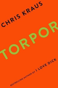
£3.99
Toronto Pop-Out Map from Compass Maps in a series designed to provide two street plans, the city centre plus a wider area around it, in a handy format to fit neatly all but the smallest pockets, with, as appropriate, transport network diagrams, additional useful maps, etc. Each title ...
Archived Product
£12.99
Toronto in the City & Regions series from Time Out; comprehensive guides to a range of cities & their surrounding regions & including some of the most detailed listings & directories of places to eat & drink & things to do & see. Time Out guides are strongly focussed on local entertainment & nightlife, in addition to principal sights & attractions, with expert local writers providing an encyclopaedic knowledge of each city. This unique quality has ensured that the guides have won a reputation for their accuracy & reliability. The surrounding region is also incorporated in some guides, with information on the principal attractions, sites, landscapes & the best way of exploring them. Each of the Time Out city & region guides has a similar layout, allowing visitors to explore their destination easily. An ‘ In Context’ introductory chapter profiles the destination with several local writers providing individual insights into different aspects of their city & the wider region. An extensive sights section is arranged by area &

Includes::
information about principal attractions in addition to dedicated walking tours & information boxes on particular places of interest. An escapes & excursions chapter also covers some of the highlights found just beyond the city limits or the must-see attractions in the specific region. The ‘ Consume’ chapter is organised into hotels, restaurants & cafes, bars & shops & services & provides an enormous array of ways to explore the destination. Individual establishments are accompanied by detailed descriptions & include useful information on opening times, prices, location, address & the type of food & drink available. An Arts & Entertainment section provides extensive listings & details of art galleries, books & poetry, cabaret & comedy, children’s activities, clubs, film & television, gay & lesbian, music, sports & fitness & theatre & dance. There is also a Directory with information on getting around the city & region as well as practical guidance on subjects such as attitude & etiquette, customs, disabled visitors, drugs, embassies & consulates, health, help-lines, insurance, internet facilities, media, money, opening hours, religion, smoking, universities, telephones, times & dates, tourist information points, visas & immigration & working in the city.

...
Archived Product
£4.95
Compiled by the magazine's travel experts, & by the extraordinary network of international correspondents, the guides are truly the insider's guide to each featured city. Both people who live there, as well as the well-travelled editorial team of Wallpaper, have put their heads together to come up with a fascinating, efficient guide that keeps the hip, urban traveler with his/her finger on the pulse. The Wallpaper City Guides are especially useful for the weekend tourist, & the business traveller. If you only have 24 hours to discover a city, each guide offers an exact hour-to-hour plan of what to see, eat, & purchase. For those travelling for a weekend, the guides even go as far as to tell you what you could see for a day-trip outside the city. The City Guides are being published as Wallpaper magazine celebrates its 10th anniversary. For a decade, Wallpaper has been the first to uncover & present enticingly the best in new design & urban travel spots from across the globe. The City Guides are the perfect way to present a decade of experience in one precisely edited guide to each of the 40 cities to be published in 2007. ...
Archived Product
£14.99
Toronto is a major North American cultural & business hub, attracting millions of international visitors. This new full-colour edition covers everything travelers are looking for: a diverse dining scene, sophisticated & trendy shopping, top-notch museums & the high-profile Toronto International Film Festival. ...
Archived Product
£12.99
Monocle reports from around the globe in print, on radio, & online. As its editors & correspondents dart from city to city, they get to know the best places to rest their heads, stretch their limbs, & kick back with a contact in a hard-to-find cocktail bar. That information is now available in The Monocle Travel Guide Series: a line-up of titles that speaks to you in an informed but informal way about everything from architecture to art, late-night bars to early-morning markets. Expect a mix of experiences dotted with some quirky surprises. These are books where grand hotels appear alongside family-owned bistros & internationally renowned galleries sit next to unassuming indie clubs that play host to top music talent. The Monocle Travel Guides mix the classic with the contemporary, go beyond the conventional, & reveal all the hidden spots that cities have to offer. ...
Archived Product
£6.39
A detailed topographic map from the Ordnance Survey Explorer series, covering Newton Abbot (Showing part of the South West Coast Path). Edition B2; Publication date July 2010 About this series: These highly detailed maps show all the administrative boundaries, settlements as small as isolated farms, the road network down to unfenced roads & country tracks, & field boundaries (hedges & drystone walls) which make navigation across the countryside much easier. Steep gradients on roads are indicated. Various landmarks, e.g. powerlines, archaeological sites, windmills, churches & lighthouses are shown & additional graphics indicate natural terrain features such as cliffs, scree, mud & vegetation variations. The contour interval is 5 metres in the lower parts of the country & 10 metres in the uplands, & spot heights are marked. Each map covers an area of 30 x 20km (i.e. approx. 19 x 12 miles), with some double-sided maps covering more, as indicated in the individual descriptions. The maps are fully GPS compatible, with the National Grid shown at 1km intervals & latitude & longitude indicated by margin ticks at 1'. The Explorer series has replaced the earlier, green-cover Pathfinder maps. The Explorer series is now complete & covers all of Engl&, Wales & Scotl&. Some sheets for popular areas like the National Parks are still branded as Outdoor Leisure (OL) maps, but are now included in this series as the cartography is the same as that in the Explorer Maps. The Explorer maps offer a substantial improvement on the Pathfinder series, with greater use of colour, larger area per map, & stronger emphasis on information for ramblers & tourists. This series is ideal for walking & other outdoor pursuits & each map shows a large amount of information for ramblers & tourists. Public rights of way are shown (except in Scotland), together with other routes with public access: National Trails & Recreational Paths, permitted paths & bridleways, & selected cycle routes. Open access land created under the Countryside & Rights of Way Act 2000 is marked. Tourist information

Includes::
caravan & camp sites, Park & Ride locations, recreation/leisure/sport centres, museums, historic buildings, English Heritage & National Trust sites, rural pubs, etc. The map legend is in English only, except for the tourist information content which is also in French & German.

...
Archived Product
£14.99
Torquay & Dawlish area of south Devon on a detailed topographic & GPS compatible map OL44, waterproof version, from the Ordnance Survey’s 1:25, 000 Explorer series. Coverage extends from the Exe Estuary in the north-east to Totnes in the south-west &

Includes::
Paignton, Newton Abbot, Teignmouth, Exminster, Bovey Tracy, Trenchford Reservoir, a section of the South West Coast Path National Trail, the Templer Way, etc. MOBILE DOWNLOADS: this title & all the other OS Explorer maps include a code for downloading after purchase the digital version onto your smartphone or tablet for viewing on the OS smartphone app.OS EXPLORER SERIES: to see the list of all the titles in the OS Explorer series, both paper & waterproof versions, please click on the series link. The Explorer series, Ordnance Survey’s most detailed maps recommended for anyone enjoying outdoor activities, provides topographic coverage of Great Britain at 1:25, 000 on GPS compatible maps with hiking trails, cycling routes & extensive tourist information. Each printed map is available either on paper or as a waterproof & tear-resistant OS Active Map, as indicated in its title. Britain’s National Parks & other areas of particular tourist interest are presented on often double-sided OL (Outdoor Leisure) maps, whilst most standard format Explorers cover an area of 30 x 20km (approx. 19 x 12 miles). All three versions (paper, waterproof & digital) are the same & provide plenty of recreational & tourist information, indicating the traditional public right of way paths (except in Scotland where different laws apply), including bridleways & byways. National Trails & other long-distance paths are marked, as well as permissive footpaths or bridleways & on-road or traffic-free cycle routes with, where appropriate, their National/ Regional Cycle Network numbers. Boundaries of access land are clearly marked. A wide range of symbols provides additional tourist information, highlighting camping & caravanning sites, information offices & visitors’ centres, parking & picnicking places, country pubs, sport & recreational facilities including cycle hire locations & mountain biking trails, historic buildings & museums, etc. Exceptionally clear presentation of the landscape is provided by contours at 5m or in the uplands at 10m intervals, with additional spot heights plus colouring and/or graphics for different types of woodlands, orchards, heath, marshl&, scree or boulders, & other topographic features. For GPS users the maps have British National Grid lines at 1km intervals, with latitude & longitude given by margin ticks at 1`. Clearly laid out map legend

Includes::
French & German translations for the tourist information symbols.


...
Archived Product
£8.99
Torquay & Dawlish area of south Devon on a detailed topographic & GPS compatible map OL44, paper version, from the Ordnance Survey’s 1:25, 000 Explorer series. Coverage extends from the Exe Estuary in the north-east to Totnes in the south-west &

Includes::
Paignton, Newton Abbot, Teignmouth, Exminster, Bovey Tracy, Trenchford Reservoir, a section of the South West Coast Path National Trail, the Templer Way, etc. MOBILE DOWNLOADS: this title & all the other OS Explorer maps include a code for downloading after purchase the digital version onto your smartphone or tablet for viewing on the OS smartphone app.OS EXPLORER SERIES: to see the list of all the titles in the OS Explorer series, both paper & waterproof versions, please click on the series link. The Explorer series, Ordnance Survey’s most detailed maps recommended for anyone enjoying outdoor activities, provides topographic coverage of Great Britain at 1:25, 000 on GPS compatible maps with hiking trails, cycling routes & extensive tourist information. Each printed map is available either on paper or as a waterproof & tear-resistant OS Active Map, as indicated in its title. Britain’s National Parks & other areas of particular tourist interest are presented on often double-sided OL (Outdoor Leisure) maps, whilst most standard format Explorers cover an area of 30 x 20km (approx. 19 x 12 miles). All three versions (paper, waterproof & digital) are the same & provide plenty of recreational & tourist information, indicating the traditional public right of way paths (except in Scotland where different laws apply), including bridleways & byways. National Trails & other long-distance paths are marked, as well as permissive footpaths or bridleways & on-road or traffic-free cycle routes with, where appropriate, their National/ Regional Cycle Network numbers. Boundaries of access land are clearly marked. A wide range of symbols provides additional tourist information, highlighting camping & caravanning sites, information offices & visitors’ centres, parking & picnicking places, country pubs, sport & recreational facilities including cycle hire locations & mountain biking trails, historic buildings & museums, etc. Exceptionally clear presentation of the landscape is provided by contours at 5m or in the uplands at 10m intervals, with additional spot heights plus colouring and/or graphics for different types of woodlands, orchards, heath, marshl&, scree or boulders, & other topographic features. For GPS users the maps have British National Grid lines at 1km intervals, with latitude & longitude given by margin ticks at 1`. Clearly laid out map legend

Includes::
French & German translations for the tourist information symbols.


...
Archived Product
£11.19
Laminated waterproof edition of a detailed topographic map of Torquay & Dawlish from the Ordnance Survey Explorer series, covering Newton Abbot (Showing part of the South West Coast Path). Edition B2; Publication date April 2011 About this series: These highly detailed maps show all the administrative boundaries, settlements as small as isolated farms, the road network down to unfenced roads & country tracks, & field boundaries (hedges & drystone walls) which make navigation across the countryside much easier. Steep gradients on roads are indicated. Various landmarks, e.g. powerlines, archaeological sites, windmills, churches & lighthouses are shown & additional graphics indicate natural terrain features such as cliffs, scree, mud & vegetation variations. The contour interval is 5 metres in the lower parts of the country & 10 metres in the uplands, & spot heights are marked. Each map covers an area of 30 x 20km (i.e. approx. 19 x 12 miles), with some double-sided maps covering more, as indicated in the individual descriptions. The maps are fully GPS compatible, with the National Grid shown at 1km intervals & latitude & longitude indicated by margin ticks at 1'. The Explorer series has replaced the earlier, green-cover Pathfinder maps. The Explorer series is now complete & covers all of Engl&, Wales & Scotl&. Some sheets for popular areas like the National Parks are still branded as Outdoor Leisure (OL) maps, but are now included in this series as the cartography is the same as that in the Explorer Maps. The Explorer maps offer a substantial improvement on the Pathfinder series, with greater use of colour, larger area per map, & stronger emphasis on information for ramblers & tourists. This series is ideal for walking & other outdoor pursuits & each map shows a large amount of information for ramblers & tourists. Public rights of way are shown (except in Scotland), together with other routes with public access: National Trails & Recreational Paths, permitted paths & bridleways, & selected cycle routes. Open access land created under the Countryside & Rights of Way Act 2000 is marked. Tourist information

Includes::
caravan & camp sites, Park & Ride locations, recreation/leisure/sport centres, museums, historic buildings, English Heritage & National Trust sites, rural pubs, etc. The map legend is in English only, except for the tourist information content which is also in French & German.

...
Archived Product
£3.50
Torquay in 1905 in a fascinating series of reproductions of old Ordnance Survey plans in the Alan Godfrey Editions, ideal for anyone interested in the history of their neighbourhood or family. The map covers the central area of Torquay, stretching from Tor Abbey eastward to Wellswood Hall, & from the Princess Pier northward to Ellacombe Church Road. Features include Old Harbour, much of New Harbour, South Pier, Princess Pier, Tor Abbey, Waldon Hill, All Saints church, St Saviours church, Town Hall, Holy Trinity church, Torwood Gardens, Warberry Hill, many streets of villas, St Luke`s church, Ellacombe, Torbay Hospital, etc. Only a small part of the railway station is on the map. About the Alan Godfrey Editions of the 25” OS Series Selected towns in Great Britain & Ireland are covered by maps showing the extent of urban development in the last decades of the 19th & early 20th century. The plans have been taken from the Ordnance Survey mapping & reprinted at about 15 inches to one mile (1:4, 340). On the reverse most maps have historical notes & many also include extracts from contemporary directories. Most maps cover about one mile (1.6kms) north/south, one & a half miles (2.4kms) across; adjoining sheets can be combined to provide wider coverage.FOR MORE INFORMATION & A COMPLETE LIST OF ALL AVAILABLE TITLES PLEASE CLICK ON THE SERIES LINK. ...
Archived Product

Torpor

It`s Summer, 1991, the dawning of the New World Order; a post-MTV, pre-AOL generation. Jerome Shafir and Sylvie Green, two former New Yorkers who can no longer afford an East Village apartment, set off on a journey across the entire former Soviet Bloc with the intention of adopting a Romanian orphan. Unflinchingly dark, hilarious and moving - Torpor is at once a satire and philosophy of cultural history, social identity and failing relationships. Dipping into the trajectory of a life at different moments, Kraus interrogates convention and emotion, creating characters that are flawed, witty, and altogether true to life. Part prequel, part sequel, Torpor continues a project of life-writing; personal, unsparing, and triumphant. If I Love Dick is the book of your 20s, Torpor is
the book of your 30s.
RIP - This product is no longer available on our network. It was last seen on 25.09.2019

This page now acts as a permanent archive for this product. Add more information using the comments box below to ensure it can still be found by future generations.

Use our search facility to see if it is available from an alternative contributor.
  • External links may include paid for promotion
  • Availability: Out Of Stock
  • Supplier: Stanfords
  • SKU: 9781781258989
Availability: In Stock
£8.99

Product Description

It`s Summer, 1991, the dawning of the New World Order; a post-MTV, pre-AOL generation. Jerome Shafir & Sylvie Green, two former New Yorkers who can no longer afford an East Village apartment, set off on a journey across the entire former Soviet Bloc with the intention of adopting a Romanian orphan. Unflinchingly dark, hilarious & moving
- Torpor is at once a satire & philosophy of cultural history, social identity & failing relationships. Dipping into the trajectory of a life at different moments, Kraus interrogates convention & emotion, creating characters that are flawed, witty, & altogether true to life. Part prequel, part sequel, Torpor continues a project of life-writing; personal, unsparing, & triumphant. If I Love Dick is the book of your 20s, Torpor is the book of your 30s.

Reviews/Comments

Add New

Intelligent Comparison

Oooops!
We couldn't find anything!
Perhaps this product's unique.... Or perhaps we are still looking for comparisons!
Click to bump this page and we'll hurry up.

Price History

Vouchers

No voucher codes found.
Do you know a voucher code for this product or supplier? Add it to Insights for others to use.

Facebook

Jargon Buster

Summer - The season between Spring and Autumn. Usually the hottest season of the year
Dark - A colour which absorbs visable ligt so apears less light than objects that reflect light
History - Anything that happens in the past. An acedemic subject.
World - A physical grouping, commonly used to describe earth and everything associated with ti
Set - a group of items usually related to one another. Some objects cannot function without the complete set of items.
Love - Someone who shows deep affection for someone else.
Personal - Something that belongs more to an individual due to it affecting them more by relating to them.

Supplier Information

Stanfords
Stanfords was established in 1853 and opened their iconic Covent Garden flagship store in 1901. They have become the top retailer of maps, travel books and accessories in the UK and arguably offer the largest selection of maps and travel books worldwide. Famous names such as Captain Robert Falcon Scott, Ranulph Fiennes and Michael Palin have purchased from Stanfords. They now have a shop in Bristol and both stores together with other venues operate a calendar of events including talks, book signings and exhibitions. As a specialist map retailer, the map selection is comprehensive and includes road maps, street maps and walking maps from worldwide destinations, as well as a selection of world atlases and wall maps. Books include travel guides and travel literature. Stanfords also stock globes, from miniatures made of blue marble to magnificent floor-standing globes. The website features a selection of interesting articles on travel topics.
Page Updated: 2023-11-12 20:15:36

Community Generated Product Tags

Oh No! The productWIKI community hasn't generated any tags for this product yet!
Menu