More From Contributor

£9.99
Top Welsh contains 100x 62mm plastic coated trumps cards featuring 33 Welsh mountains selected mostly by height but with an eye on geographical distribution & popularity. The pack allows for 2 or 3 players to play easily. The cards arrive wrapped in cellophane in a laminated tuck box for added protection. Full instructions are included. Each card features a photograph of a Welsh mountain & six key facts/criteria about that hill & a potential route to climb it. The card reverses feature range maps so you can check the location of the summit within its range should you wish to. ...
Archived Product
£9.99
Topkegola, sheet no. 2787-07, in the topographic survey of Nepal at 1:50, 000 published by the Nepali Government in the late 1990s & early 2000s & produced from remote sensing data by Finnish cartographers as part of that country’s international aid program. The maps cover 15’ x 15’ quadrangles.IMPORTANT – PLEASE NOTE BEFORE ORDERING: AVAILABILITY: although, theoretically at least, still in print, these maps are very difficult to get locally in Nepal and/or from various suppliers elsewhere specializing in obtaining such maps. DELIVERIES MAY TAKE SEVERAL WEEKS OR EVEN MONTHS.PROBLEMS WITH PLACE NAMES: reports from previous users indicate that transliteration of place names differs from that used widely not only on other maps & in guide books but also on the ground itself, in road signs & in the tourist & trekking industry in general. Whilst most names are similar enough to be easily recognizable, e.g. Namche Bajar for Namche Bazar or Lantan for Langtang, we have been told of confusion & difficulties arising from different spellings appearing on these maps.TREKKING ROUTES & TOURIST INFORMATION: whilst the maps show foot trails & mark locations of temples, etc, they carry no specific trekking information. Major trekking routes & places of interest are not highlighted. There is no marking for base camps & other tourist facilities. Map specifications: Contours are at 40m intervals, with graphics and/or coloring to show various features of the terrain (glaciers with moraines & crevasses, quarries, gravel or clay pits, etc.) & vegetation (forests, bush, grass, orchards & plantations, etc). Additional comments such as “open mixed forest mainly bajh & pine” annotate many area. The maps have numerous spot heights, but relatively few peaks are named. Areas outside the country’s borders are left blank. Settlements in remote areas are indicated by markings for individual buildings & the placing of names does not always make it clear which group of buildings they refer to. Road network distinguishes between major & minor foot trails. Symbols mark features such as temples, schools & hospitals, police stations, etc. Also shown are the country’s administrative divisions. The maps have a 1-km UTM grid, plus latitude & longitude lines at intervals of 5’. Map legend & all the text is in English. Coverage: the whole country is now covered, with the north at 1:50, 000, plus central & southern Nepal at 1:25, 000. The two series are complementary, do not overlap & use the same grid & numbering system (apart from the Lumbini Zone, where a different grid & numbering are used). For areas not shown on our grid & titles not listed here, please contact us by e-mail, but please do bear in mind the problems with availability & the likely very long delivery time. ...
Archived Product
£12.99
Spying inside the Embargoed Zone is an expensive business, not to say risky, & Agent Cobra wants his wages in full. But his down-at-heel spymaster can only offer payment in kind
- & the first thing he finds in an unattended storeroom. & so both men are sucked into the mysterious Toploader project, a race to retrieve a deadly secret from inside the world's first
- & best
- walled-off terrorist entity. Also caught in the crossfire are a resourceful teenage girl, a gung-ho reporter, a hapless drone-pilot & at least one very unfortunate donkey. Toploader is about to make their lives a lot more dangerous, & an awful lot more bizarre.


...
Archived Product
£25.00
Topography of Armageddon: A British Trench Map Atlas of the Western Front 1914
- 1918 is an impressive, large format paperback
...
Archived Product
£7.95

Includes: all of the basics of toproping. Covers basic & advanced anchor set-ups, belay techniques, how to lower from
...
Archived Product
£4.99
Topsy & Tim find fun & adventure in the real world. Their engaging stories are reassuring for young children having first experiences of their own. In ” Topsy & Tim: Visit London”, the twins have an exciting trip to the capital city. They see the changing of the guard at Buckingham Palace, see the dinosaurs at the Natural History Museum, & even meet the famous Beefeaters at the Tower of London. A trusted & well-loved pair who can help guide parents & children through `first experiences`, ” Topsy & Tim” books have been beautifully updated with contemporary artwork. Topsy & Tim remain instantly recognisable to parents while in a fresh style that will appeal to a new generation of fans. These wonderful books deserve a place on every child`s bookshelves. ...
Archived Product
£4.99
Topsy & Tim find fun & adventure in the real world. Their engaging stories are reassuring for young children having first experiences of their own. In Topsy & Tim: Go on Holiday Topsy, Tim, Mummy & Dad are off on holiday, but the journey there is an eventful one! A trusted & well-loved pair who can help guide parents & children through `first experiences`, Topsy & Tim books have been beautifully updated with contemporary artwork. Topsy & Tim remain instantly recognizable to parents while in a fresh style that will appeal to a new generation of fans. ...
Archived Product
£9.99
Torbay & Newton Abbot in the Cassini Past & Present map series which covers town & cities of England & Wales & offers a unique way of tracing their history & expansion by showing four different periods of their development using Ordnance Survey mapping from the mid-19th century, the late 19th century, the 1920s & the present day. Coverage

Includes::
Abbotskerswell, Brixham, Dartington, Ipplepen, Kingskerswell, Paignton, Stoke Gabriel, Shaldon, Torquay & Totnes. Each Past & Present map consists of four panels, all centred on a city or a town & covering exactly the same 15km x 15km area. Three of the panels reproduce Ordnance Survey’s historical editions: the Old Series, the Revised New Series & the Popular Edition, enlarged from their original inch-to-the-mile to match the 1:50, 000 scale of the present-day Landranger extract shown in the fourth panel.* Old Series: the first detailed survey mapping dating from the first half of the 19th century, in black & white & with relief shown by hachuring.* Revised New Series from 1880s/1900s, with some colouring & a mixture of hachuring & contour lines.* Popular Edition from the inter-war years, with contour lines & colouring to indicate woodlands, parks, etc. National Grid lines are shown on all four panels for easy comparison across the four time periods. Historical notes, details of the original maps used & web-links for local history societies & other sources of information are also provided. *PLEASE NOTE:** Reproductions from the Ordnance Survey’s historical series are also available as maps of a wider area, with each title corresponding in its coverage to a present day Landranger map. Please see Great Britain: Cassini Historical Reproductions of Ordnance Survey One-Inch Maps series.* Stanfords can also print on request mapping from all the series *centring the map on a location of your choice.* For more information please click on the link below.

...
Archived Product
£9.99
Map No. 202, Torbay & South Dartmoor 1809, in the Cassini Historical Series of old Ordnance Survey mapping of England & Wales at 1:50, 000 in a format designed to offer a convenient comparison with the present day coverage from the OS, & most locations in three different editions. Old historical maps have been combined so that the sheet lines correspond to the current Landranger series & reproduced with the scale changed from one inch to one mile to 1:50, 000. Most locations are covered by three separate maps, showing how the area has changed over the decades, with selected major cities also presented in a fourth edition. * Old Series: the first detailed survey mapping dating for most areas from the first half of the 19th century, in black & white & with relief shown by hachuring.* Revised New Series from 1880s/1900s, with some colouring & a mixture of hachuring & contour lines.* Popular Edition from the inter-war years, with contour lines & colouring to indicate woodlands, parks, etc.* New Popular Edition from the late 1940s, reproduced in the Cassini series for the major cities. Each map

Includes::
notes on the development of Ordnance Survey & the various series produced by them. For those interested in maps & cartography in general, the Cassini series also provides a fascinating insight into how Ordnance Survey cartographic style has developed over a period of over 100 years. Coverage in this title

Includes::
present day Torquay, Totnes, Newton Abbot, Paignton, Brixham, Dartmouth, Salcombe, Kingsbridge, Ivybridge, Buckfastleigh, Ashburton, Darlington, Cornworthy, East Allington, Slapton, Torcross, East Prawle, South Pool, Ringmore, Bigbury-on-Sea, Modbury, Brownston, Aveton Gifford, Holbeton, Yealmpton, Lee Mill, Wotter, Hallwell, Habertonford, South Brent, Broadhempston, Rattery, Bittaford, Cornwood, Didworthy, Holne & Sheepstor, together with the southern part of the Dartmoor National Park.* PLEASE NOTE: Stanfords can also print on request mapping from all four series *centring the map on a location of your choice.* For more information please click on the link below.


...
Archived Product
£14.99
Map No. 202, Torbay & South Dartmoor 1809-1919 (3-map set), in the Cassini Historical Series of old Ordnance Survey mapping of England & Wales at 1:50, 000 in a format designed to offer a convenient comparison with the present day coverage from the OS, & most locations in three different editions. Old historical maps have been combined so that the sheet lines correspond to the current Landranger series & reproduced with the scale changed from one inch to one mile to 1:50, 000. Most locations are covered by three separate maps, showing how the area has changed over the decades, with selected major cities also presented in a fourth edition. Old Series: the first detailed survey mapping dating for most areas from the first half of the 19th century, in black & white & with relief shown by hachuring. Revised New Series from 1880s/1900s, with some colouring & a mixture of hachuring & contour lines. Popular Edition from the inter-war years, with contour lines & colouring to indicate woodlands, parks, etc. New Popular Edition from the late 1940s, reproduced in the Cassini series for the major cities. Each map

Includes::
notes on the development of Ordnance Survey & the various series produced by them. For those interested in maps & cartography in general, the Cassini series also provides a fascinating insight into how Ordnance Survey cartographic style has developed over a period of over 100 years. Coverage in this title

Includes::
present day Torquay, Totnes, Newton Abbot, Paignton, Brixham, Dartmouth, Salcombe, Kingsbridge, Ivybridge, Buckfastleigh, Ashburton, Darlington, Cornworthy, East Allington, Slapton, Torcross, East Prawle, South Pool, Ringmore, Bigbury-on-Sea, Modbury, Brownston, Aveton Gifford, Holbeton, Yealmpton, Lee Mill, Wotter, Hallwell, Habertonford, South Brent, Broadhempston, Rattery, Bittaford, Cornwood, Didworthy, Holne & Sheepstor, together with the southern part of the Dartmoor National Park. PLEASE NOTE: Stanfords can also print on request mapping from all four series centring the map on a location of your choice. For more information please click on the link below.


...
Archived Product

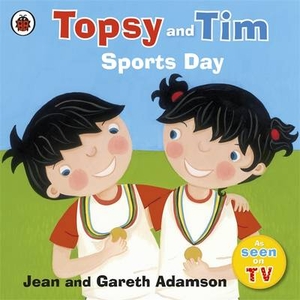
Topsy And Tim Go For Gold

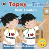
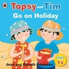
Topsy and Tim find fun and adventure in the real world. Their engaging stories are reassuring for young children having first experiences of their own. In ”Topsy and Tim Go for Gold”, the twins take part in their school sport`s day. They take part in all sorts of races, and try to prove who is the fastest! A trusted and well-loved pair who can help guide parents and children through `first experiences`, ”Topsy and Tim ”books have been beautifully updated with contemporary artwork. Topsy and Tim remain instantly recognisable to parents while in a fresh style that will appeal to a new generation of fans. These wonderful books deserve a place on every child`s bookshelves.
RIP - This product is no longer available on our network. It was last seen on 25.09.2019

This page now acts as a permanent archive for this product. Add more information using the comments box below to ensure it can still be found by future generations.

Use our search facility to see if it is available from an alternative contributor.
  • Availability: Out Of Stock
  • Supplier: Stanfords
  • SKU: 9781409309468
Availability: In Stock
£4.99

Product Description

Topsy & Tim find fun & adventure in the real world. Their engaging stories are reassuring for young children having first experiences of their own. In ” Topsy & Tim Go for Gold”, the twins take part in their school sport`s day. They take part in all sorts of races, & try to prove who is the fastest! A trusted & well-loved pair who can help guide parents & children through `first experiences`, ” Topsy & Tim ”books have been beautifully updated with contemporary artwork. Topsy & Tim remain instantly recognisable to parents while in a fresh style that will appeal to a new generation of fans. These wonderful books deserve a place on every child`s bookshelves.

Reviews/Comments

Add New

Intelligent Comparison

Oooops!
We couldn't find anything!
Perhaps this product's unique.... Or perhaps we are still looking for comparisons!
Click to bump this page and we'll hurry up.

Price History

Vouchers

No voucher codes found.
Do you know a voucher code for this product or supplier? Add it to Insights for others to use.

Facebook

Jargon Buster

Contemporary - Modern era design
Gold - A precious highly conductive metal
Contemporary - A design reference to indicate post war modern design
World - A physical grouping, commonly used to describe earth and everything associated with ti
Fun - Something that provides amusement or enterainment
Day - The time it takes a planet or other space objects to complete one rotation.
Adventure - an undertaking of an exciting challenge or experience.
Gold - A colour, a type of rich metal. Chemical symbol AU.
Contemporary - An object that is living in the same time.
Children - A young life form within the early stages of physical development,
Wonderful - Another word for describing something that is extremely good, marvellous.

Supplier Information

Stanfords
Stanfords was established in 1853 and opened their iconic Covent Garden flagship store in 1901. They have become the top retailer of maps, travel books and accessories in the UK and arguably offer the largest selection of maps and travel books worldwide. Famous names such as Captain Robert Falcon Scott, Ranulph Fiennes and Michael Palin have purchased from Stanfords. They now have a shop in Bristol and both stores together with other venues operate a calendar of events including talks, book signings and exhibitions. As a specialist map retailer, the map selection is comprehensive and includes road maps, street maps and walking maps from worldwide destinations, as well as a selection of world atlases and wall maps. Books include travel guides and travel literature. Stanfords also stock globes, from miniatures made of blue marble to magnificent floor-standing globes. The website features a selection of interesting articles on travel topics.
Page Updated: 2023-11-12 20:15:36

Community Generated Product Tags

Oh No! The productWIKI community hasn't generated any tags for this product yet!
Menu