
 United Kingdom
 France
 Germany
 Netherlands
 Sweden
 USA
USA
 Italy
Italy
 Spain
Spain
More From Contributor


Thurso And Dunbeath WATERPROOF
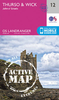
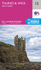
Map No. 11, Thurso and Dunbeath, in a waterproof and tear-resistant version of the Ordnance Survey Landranger series at 1:50, 000, including Lower Dounreay, Reay, Shebster, Westfield, Halkirk, Castletown, Slickly, Bower, Catchory, Watten, Spittal, Westerdale, Bilbster, Roster, Lybster, Latheronwheel, Braemore, Loch Calder, Loch Heilen, Loch Scarmclate, Loch Shurrary, Loch More, the peaks of Cnoc an Fhuarain Bh
Product Description
Reviews/Comments
Add New
Intelligent Comparison
Archived Product
Thurso And Dunbeath Stanfords
£5.59
Archived Product
Bristol And Bath WATERPROOF Stanfords
£10.39
Archived Product
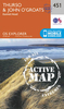
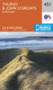
Thurso And Dunbeath OS ACTIVE Map Stanfords
£9.09
Vouchers
No voucher codes found.
Do you know a voucher code for this product or supplier? Add it to Insights for others to use.
Do you know a voucher code for this product or supplier? Add it to Insights for others to use.
 Denmark