
 United Kingdom
 France
 Germany
 Netherlands
 Sweden
 USA
USA
 Italy
Italy
 Spain
Spain
More From Contributor


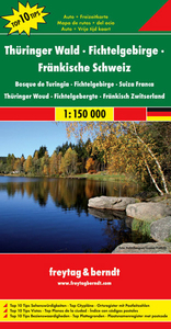
Thuringian Forest - Fichtelgebirge - Franconian Highlands F&B Top 10
Tips
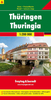
Thuringian Forest - Fichtelgebirge - Franconian Highlands ”Top 10 Tips” Map in Freytag & Berndt’s series of detailed road maps at 1:150, 000 covering Germany’s popular holiday areas, each with a booklet with street plans, an index and descriptions of 10 selected places of interest, all prominently highlighted on the maps.Relief is portrayed by hill-shading without distracting from other detail. Although these maps are using the same cartography as the publishers’ 1:200, 000 regional series, better scale and colouring make minor local roads and motorway junctions stand out more clearly. Road information includes intermediate driving distances, toll routes, scenic roads and tourist routes, steep gradients, caravan traffic restrictions, seasonal closures on mountain roads,
etc. Railways, cable cars, ferries and airfields are also shown. Selected cycle routes and long distance hiking trails are included. Picturesque towns are highlighted and in each title 10 selected places of interest are prominently marked and briefly described in the index booklet attached to the map cover. The booklet also provides street plans main towns in the region. Symbols mark various landmarks, places of interest and facilities, e.g. selected hotels, campsites, historical and architectural sites, etc. Latitude and longitude lines are drawn at 10` intervals.*Map legend and the descriptions include English.**In this title:* street plans of central Erfurt, Leipzig and Würzburg.
etc. Railways, cable cars, ferries and airfields are also shown. Selected cycle routes and long distance hiking trails are included. Picturesque towns are highlighted and in each title 10 selected places of interest are prominently marked and briefly described in the index booklet attached to the map cover. The booklet also provides street plans main towns in the region. Symbols mark various landmarks, places of interest and facilities, e.g. selected hotels, campsites, historical and architectural sites, etc. Latitude and longitude lines are drawn at 10` intervals.*Map legend and the descriptions include English.**In this title:* street plans of central Erfurt, Leipzig and Würzburg.

Product Description
Reviews/Comments
Add New
Vouchers
No voucher codes found.
Do you know a voucher code for this product or supplier? Add it to Insights for others to use.
Do you know a voucher code for this product or supplier? Add it to Insights for others to use.
 Denmark