More From Contributor

£16.99
Thug Kitchen started their wildly popular website to inspire people to eat some Goddamn vegetables & adopt a healthier lifestyle. Beloved by Gwyneth Paltrow (` This might be my favorite thing ever`) & with half a million Facebook fans & counting, Thug Kitchen wants to show everyone how to take charge of their plates & cook up some real f*cking food. Yeah, plenty of blogs & cookbooks preach about how to eat more kale, why ginger fights inflammation, & how to cook with microgreens & nettles. But they are dull or pretentious as hell -and most people can`t afford the hype. Thug Kitchen lives in the real world. In their first cookbook, they`re throwing down more than 100 recipes for their best-loved meals, snacks & sides for beginning cooks to home chefs. (Roasted Beer & Lime Cauliflower Tacos? Pumpkin Chili? Grilled Peach Salsa? Believe that sh*t.) Plus they`re going to arm you with all the info & techniques you need to shop on a budget & go & kick a bunch of ass on your own. This book is an invitation to everyone who wants to do better to elevate their kitchen game. No more ketchup & pizza counting as vegetables. No more drive-thru lines. No more avoiding the produce corner of the supermarket. Sh*t is about to get real. ...
Archived Product
£11.99
Topographical survey of Belgium at 1:50, 000 from the country’s national survey organization, Nationaal Geografisch Instituut / Institut Géographique National. Contour interval varies according to the terrain, from 2.5 metres in the coastal areas to 10 metres in the Ardennes. The maps provide all the information expected of topographic mapping at this scale & in addition have an unusually large amount of vegetation and/or land use information (different types of woodlands, gardens, orchards, heath, etc). Each standard sheet covers Approx. 32 x 20 km / 20 x 12 miles, with larger maps published for the border or coastal areas. The maps have a 1-km UTM grid, with margin ticks for latitude & longitude at intervals of 1`. Map legend & a glossary of terms used on the maps include English.PLEASE NOTE: the Long-Distance Footpaths Map of Belgium at 1:300, 000 is overprinted with the grid for the 1:50, 000 topographic survey, showing the exact coverage of each sheet. Stanfords keeps as regular stock 50K maps for the World War I battlefields around the Ypres, Messines & Passchendaele, & for the area of the Battle of Waterloo. Maps for other regions can be supplied as special orders – to see the list of all the titles in this series please click on the series link. ...
Archived Product
£9.99
On the Road meets Down Under in this really rough guide to the adventures of an enthusiastic hitchhiker & his reluctant girlfriend on their quest for the real Australia. Hitching lifts with the desert`s dodgiest drivers & taking breaks in the roughest roadhouses, this is Tom Parry`s witty, warts-&-all tale of hitchhiking 8, 000 miles across
- & around
- the Australian outback with his thumb, his backpack & his French girlfriend, Katia. As the couple hitch their way around the near empty highways, they encounter as wide a cross-section of Aussie society as you could ever hope to meet. In cattle stations, Aboriginal communities, remote waterholes, caravan parks, hippy communes & roadhouses, they see a country that remains as extraordinary today as it was for the first nineteenth century settlers. Loosely following the routes carved out by the legendary explorers who first traversed the great continent, the couple get to grips with the country`s fascinating history. Set against a backdrop of the real Australia
- not `as seen on TV`- ” Thumbs Up Australia” is full of wonderful anecdotes & endearing tales of some of the country`s most idiosyncratic characters, from the grizzled Aboriginal elder with his tales of dreamtime, to an amphetamine-swallowing road train driver. & at the end of their journey, it is ironically Katia who suggests thumbing a lift to the airport!


...
Archived Product
£12.99
Map No. 1207, Thun, in the topographic survey of Switzerland at 1:25, 000 from Bundesamt für Landestopographie (swisstopo), covering the whole country on 247 small format sheets, with special larger maps published for popular regions including some titles now available in hiking versions. Highly regarded for their superb use of graphic relief & hill shading, the maps give an almost 3-D picture of Switzerland`s mountainous terrain. Contours are at 10 m intervals, with 20m intervals in the mountainous areas. All the maps have a 1-km grid for Swiss national coordinates (datum CH 1903). * Small format sheets (Nos. 1011
- 1374)* Map legend in the language of the area covered by the map. Additional margin ticks show latitude & longitude in steps of 2`. The area covered by each map is 17 x 12 km (11 x 7 miles approx). * Special larger sheets (Nos. from 2501 onwards) – STANDARD editions:* No map legend is included but a separate leaflet can be provided instead. The area covered by each map is 25 x 17 km (15 x 11 miles approx).* Special larger sheets (Nos. from 2501 onwards) – HIKING editions:* An overprint highlights hiking, mountain & alpine paths, including regional & national long-distance trails. The maps also show bus routes with bus stops, plus inns in remote locations. The area covered by each map is 25 x 17 km (15 x 11 miles approx).
...
Archived Product
£7.99
At the age of 24, Alastair Humphreys set off to try to cycle round the world. By the time he arrived back home, four years later, he had ridden 46, 000 miles across five continents on a tiny budget of just £7, 000. Thunder & Sunshine is the sequel to the best-selling Moods of Future Joys. Here Alastair sails from Africa to South America, where he rides from the southern tip of Patagonia to northern Alaska. Crossing the Pacific, he cycles into a Siberian winter, carries on through Japan, China & nearing the end of his journey at last, across Asia & Europe towards his home in Yorkshire. ...
Archived Product
£36.95
Military topographic survey mapping with contours. These maps are designed primarily as flying charts for aircraft, but they are useful as general topographical maps where nothing else is available. Contours are shown in feet, with elevation colouring & spot heights. Towns, villages, major roads, railways & airports are shown (but please note that many of the smaller settlements are not named, & the road information is not necessarily up to date). Some air navigation information also appears on the map, such as radio beacons & restricted flying zones. Double-sided sheet. ...
Archived Product
£14.99
A unique collection of 100 postcards, each featuring a different Thunderbirds TV image. From Tracy Island & the Thunderbird machines to the Hood & Lady Penelope, there`s an abundance of classic images in a sturdy gift box. A perfect gift for all Thunderbirds fans. ...
Archived Product
£25.00
Blast off on a thrilling adventure through Thunderbirds comic history! Discover the iconic comic strips that captured the thrill & excitement of the cult TV series, read about the geniuses who created them, & look inside the spectacular Thunderbirds vehicles. With original comic artwork by leading British artists & a F.A.B. selection of Thunderbirds cross-sections, this exciting collection is perfect for Thunderbirds fans everywhere. 5, 4, 3, 2, 1... Thunderbirds are Go! ...
Archived Product
£700.00
Each model is hand painted & finished with exceptional detail. This extraordinary collectible piece is a rich mahogany model with detailed cockpit & leather seats. A replica of a 1950s hydroplane. Crafted from lustrous red woods, the piece will look fabulous teamed with dark furniture for a truly masculine look. If we do not have this item in stock we will order it for you from our supplier. Delivery generally takes 3 weeks within the UK. For overseas delivery queries please email sales@stanfords.co.uk ...
Archived Product
£20.99
The Alps of central Switzerland on a Swiss topographic survey map at 1:100, 000. Coverage extends south from Luzern to Grindelwald & the Alps of the Bernese Oberland & the Gotthard Pass. Maps in the Swiss topographic survey at 1:100, 000 from Swisstopo are highly regarded for their superb use of graphic relief & hill shading, presenting an almost 3-D picture of the country`s mountainous terrain. Coverage is available either as small size standard sheets – Nos 26 to 48, each covering 70 x 48 km / 43 x 30 miles approx, or as larger size maps
- Nos. 101 onwards, each covering 100 x 70 km / 62 x 43 miles approx. Both formats have identical cartography, with contours at 50-metres intervals. Standard sheets include margin ticks showing latitude & longitude in steps of 10`, & both formats have an overprint showing the Swiss national grid lines at 10km intervals; latest editions of the larger sheets now have the Swiss grid lines at 1km intervals. Standard sheets have a map legend in the language of the area covered by the map. The larger sheets have no legend but a separate “ Conventional Signs” leaflet, in English, can be provided with the map. To see the list of titles in this series please click on the series link.
...
Archived Product

Thunder Bay

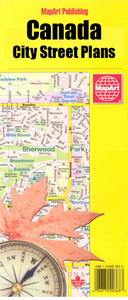
Double-sided, indexed street plan of Thunder Bay, including Atikokan, Dryden, Fort Frances, Kenora, Geraldton, Ignace and Longlac. Street plans from the MapArt / Canadian Cartographics Corporation / JDM Géo publishing group are usually produced at scales around 1:25, 000 to 1:35, 000 with smaller towns often shown at more detailed scales. All plans have street indexes. Plans of larges cities usually include an enlargement for the downtown area. Plans grouping together several smaller towns often have an overview map showing the whole of the relevant region. The plans have colouring to indicate commercial, institutional or industrial use, etc. Main traffic arteries are highlighted and one way streets are marked. A range of symbols shows, as appropriate, parking facilities, bus
terminals, metro and/or railway stations, various public facilities and services, places of interest, recreational centres, etc. Map legends for cities and towns in the French speaking part of the country are sometimes in French only.To see the list of currently available Canadian street plans and pocket atlases form the MapArt / Canadian Cartographics Corporation / JDM Géo publishing group, including waterproof and tear-resistant FastTrack titles, please click on the series link.
RIP - This product is no longer available on our network. It was last seen on 25.09.2019

This page now acts as a permanent archive for this product. Add more information using the comments box below to ensure it can still be found by future generations.

Use our search facility to see if it is available from an alternative contributor.
  • Availability: Out Of Stock
  • Supplier: Stanfords
  • SKU: 9781553685159
Availability: In Stock
£7.99

Product Description

Double-sided, indexed street plan of Thunder Bay, including Atikokan, Dryden, Fort Frances, Kenora, Geraldton, Ignace & Longlac. Street plans from the Map Art / Canadian Cartographics Corporation / JDM Géo publishing group are usually produced at scales around 1:25, 000 to 1:35, 000 with smaller towns often shown at more detailed scales. All plans have street indexes. Plans of larges cities usually include an enlargement for the downtown area. Plans grouping together several smaller towns often have an overview map showing the whole of the relevant region. The plans have colouring to indicate commercial, institutional or industrial use, etc. Main traffic arteries are highlighted & one way streets are marked. A range of symbols shows, as appropriate, parking facilities, bus terminals, metro and/or railway stations, various public facilities & services, places of interest, recreational centres, etc. Map legends for cities & towns in the French speaking part of the country are sometimes in French only. To see the list of currently available Canadian street plans & pocket atlases form the Map Art / Canadian Cartographics Corporation / JDM Géo publishing group, including waterproof & tear-resistant Fast Track titles, please click on the series link.

Reviews/Comments

Add New

Price History

Vouchers

No voucher codes found.
Do you know a voucher code for this product or supplier? Add it to Insights for others to use.

Facebook

Jargon Buster

Waterproof - Resistant to water, usualy specified by depth in metres
Resistant - Something that can repel against something.
Pocket - A bag shaped insert in clothing used to carry items

Supplier Information

Stanfords
Stanfords was established in 1853 and opened their iconic Covent Garden flagship store in 1901. They have become the top retailer of maps, travel books and accessories in the UK and arguably offer the largest selection of maps and travel books worldwide. Famous names such as Captain Robert Falcon Scott, Ranulph Fiennes and Michael Palin have purchased from Stanfords. They now have a shop in Bristol and both stores together with other venues operate a calendar of events including talks, book signings and exhibitions. As a specialist map retailer, the map selection is comprehensive and includes road maps, street maps and walking maps from worldwide destinations, as well as a selection of world atlases and wall maps. Books include travel guides and travel literature. Stanfords also stock globes, from miniatures made of blue marble to magnificent floor-standing globes. The website features a selection of interesting articles on travel topics.
Page Updated: 2023-11-12 20:15:36

Community Generated Product Tags

Oh No! The productWIKI community hasn't generated any tags for this product yet!
Menu