
 United Kingdom
 France
 Germany
 Netherlands
 Sweden
 USA
USA
 Italy
Italy
 Spain
Spain
More From Contributor


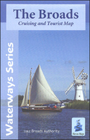
The Broads Heron Map
A cruising and tourist map of the Broads is at 1:50, 000 with detailed town plans at 1:12, 500 for Wroxham and Hoveton, Stalham, Horning, Potter Heigham, Norwich, Brundall, Beccles, Loddon, Great Yarmouth, Reedham and Oulton Broad. Suitable for both waterways and leisure users.The Broads is Britain`s largest protected wetland, covering some 300 sq km. Its rivers, broads, marshes and fens make it a unique area with some rare habitats, plants and wildlife. It was the arrival of the railways in the late 19th century that opened the area to tourism. Today it is one of the most popular inland waterways with in excess of 125 miles of lock-free navigable waterways. Other popular activities include fishing, walking, cycling and bird watching.This map gives detailed coverage of the
Broads with emphasis on the waterways and information useful and relevant to users of the waterways without neglecting other leisure users. The map detail is complimented by information panels and photographs.The map shows navigation information, visitor moorings, boatyards, boat hire centres, facilities for the boat user and shops. Tourist information includes places of interest, pubs, nature reserves, windmills, churches, long distance paths, public toilets and caravan and camp sites. The reverse side has detailed boating information including location of visitor moorings, details of facilities at boatyards and marinas, journey times, day boat hire and boat trip locations, as well as contact details and opening times for a wide selection of visitor destinations and
attractions, canoe and cycle hire details and some useful waterways contact numbers. To see the list of other titles in this series please, click on the series link.

Product Description
Reviews/Comments
Add New
Vouchers
No voucher codes found.
Do you know a voucher code for this product or supplier? Add it to Insights for others to use.
Do you know a voucher code for this product or supplier? Add it to Insights for others to use.
 Denmark