
 United Kingdom
 France
 Germany
 Netherlands
 Sweden
 USA
USA
 Italy
Italy
 Spain
Spain
More From Contributor


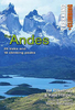

The Andes
The Andes at 1:4, 500, 000 from Nelles Verlag on a double-sided map offering a convenient format for use when travelling. The map includes street plans of main cities and enlargements for the Cusco area and the region around Santiago.Coverage of the Andes is divided into two sections, each accompanied by the appropriate plans or enlargements. The northern half extends to Antofagasta in Chile and includes insets with street plans of central Bogota, Quito, Lima and La Paz, plus and enlargement of the Cusco area with Machu Picchu and Cordillera Vilcabamba. The southern half start at Iquique, providing a good overlap with the northern side, and includes street plans of central Santiago, Antofagasta, Iquique, Arica and La Serena, plus an enlargement of the region around
Santiago.Relief shading, spot heights and names of mountain ranges and peaks present the topography. Road network indicates highways in good or poor condition and includes partly surfaces roads and selected tracks. Driving distances are marked on main routes. Railway lines and local airports are included, and the map also shows internal administrative boundaries within each country with names of the provinces. National parks or protected areas and main places of interest are highlighted. Latitude and longitude are indicated by margin ticks at 4
Santiago.Relief shading, spot heights and names of mountain ranges and peaks present the topography. Road network indicates highways in good or poor condition and includes partly surfaces roads and selected tracks. Driving distances are marked on main routes. Railway lines and local airports are included, and the map also shows internal administrative boundaries within each country with names of the provinces. National parks or protected areas and main places of interest are highlighted. Latitude and longitude are indicated by margin ticks at 4
Product Description
Reviews/Comments
Add New
Intelligent Comparison
Archived Product

The End Stanfords
£7.99
Archived Product

The Ganges Stanfords
£16.95
Archived Product
The Ganges Stanfords
£29.95
Archived Product

The Aeneid Stanfords
£10.99
Archived Product

The Aeneid Stanfords
£10.99
Archived Product

The Wonder Stanfords
£14.99
Archived Product

The Wonder Stanfords
£7.99
Archived Product

The Riders Stanfords
£8.99
Vouchers
No voucher codes found.
Do you know a voucher code for this product or supplier? Add it to Insights for others to use.
Do you know a voucher code for this product or supplier? Add it to Insights for others to use.
 Denmark