
 United Kingdom
 France
 Germany
 Netherlands
 Sweden
 USA
USA
 Italy
Italy
 Spain
Spain
More From Contributor

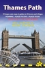


Thames Valley & Chilterns
The Chilterns form part of the long line of chalk hills stretching intermittently across southern and eastern England. It is an area characterised by beech woods and dry valleys, and these natural features are explored in the routes. The Thames Valley is steeped in history, from Windsor Castle and Richmond Park to Runnymede Meadows, where the Magna Carta was signed in 1215, and there are opportunities to absorb this evocative atmosphere, as well as genteel towns like Dorchester, Henley and Princes Risborough. -See walk locations by Looking Inside Inside: -28 great walks in Thames Valley & Chilterns from 2 to 10 miles -Clear, large scale Ordnance Survey route maps -GPS reference for all waypoints -Where to park, good pubs and places of interest en route -All routes have been fully
researched and written by expert outdoor writers -Beautiful photography of scenes from the walks Pathfinder(R) Guides are Britain`s best loved walking guides. Made with durable covers, they are the perfect companion for countryside walks throughout Britain. Each title features circular walks with easy-to-follow route descriptions, large-scale Ordnance Survey route maps and GPS waypoints.With over 70 titles in the series, they offer essential information for walkers throughout the country.Contents* Wallingford* Watlington Hill* Hedgerley and Burnham Beeches* West Woodhay and Inkpen* Dorchester and Wittenham Clumps* Aldermaston and the Kennet and Avon Canal* Cuckhamsley Hill and the Ridgeway* Port Meadow* Old Boars Hill* Marlow and Hurley* Widbrook Common and Cliveden Reach* Goring*
Whitehorse Hill and Kingston Lisle* Great Hampden and Little Hampden* Cookham, Winter Hill and Cock Marsh* Abingdon and Sutton Courtenay* Henley-on-Thames and Hambleden* Runnymede and Windsor Great Park* Longworth and Hinton Waldrist* Aldbury, Ivinghoe Beacon and Ashridge* Ibstone, Turville and Fingest* Coombe Hill and Chequers* Whitchurch and Mapledurham* West Wycombe, Hughenden and Bradenham* Chesham and Little Missenden* Chess Valley* Lardon Chase, Moulsford and Streatley* Princes Risborough and Chinnor Hill
Product Description
Reviews/Comments
Add New
Vouchers
No voucher codes found.
Do you know a voucher code for this product or supplier? Add it to Insights for others to use.
Do you know a voucher code for this product or supplier? Add it to Insights for others to use.
 Denmark