More From Contributor

£8.95
The A-Z Adventure series features the accuracy & quality of Ordnance Survey`s Explorer mapping in a convenient book, therefore eliminating the need to fold & re-fold a large sheet map to the desired area. OS Explorer is Ordnance Survey`s most detailed mapping at a scale of 1:25 000 showing public rights of way, open access l&, national parks, tourist information, car parks, public houses & camping & caravan sites. The Thames Path is a National Trail which covers 296km (184 miles) & follows the length of Englands longest river, the Thames, from its source in the Cotswolds to the Thames Barrier in Greenwich, London. This A-Z Adventure Atlas of the Thames Path features 60 pages of continuous Ordnance Survey mapping providing complete coverage of the Thames Path. Clearly highlighted in yellow, the route is easy to identify & shows both north & south bank alternatives. In addition mileage markers have been introduced to the map making it easy to gauge distances when planning your own sections of the walk to enjoy. A route planner is also included providing distances between places & the amenities available, featuring: Information Centres, Hotels/B& Bs, Youth Hostels, Campsites (seasonal opening), Restaurants, Public Houses, Cafes (seasonal opening), Shops & Petrol Stations. Unlike OS sheets, this A-Z Adventure Atlas

Includes::
a comprehensive index to towns, villages, hamlets & locations, natural features, nature reserves, car parks & youth hostels, making it quick & easy to use. Each index entry has a page reference & a six figure National Grid Reference. With a book size of 240mm x 134mm it is the same size as a standard OS Explorer map when closed. Also featured is advice on safety & security when walking, details of Tourist Information Centres & a selection of QR codes linked to useful web sites. This A-Z Adventure Atlas has the accuracy & quality of OS Explorer mapping indexed within a book, making it the perfect companion for walkers, off-road cyclists, horse riders & anyone wishing to explore the great outdoors. Other National Trails available within the A-Z Adventure series: Coast to Coast, Cotswold Way, Pembrokeshire Coast Path, Pennine Way, South Downs Way, The Ridgeway & SW Coast Path.

...
Archived Product
£13.95
The Thames Path National Trail map on light, waterproof & tear-resistant synthetic paper. Unlike other titles in Harvey’s very popular series covering the long-distance trails, The Thames Path map is at 1:60, 000 & shows the whole route & the surrounding countryside on three large panels: on one side from the source to Dorchester in Oxfordshire, on the reverse the rest of the route on two panels. The overprint highlighting the route indicates whether it runs on a track, a path, a not visible path or a road, & within London indicates alternative routes on both sides of the river. Points where particular care should be taken crossing a road are clearly marked. Locations along the route & within easy distance from it are annotated with symbols indicating what facilities can be found there (campsites, caravan sites, youth hostels, pubs & refreshments, restaurants, shops & drinking water supplies, toilets, etc). On the river the maps shows locks where facilities are available, with a separate panel indicating what is available at each lock & providing phone numbers. In the surrounding countryside the map has contours at 10m intervals, with additional colouring for open forest/woodland & dense plantations. Roads a graded by colouring, local tracks & footpaths are marked, & railway lines are shown with stations. Within London Underground stations are shown (though not all are named); 18 of the capital’s major attractions are highlighted & listed with their websites. The map has British National Grid lines at intervals of 1km. Also provided are several other useful contact details, information on waymarking, general notes about the history of the Thames Paths, etc. To see other titles in this series please clock on the series link. ...
Archived Product
£14.99
A completely new Trail Guide dedicated to the London section of the Thames Path from Hampton Court to the Thames Barrier. Until now, Aurum`s popular one-volume Thames Path guide has had all too little room to cover the endlessly rich array of sights & history along its London section
- something to look at literally every yard of the way. Now, Aurum publishes a completely new walker`s guide just to the London Thames, laid out to its new full-colour Trail Guide design, & including the extension to Crayford. Here is all the history along the river from the Mesolithic Period timber piles near Vauxhall Bridge to the new Shard skyscraper shooting skywards at London Bridge. It covers all the folklore from the famous frost fairs to the much-lamented beach near Tower Bridge, not forgetting the poignant recent visit of a large whale to the centre of London. The Thames winds all the way through London`s history & culture, from Henry VIII`s Hampton Court to the chequered fate of the Dome/O2: the London resident as much as the visiting tourist will find in this guide something new every step of the way.
...
Archived Product
£14.99
This comprehensive guide to the London section of the Thames Path Trail Guide covers the route from Hampton Court in the east to the Thames Barrier in the west, with an extension into Crayford Ness. From the Mesolithic Period timber piles near Vauxhall Bridge to the innovative Shard skyscraper at London Bridge, the long & remarkable history of London is revealed. Clapham covers all the folklore from the famous frost fairs to the much-lamented beach near Tower Bridge, not forgetting the poignant recent visit of a large whale to the centre of London. The Thames winds all the way through London`s history & culture, from Henry VIII`s Hampton Court to the chequered fate of the Dome/O2. Accompanied by easy-to-read maps & colour photography, the London resident as much as the visiting tourist will find in this guide something new every step of the way. ...
Archived Product
£14.99
Thames Path in London, an 80-km / 50 mile route from Hampton Court across London to the Thames Barrier & along the Thames Path Extension to Crayford Ness. The course of the path, along both banks of the river between Teddington & Greenwich, is highlighted on street plan extracts which also show locations of riverside pubs & nearby tube or railway stations. The colour of the text indicates whether the north or the south bank route is being described. Special panels provide more background information about important buildings or sights. The guide, part of a series of walking guides to the National Trails in England & Wales, also

Includes::
information on boat services along the Thames & useful contact details. To see other titles in the Aurum Press series of guides to the national trails & other long-distance footpaths, please click on the series link.

...
Archived Product
£14.99
Thames Path in the Country, a 235-km / 147 mile route from the source to Hampton Court in London in a series of walking guides to the National Trails in England & Wales with colour extracts from the Ordnance Survey`s Explorer series at 1:25, 000 showing points along the route cross-referenced to the text. The maps also indicate nearby places of interest & various facilities including campsites & caravan parks, youth hostels, water points, pubs, information or visitor centres, etc. Detailed descriptions of the route include information on access by public transport, refreshment facilities & toilets, & accommodation. The guide also

Includes::
two circular detours from the main route, around Oxford plus around Windsor & Eton, both highlighted on street plans & accompanied with descriptions of main sights. The guide is illustrated throughout with colour photos &

Includes::
an introductory chapter with the history of the path & notes describing various sections of the Thames. Also provided is a list of useful contact addresses. To see other titles in the Aurum Press series of guides to the national trails & other long-distance footpaths, please click on the series link.


...
Archived Product
£4.95
The Thames Path National Trail companion is an invaluable guide for walkers & is full of all the practical information needed to plan a visit to the Trail. It

Includes::
in-deph detailes about a wide variety of accommodation & facilities such as pubs, village stops & attractions close to the Trail. It also gives advice about a range of other things including maps, transport & appropriate clothing to wear on your walk.

...
Archived Product
£4.95
The Thames Path National Trail Companion by the National Trail Office is an invaluable book that complements the Trail Guide to the Thames Path. It divides the Trail in 15 stages, for each one, it provides a wealth of practical information ranging from maps, nearest transport stations, local taxis, with details & phone numbers, equipment, accommodation listings, pubs, village shops & facilities & attractions. An introduction explores the path in broader terms touching on the history & wildlife, how to prepare & stay safe, the weather & equipment, tourist information offices & other useful contacts. ...
Archived Product
£11.99
Practical Trailblazer British Walking Guide to the Thames Path National Trail running for 184 miles from the river`s source at Thames Head near Kemble, Gloucestershire to the Thames Barrier in London. The path leads from the start of the river in a meadow in the Cotswolds through Oxford, & further historic towns, churches, abbeys & castles including Lechlade, Abingdon, Wallingford, Henley, past Runnymede, the site of the signing of Magna Carta, & Windsor Castle. Passing by so many ancient sites, this is as much a walk through history as an easy ramble along a river bank. The route through London
- particularly along the south bank
- remains relatively countrified, at least as far as Putney, from which the approaching sights of Westminster & Tower Bridge offer vistas as impressive as any others along the river`s green & scenic upper reaches. Leaving central London, the regenerated dockland areas of East London lure you to your journey`s end at the Thames Barrier & the conclusion of a most enjoyable & easy ramble. The guide

Includes::
90 large-scale walking maps & 10 town plans. Public transport information showing all access points on the path. Accommodation & places to eat with reviews. 30 colour photos including 4pp colour flower guide. Extra colour mapping
- stage maps (one page per stage) & profiles. New guide in the classic Trailblazer style with uncluttered, fully-edited maps drawn by walkers for walkers. Downloadable GPS waypoints also included. The largest scale walking maps available
- At just under 1:20, 000 (8cm or 31/8 inches to 1 mile), bigger than most detailed walking maps currently available in the shops.


...
Archived Product
£11.99
Practical, all-in-one guide to walking the Thames Path National Trail from the Costwolds to the Thames Barrier in London, including large-scale trail maps, places to stay, places to eat & public transport information. The Thames Path`s National Trail runs for 184 miles (294km) from the river`s source at Thames Head near Kemble in the Cotswolds to the Thames Barrier in London. The scenery is magnificently varied ranging from wild & lonely sections of the upper reaches of the river to equally impressive urban vistas. Passing so many ancient sites
- Oxford, Lechlade, Abingdon, Henley, Runnymede, Windsor & London
- this is as much a walk through history as an easy ramble along a river bank. *
Includes: 99 walking maps
- the largest-scale maps available. At a scale of just under 1:20, 000 (8cm or 3-1/8 inches to one mile) these are bigger than the most detailed walking maps currently available. * Unique mapping features
- walking times, directions, tricky junctions, places to stay & eat, points of interest. These are not general-purpose maps but fully-edited maps drawn by walkers for walkers. * Itineraries for all walkers
- whether hiking the 184-mile route in its entirety or sampling the highlights on day walks or short breaks. *
Includes: detailed public transport information for all access points. * Practical information for all budgets
- what to see, where to stay with reviews, where to eat with reviews: pubs, hotels, B&B, camping, bunkhouses, hostels. *GPS waypoints. These are also downloadable from the Trailblazer website. * Stage maps in full colour show gradients. * Overview maps
- 14 in full colour. * Colour flower guide
- 4pp.


...
Archived Product

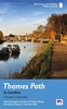
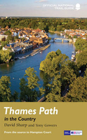
Thames Path In The Country: From The Source To Hampton Court

The official guide to the riverside path from its Gloucestershire source all the way to the outskirts of London. With the London Thames now covered by Aurum`s separate new guide, a companion volume can concentrate on the appeal of the full 150 miles of the country Thames, which winds all the way from its Gloucestershire source near Cirencester to Hampton Court on the edge of the London conurbation. This new edition has a wealth of new information about the many sights and places of interest along the way, from Wittenham Clumps that Paul Nash used to paint to Heston Blumenthal`s Fat Duck restaurant at Bray, as well as full walking tours of historic Oxford and Windsor & Eton. There are sections on Stanley Spencer at Cookham, and Cliveden and the Cliveden Set, as well as on handsome and
interesting towns like Henley and Abingdon. There is also a new section on the wildlife and natural history of the Thames, and plenty of extra information on transport links to and from individual sections.
RIP - This product is no longer available on our network. It was last seen on 25.09.2019

This page now acts as a permanent archive for this product. Add more information using the comments box below to ensure it can still be found by future generations.

Use our search facility to see if it is available from an alternative contributor.
  • Availability: Out Of Stock
  • Supplier: Stanfords
  • SKU: 9781781315750
Availability: In Stock
£14.99

Product Description

The official guide to the riverside path from its Gloucestershire source all the way to the outskirts of London. With the London Thames now covered by Aurum`s separate new guide, a companion volume can concentrate on the appeal of the full 150 miles of the country Thames, which winds all the way from its Gloucestershire source near Cirencester to Hampton Court on the edge of the London conurbation. This new edition has a wealth of new information about the many sights & places of interest along the way, from Wittenham Clumps that Paul Nash used to paint to Heston Blumenthal`s Fat Duck restaurant at Bray, as well as full walking tours of historic Oxford & Windsor & Eton. There are sections on Stanley Spencer at Cookham, & Cliveden & the Cliveden Set, as well as on handsome & interesting towns like Henley & Abingdon. There is also a new section on the wildlife & natural history of the Thames, & plenty of extra information on transport links to & from individual sections.

Reviews/Comments

Add New

Intelligent Comparison

Oooops!
We couldn't find anything!
Perhaps this product's unique.... Or perhaps we are still looking for comparisons!
Click to bump this page and we'll hurry up.

Price History

Vouchers

No voucher codes found.
Do you know a voucher code for this product or supplier? Add it to Insights for others to use.

Facebook

Jargon Buster

History - Anything that happens in the past. An acedemic subject.
edge - Enhanced data rates for GSM evolution also known as enhanced GPRS. A mobile phone technology with improved data transmission rates.
edge - The point at which two surfaces meet
Set - a group of items usually related to one another. Some objects cannot function without the complete set of items.
Natural - not manmade
Fat - A natural substance that is oily and can be harmful to health if consumed too much.
Individual - A single separate item or person.
Transport - Something that carries people or goods.

Supplier Information

Stanfords
Stanfords was established in 1853 and opened their iconic Covent Garden flagship store in 1901. They have become the top retailer of maps, travel books and accessories in the UK and arguably offer the largest selection of maps and travel books worldwide. Famous names such as Captain Robert Falcon Scott, Ranulph Fiennes and Michael Palin have purchased from Stanfords. They now have a shop in Bristol and both stores together with other venues operate a calendar of events including talks, book signings and exhibitions. As a specialist map retailer, the map selection is comprehensive and includes road maps, street maps and walking maps from worldwide destinations, as well as a selection of world atlases and wall maps. Books include travel guides and travel literature. Stanfords also stock globes, from miniatures made of blue marble to magnificent floor-standing globes. The website features a selection of interesting articles on travel topics.
Page Updated: 2023-11-12 20:15:36

Community Generated Product Tags

Oh No! The productWIKI community hasn't generated any tags for this product yet!
Menu