
 United Kingdom
 France
 Germany
 Netherlands
 Sweden
 USA
USA
 Italy
Italy
 Spain
Spain
More From Contributor


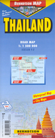
Thailand
Thailand on a light, waterproof and tear-resistant, double-sided map from Berndtson, highlighting the country’s 15 top sights, with an enlargement showing road access to and main routes across Bangkok.The whole country is presented in three sections. On one side is the northern half of the country, from the outskirts of Bangkok northwards. On the reverse, the capital and the areas south of it are shown in two panels. All the sections are at the same scale of 1:1, 500, 000 and show the country’s road and rail networks. National parks and other protected areas are prominently marked, with symbols indicating numerous places of interest including archaeological sites, beaches, etc. 15 of the country’s top sites are highlighted, with a separate panel providing brief
descriptions. The maps have no geographical coordinates.An enlargement shows the Bangkok area at 1:400, 000. The index of localities includes separate lists of places of interest, beaches, etc. Also included are graphs showing the country’s climate month by month, plus general tourist information.The map is printed on light, waterproof and tear-resistant plastic paper. Map legend includes English. All descriptions and general information are in English only.
descriptions. The maps have no geographical coordinates.An enlargement shows the Bangkok area at 1:400, 000. The index of localities includes separate lists of places of interest, beaches, etc. Also included are graphs showing the country’s climate month by month, plus general tourist information.The map is printed on light, waterproof and tear-resistant plastic paper. Map legend includes English. All descriptions and general information are in English only.

Product Description
Reviews/Comments
Add New
Vouchers
No voucher codes found.
Do you know a voucher code for this product or supplier? Add it to Insights for others to use.
Do you know a voucher code for this product or supplier? Add it to Insights for others to use.
 Denmark