More From Contributor
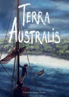
£17.99
Kadaster, Holland`s national survey organization, produces one of the most attractive topographic surveys in Europe. The maps are very colourful, with their characteristic patchwork of polders & an unusually large amount of land use information: meadows, arable l&, different types of forest, marshes, sand dunes, etc. Contours are shown at 5-metre intervals with numerous spot heights &, with such a large part of the country below the sea level, ”spot depths”. Each map covers an area of Approx. 25 x 20 km / 15 x 12 miles, with some sheets slightly larger. The maps have a 1-km Dutch national grid, plus latitude & longitude at intervals of 1`. Map legend

Includes::
English.IMPORTANT
- PLEASE NOTE BEFORE ORDERING: both the west (W) & the east (O) sheet of each number has the same name, although the town after which the two maps are named appears only on one of the sheets. For example: maps 41W & 41O are both called Arnhem, although the city of Arnhem appears only on sheet 40W, etc. To see the list of titles available in this series please click on the series link.


...
Archived Product
£12.99
Terni Provnce at 1:150, 000 in a series of handy size provincial road maps from Litografia Artistica Cartografica (LAC) with more minor local roads & country tracks than can be found on most regional maps from other publishers. This title is published with the traditional style LAC cartography.LAC’s provincial series is gradually being changed to a new style of digitally derived cartography, so presentation of adjoining titles may vary. All the maps have hill shading to represent the general relief with spot heights for selected peaks, & show a few more local roads & rough tracks than the other road map series. Intermediate road distances are indicated. Regional, provincial & communal borders are marked, & railways, funiculars, airports, sea ferry links & campsites are shown. The legend is in Italian only. The new, digitally produced editions are indexed & have enhanced, more finely drawn cartography: the hill-shading is less bold, motorway service areas are marked, natural parks are highlighted & an expanded range of symbols indicates various landmarks & sites, e.g. antiquities, churches, etc. Two styles of the new cartography are produced, differing only in the colour of the predominant background shading: grey or yellow/green. Some of the new editions include geographical coordinates for the map corners. The index of localities is on the reverse. To see all the titles in this series please click on the series link. ...
Archived Product
£5.99
Administrative provinces of the Ukraine on indexed road maps at 1:250, 000, each with a town centre street plan of its capital city. All place names are in Cyrillic only, but the map legend

Includes::
English. Coverage of the larger provinces is divided between the two sides of the map. Road network is presented in great detail, from international roads, shown with their E numbers, to dirt roads & country paths. Driving distances are marked on main, secondary & selected local roads; the maps also show border crossings, fuel stations, car service stations, & traffic patrol service points. Railway lines are shown with stations & local airports are marked. The maps also show boundaries of districts into which each region (oblast) is subdivided, & indicate their administrative headquarters. Topography is indicated by spot height, plus boundaries of national parks & other protected areas, & colouring and/or graphics for forests, orchards, vineyards, swamps & salt marshes. The maps have latitude & longitude lines at 10’ & 15’ respectively, & are indexed. Map legend

Includes::
English. Each title also

Includes::
a local table of driving distances & a street plan of the region’s administrative capital annotated with locations of selected hotels, car parks & petrol stations, museums & monuments, etc. In some titles more street plans are included.IMPORTANT
- PLEASE NOTE: supplies of all maps published by the Kartografija in Kiev are irregular & we cannot guarantee a definite delivery time for titles currently not in stock. To see the list of other titles in this series please click on the series link.


...
Archived Product
£6.50
Topographic coverage of the Canary Islands at 1:25, 000 published by the Instituto Geográfico Nacional – Centro Nacional de Información Geografica, the country’s civilian survey organization. The maps have contours at 10m intervals & colouring and/or graphics to show different types of vegetation or land use. Boundaries of national parks & other protected areas are marked. In addition to all the usual information shown on topographic mapping at this scale: detailed presentation of the road network with rural tracks & paths, etc, the maps also show campsites. The maps have a 1-km UTM grid, plus margin ticks for latitude & longitude at 1` intervals. The majority of the titles have been published since late 1990s. Map legend is in Spanish only.COVERAGE: each 25K map covers one quarter of the corresponding 1:50, 000 map, with the numbering system: I = NW quarter, II = NE quarter, III = SW quarter, & IV = SE quarter. To see other titles in this series please click on the series link. ...
Archived Product
£10.99
Topographic survey of Catalonia at 1:50, 000 from the Institut Cartogràfic de Catalunya, with vivid presentation of the terrain & an overprint for long-distance GR hiking trails. The series provides an excellent alternative to the much smaller sheets in the civilian or military surveys produced for the whole of Spain. The Catalan 50K series has not only a much larger area per sheet (each map covers one comarca, an administrative division of a province) than the maps from the national surveys, but also has more colourful, elegant & clear cartography with contours at 20m intervals, hill shading & fine graphics to portray the relief, vegetation types & landmarks. Most maps also have more tourist-related information, with an overprint highlighting long-distance GR trails & the Via Verde routes. Mountain refuges are marked & a range symbols indicate various places of interest including historical monuments, sport & recreational facilities, etc. Four different types of interesting locations are highlighted: picturesque towns or villages, individual isolated building or monuments, natural sites, & hydrographic features such as waterfalls. The maps have a 5km UTM grid, with latitude & longitude values shown for the map corners. Map legend is in Catalan only. To see other titles in this series please click on the series link. ...
Archived Product
£60.00
In 1991 the Swiss photographer Marco Paoluzzo discovered Icel&, its dramatic light conditions & impressive sceneries. Mesmerised by the mysterious north, he would gradually expand his travels to include Norway, the Faroe Islands & even Greenl&. That triggered his idea to combine the isles & countries in the 60th parallel north into a photo collection. ” Terra Borealis” contains photographs that were taken on Icel&, the Faroe Islands, the Shetlands, Norway, Greenland & Svalbard. The book offers an enchanting & magical journey in black-&-white. ...
Archived Product
£5.00
Small historical map from the late eighteenth century showing the Caribbean & the northern settled part of South America, known then as Terra Firma. Coverage stretches from the mouth of the Amazon in the south-east to eastern Panama & Cuba in the west. Islands, selected towns & major rivers are named, & mountainous regions are represented pictorially. Latitude & longitude scales are marked in the borders. Reproduced on heavyweight, parchment effect paper, with a generous border area. Paper

Size:
23.7 x 21.6 cm (19 1/4 x 8 1/2 inches) Map

Size:
16.7 x 18.7 cm (6 1/2 x 7 3/8 inches)


...
Archived Product
£10.99
Terra Incognita stems from when Sara Wheeler was invited by the American government to be the 1994 Writer in Residence at the US South Pole Station. She spent six weeks at the pole & on the edge of the infamous Ross Ice Shelf which finally defeated Fiennes & Stroud in their recent unsupported Antarctic crossing. She then joined the British Antarctic Survey for a month on the other side where oil & minerals are rich but too expensive to extract. She looked at how people live on the bases & how the landscape affects them. For her, Antarctica functions as Patagonia did for Bruce Chatwin, the myths & history carrying as much import as the ration of two two-minute showers a week, or how the inhabitants let off steam & avoid hating each other in confined quarters. ...
Archived Product
£35.00
From the most widely used languages & scripts, to the great religious communities, to the giant structures & the technological successes of the modern age
- this volume offers a fascinating overview of the records & achievements of civilization in their entirety & diversity. More than 3000 colour photographs taken by top photographers around the world celebrate the cultural & technological touchstones of human history. Ranking lists provide at-a-glance overviews while descriptive captions give substantial information on a number of topics. Concise text tells of the economic developments & population growth in our megacities, the pioneering work done in science & technology, & the remarkable innovations in the construction of museums, theatres, libraries & sports venues, among many other human achievements. The book is set out in ten chapters, each covering dozens of topics laid out in double-page spreads filled with brilliant photographs of structures & technology. Fascinating browsing, essential reference, & a tremendous documentation of contemporary achievement, Terra Maxima is a unique compilation of the ultimate.
...
Archived Product
£52.00
Maps have been invaluable throughout Canada`s history. They promised fame & fortune to early merchant-adventurers & guided army commanders. They legitimized a politician`s dominion & allowed businessmen to stake new claims. & they helped ordinary citizens build communities. Terra Nostra celebrates the mapping of Canada, in part by telling the stories of the exceptional individuals who helped to create the maps. Drawn from the rich cartographic holdings of Library & Archives Canada, it spans four centuries
- from the portolan charts of the early explorers to recent aerial images of east coast ice floes. Canada`s maps provide evidence of our nation`s technical accomplishments & offer insight into the development of our geographical knowledge. This year marks the 100th anniversary of the official Atlas of Canada; Terra Nostra provides a beautifully illustrated & timely celebration of the country`s cartographic history.
...
Archived Product

Terra Australis

Just over 225 years ago, one of the most incredible odysseys in human history took place. 1, 500 men and women were crammed aboard 11 ships and transported to the other side of the planet. They were criminals, outcasts, renegades: the scum of England. Having travelled over 24, 000km, across three oceans, they arrived at a country that did not yet exist. For some, it was a one-way trip to hell; for others, it proved an unexpected chance of a new life. Bollee and Nicloux`s 500-page masterpiece is an accurate, perceptive and sympathetic account of the birth of Australia.
RIP - This product is no longer available on our network. It was last seen on 25.09.2019

This page now acts as a permanent archive for this product. Add more information using the comments box below to ensure it can still be found by future generations.

Use our search facility to see if it is available from an alternative contributor.
  • External links may include paid for promotion
  • Availability: Out Of Stock
  • Supplier: Stanfords
  • SKU: 9781906838751
Availability: In Stock
£16.99

Product Description

Just over 225 years ago, one of the most incredible odysseys in human history took place. 1, 500 men & women were crammed aboard 11 ships & transported to the other side of the planet. They were criminals, outcasts, renegades: the scum of Engl&. Having travelled over 24, 000km, across three oceans, they arrived at a country that did not yet exist. For some, it was a one-way trip to hell; for others, it proved an unexpected chance of a new life. Bollee & Nicloux`s 500-page masterpiece is an accurate, perceptive & sympathetic account of the birth of Australia.

Reviews/Comments

Add New

Intelligent Comparison

Oooops!
We couldn't find anything!
Perhaps this product's unique.... Or perhaps we are still looking for comparisons!
Click to bump this page and we'll hurry up.

Price History

Vouchers

No voucher codes found.
Do you know a voucher code for this product or supplier? Add it to Insights for others to use.

Facebook

Jargon Buster

England - A country within the United Kingdom.
Human - A highly developed and adapted mamal and deminant species on earth
History - Anything that happens in the past. An acedemic subject.
Accurate - A measurement of precision when all elements are correct.

Supplier Information

Stanfords
Stanfords was established in 1853 and opened their iconic Covent Garden flagship store in 1901. They have become the top retailer of maps, travel books and accessories in the UK and arguably offer the largest selection of maps and travel books worldwide. Famous names such as Captain Robert Falcon Scott, Ranulph Fiennes and Michael Palin have purchased from Stanfords. They now have a shop in Bristol and both stores together with other venues operate a calendar of events including talks, book signings and exhibitions. As a specialist map retailer, the map selection is comprehensive and includes road maps, street maps and walking maps from worldwide destinations, as well as a selection of world atlases and wall maps. Books include travel guides and travel literature. Stanfords also stock globes, from miniatures made of blue marble to magnificent floor-standing globes. The website features a selection of interesting articles on travel topics.
Page Updated: 2023-11-12 20:15:36

Community Generated Product Tags

Oh No! The productWIKI community hasn't generated any tags for this product yet!
Menu