
 United Kingdom
 France
 Germany
 Netherlands
 Sweden
 USA
USA
 Italy
Italy
 Spain
Spain
More From Contributor

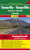


Tenerife Hikers` Super-Durable Map
Our latest hiking research on Tenerife has resulted in new editions of Walk! Tenerife and Tenerife Hikers` Super-Durable Maps being published in 2017. Thanks to Jan Kostura`s 2016 research we have several new hiking adventures described in detail in Walk! Tenerife. Jan`s gps records of his research for new routes and updating of current routes has provided the detailed information to produce our new edition of Tenerife Hikers Super-Durable Maps.Note that Tenerife Hikers` Super-Durable Maps is a collection of four 30k scale map sections on a double sided sheet of 840mm by 600mm which folds up to 220mm by 120mm. It is not a map of all of Tenerife. In our 2017 edition you will find 30k scale maps covering Valle de Orotava, West, Anaga and Adeje/Arona - Teide printed on a double sided map
sheet. We have combined two previous maps into a single map section; El Portillo and Valle de Orotava (and all the area between) is now a single map section covering the Orotava Valley from Aguamansa to beyond El Portillo and it also includes 4 new walking routes from Walk! Tenerife (2017) including the GR131 El Portillo to La Caldera, and two ascents of Montana Limon.Our `Las Canadas-Adeje/Arona` map is now extended northwards beyond Teide so it now also includes Pico del Teide, Montana Blanca, Pico Viejo and Montana Rajada as well as the full Las Canadas crater.The `West` map includes the latest TF-1 road along with the rerouting of three walking routes in this region. Not a lot changes in the Anaga except that Jan`s research has produced three new hiking routes; Igueste - Chamorga,
Igueste - Semaforo, and Cruz del Carmen - Punta del Hidalgo.Tenerife Hikers` Super-Durable Maps includes the details for you to receive free digital Custom Map editions of the four maps. Delivered by `digital download` as a zip file, you then `unzip` into the 4 separate Custom Maps. These Custom Maps can then be used with Garmin Basecamp software, and Google Earth, and may be loaded into modern Garmin gps units so that you can use the maps as the base map in your gps.Tenerife Hikers` Super-Durable Maps is produced using our `Tour & Trail` level of detail ranging from major roads to secondary roads to minor roads to streets and camino rural narrow country roads, plus dirt roads and walking trails.Altitude background colouring is designed to clearly show the altitude range when
travelling across the regions by car or on foot.100 metre and 50 metre contours are clearly shown on the map along with a large number of individual height points and all of the official `Trig` points. Our useful symbol range includes miradors, picnic areas, petrol stations, bar/restaurants and parking areas where you can pull off the road safely. You will easily identify springs, caves, sports grounds, cemeterys, churchs, chapels, lighthouses, towers and forts, camping areas, wind turbines, hotels and those all important information offices. Our `Special Concertina Map Fold` makes Tour & Trail Maps easy to use, and more importantly easy to fold back to their handy pocket size.`Super-Durable` means you get a map printed on Polyart with 100% oxygenation inks by a UK leading
map printer. This gives you a map that feels like silk but will stand up to the roughest treatment of outdoor adventuring and yet fold up like new at the end of your adventure. Polyart is made of high-density polyethylene (HDPE) and is therefore 100% recyclable in category 2 HDPE. For more information see the Polyart website.
Product Description
Reviews/Comments
Add New
Vouchers
No voucher codes found.
Do you know a voucher code for this product or supplier? Add it to Insights for others to use.
Do you know a voucher code for this product or supplier? Add it to Insights for others to use.
 Denmark