More From Contributor
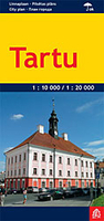
£6.95
Topographic coverage of mainland Spain at 1:50, 000 in the MTN50 (Mapa Topográfico Nacional) series from the Centro Nacional de Información Geografica, the country’s civilian survey organization. The maps have contours at 20m intervals, enhanced by relief shading, plus colouring and/or graphics to show different types of terrain, vegetation or land use. Boundaries of national parks & other protected areas are marked. In addition to all the usual information featured on topographic mapping at this scale, detailed presentation of the road & rail networks, rural tracks & paths, etc, the maps also show campsites & mountain refuges. On more recent editions some GRs, the official long-distance hiking routes, are also marked (although not as clearly as on hiking maps from other publishers). Each map covers 29.5x 18.5 km (with adjustments in the border or coastal areas). The maps have a 1-km UTM grid, plus margin ticks for latitude & longitude at 1` intervals. Map legend is in Spanish only.HOW TO CHOOSE THE RIGHT 50K MAP: all the titles in CNIG’s 200K Provincial Road Maps series at 1:200, 000 are overprinted with the grid for the 1:50, 000 maps & can be used to see the area covered by each 50K title. TO SEE THE LIST OF TITLES IN THIS SERIES PLEASE CLICK ON THE SERIES LINK.PLEASE NOTE
- MAP TITLES: the grids shown on our website serve both the civilian & the military 1:50, 000 topographic series. Although the areas covered by maps in both series are identical (apart from some border or coastal sheets), occasionally map titles differ – only one title is shown on the grid, usually the military one. In Galicia, the Basque country & in the Catalan speaking areas the tendency now is to use local place names rather than the often better known Castilian ones. Where possible, both versions are included in our titles. Map titles listed on our website are based on information received by us at the time of publication, but sometimes maps arrive showing a completely different title! As long as the map number is as ordered, the correct map has been supplied.
...
Archived Product
£9.99
A man`s mother can be a terrible burden sometimes. For Tarry Flynn
- poet, farmer & lover-from-afar of beautiful young virgins
-

...
Archived Product
£9.99
Map No. 105, Tarryall Mountains in Colorado, at 1:40, 680 in an extensive series of GPS compatible, contoured hiking maps of USA’s national & state parks or forests & other popular recreational areas. Cartography based on the national topographic survey, with additional tourist information. The maps, with most titles now printed on light, waterproof & tear-resistant plastic paper, highlight walking trails along with campsites & other accommodation, picnic sites, areas for various recreational pursuits such as horse riding or skiing, drinking water sources, & many other facilities of interest to the outdoor enthusiast. Cartography is based on information from the USGS (United States Geological Survey
- the country’s national survey organization), revised by the National Geographic Maps in cooperation with the National Park Service, USDA Forest Service, etc. Topography is excellently presented by contours (interval varies according to scale), enhanced by relief shading & colouring/graphics for wood cover, glaciers, etc. All heights are given in feet. The maps have a UTM grid plus latitude & longitude margin ticks & GPS waypoints for selected important locations. Each map is double-sided to give either maximum coverage of the chosen area or additional enlargements of its important sections. Accompanying notes provide useful information on relevant regulations, safety precautions, contact addresses, etc.IMPORTANT
- PLEASE NOTE: the series is very extensive, ranging in scale from 1:400, 000 for the vast national parks of Alaska to 1:25, 000 for local map in several states. We recommend, therefore, viewing the series by state rather than the whole list.

...
Archived Product
£4.99
Scotland`s clans, tartans & family names shown on a large map
- officially approved by the Scottish Tartans Authority. This beautifully
...
Archived Product
£12.99
Topographic survey of France at 1:25, 000 in IGN`s excellent TOP25 / Série Bleue series. All the maps are GPS compatible, with a 1km UTM grid plus latitude & longitude lines at 5’ intervals. Contours are at 5m intervals except for mountainous areas where the maps have contours at 10m intervals, vividly enhanced by hill shading & graphics for rocky terrain. Colouring with graphics indicates different types of vegetation or land use (deciduous or coniferous forests, moors, orchards, vineyards, etc). PLEASE NOTE: coverage of France at this scale is currently being revised – the format & the presentation of each title are indicated by the letters at the end of its Sheet Reference number (e.g. 0416ET, 3531ETR, 1923SB, etc.)MAPS WITH FULL TOURIST OVERPRINT & AN ENGLISH MAP LEGEND: all TOP25 maps & the SB editions of Série Bleue have an overprint highlighting waymarked walking trails including long-distance GR routes &, where appropriate, ski routes. Symbols indicate campsites, gîtes d’etape, refuges, equestrian centres & other recreational facilities or sites, tourist information centres, cultural heritage, etc. Towns & locations of particular interest are highlighted.- ET or OT = single-sided TOP25 map covering approx. 29x 21 km / 18x 13 miles.- ETR or OTR = waterproof & tear resistant TOP25 map covering the same area as the corresponding ET or OT number, but double-sided, printed on a smaller size sheet with a good overlap between the sides.- SB = Série Bleue map with full tourist overprint; these maps, first introduced in summer 2014, each cover approx. 29x 24km / 18x 15 miles.SÉRIE BLEUE maps with numbers ending in E (Est) or O (Ouest): most editions now indicate the GR routes, but do not show any other tourist information. Map legend is in French only. Each map covers approx. 14x 20km / 9x 12 miles. ...
Archived Product
£7.99
Tartu, Estonia’s second largest city on a street plan from the Tallinn-based publishers Regio, showing the town on one side at 1:30, 000 with on the reverse the town centre in greater detail at 1:7, 000. A wide range of symbols indicates various places of interest, including hotels, markets & shopping centres, car parks & petrol stations, etc. Map legend

Includes::
English. An inset indicates different parking zones, showing times & fees, & the map also provides the mobile phone numbers for English language descriptions of 23 recommended sights.

...
Archived Product
£7.99
Abandoned to his fate when his English parents die in the African jungle, a baby boy is rescued & reared by a loving ape foster mother. Conquering the savage laws of the wilderness, Tarzan grows into a mighty warrior & becomes leader of his tribe of apes until he encounters, for the first time, his own kind
- humans. An expedition of white treasure hunters has entered his jungle kingdom, accompanied by the beautiful Jane Porter. Tarzan`s primitive heart is struck & he determines to become civilized in order to win her. But will the charms of this charming & cultured young woman overcome when the spirit of his wild nature beckons?
...
Archived Product
£27.99
Get the most out of London. From Dickensian charm to modern cool, London has it all
- & this guide will help you find it. A wide
...
Archived Product
£27.99
Ville magique. Keep it chic in Paris with TASCHEN`s city guide. A dependable companion for any discerning visitor to the city of lights & love, this updated edition of TASCHEN`s Paris guide offers a selection of hotels, shops, restaurants, cafes, & bars. Drawing on the city`s evocative history as well as its contemporary culture, recommendations range from the ultra-hot Colette fashion concept store to Tom Ford`s secret hideaway to Hemingway`s favorite brasserie. Dine at a table with one of the best views in town, find a perfect fragrance at one of the city`s chicest boutiques, & have your head rest on pillows at one of the cutest & cosiest Marais hotels. It comes with dictionary-style cutout tabs for easy navigation & a companion pocket-sized map. ...
Archived Product
£12.50
Indexed street plan of Tashkent with an enlargement of the central area, a diagram of the metro & lists of various public transport lines & places of interest, plus a basic map & a distance table for the whole country. The main plan at 1:33, 000 shows the transport network indicating metro stations as well as bus, trolleybus & tram lines with numbers & stops. Various places of interest & facilities are highlighted. Local administrative districts of the city are indicated by colours. The city centre is shown in greater detail on an inset. On the reverse is a street index plus lists of various facilities & places of interest as well as of bus, tram & trolleybus routes. Also included is map of the city ...
Archived Product

Tartu

Tartu on a waterproof and tear-resistant indexed street plan from Jana Seta, including on the reverse side, an enlargement of the city centre and descriptions of main places of interest.On one side is the city with its outer districts indicating locations of main places of interest. Principal traffic arteries are highlighted and one way streets, car parks and locations of hotels and petrol stations are marked. On the reverse the city’s centre is shown in greater detail, with more principal sights highlighted.Map legend and descriptions of places of interest include English, Estonian, Latvian and Russian.
RIP - This product is no longer available on our network. It was last seen on 25.09.2019

This page now acts as a permanent archive for this product. Add more information using the comments box below to ensure it can still be found by future generations.

Use our search facility to see if it is available from an alternative contributor.
  • External links may include paid for promotion
  • Availability: Out Of Stock
  • Supplier: Stanfords
  • SKU: 9789984076386
Availability: In Stock
£8.99

Product Description

Tartu on a waterproof & tear-resistant indexed street plan from Jana Seta, including on the reverse side, an enlargement of the city centre & descriptions of main places of interest. On one side is the city with its outer districts indicating locations of main places of interest. Principal traffic arteries are highlighted & one way streets, car parks & locations of hotels & petrol stations are marked. On the reverse the city’s centre is shown in greater detail, with more principal sights highlighted. Map legend & descriptions of places of interest include English, Estonian, Latvian & Russian.

Reviews/Comments

Add New

Intelligent Comparison

Oooops!
We couldn't find anything!
Perhaps this product's unique.... Or perhaps we are still looking for comparisons!
Click to bump this page and we'll hurry up.

Price History

Vouchers

No voucher codes found.
Do you know a voucher code for this product or supplier? Add it to Insights for others to use.

Facebook

Jargon Buster

Waterproof - Resistant to water, usualy specified by depth in metres
Car - A machine used for transport which runs on roads
Resistant - Something that can repel against something.

Supplier Information

Stanfords
Stanfords was established in 1853 and opened their iconic Covent Garden flagship store in 1901. They have become the top retailer of maps, travel books and accessories in the UK and arguably offer the largest selection of maps and travel books worldwide. Famous names such as Captain Robert Falcon Scott, Ranulph Fiennes and Michael Palin have purchased from Stanfords. They now have a shop in Bristol and both stores together with other venues operate a calendar of events including talks, book signings and exhibitions. As a specialist map retailer, the map selection is comprehensive and includes road maps, street maps and walking maps from worldwide destinations, as well as a selection of world atlases and wall maps. Books include travel guides and travel literature. Stanfords also stock globes, from miniatures made of blue marble to magnificent floor-standing globes. The website features a selection of interesting articles on travel topics.
Page Updated: 2023-11-12 20:15:36

Community Generated Product Tags

Oh No! The productWIKI community hasn't generated any tags for this product yet!
Menu