More From Contributor
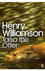
£10.99
The cloak-&-dagger war fought by British secret agents against Mussolini`s Italy has been little known
- until now. Target: Italy
...
Archived Product
£6.95
Topographic coverage of mainland Spain at 1:50, 000 in the MTN50 (Mapa Topográfico Nacional) series from the Centro Nacional de Información Geografica, the country’s civilian survey organization. The maps have contours at 20m intervals, enhanced by relief shading, plus colouring and/or graphics to show different types of terrain, vegetation or land use. Boundaries of national parks & other protected areas are marked. In addition to all the usual information featured on topographic mapping at this scale, detailed presentation of the road & rail networks, rural tracks & paths, etc, the maps also show campsites & mountain refuges. On more recent editions some GRs, the official long-distance hiking routes, are also marked (although not as clearly as on hiking maps from other publishers). Each map covers 29.5x 18.5 km (with adjustments in the border or coastal areas). The maps have a 1-km UTM grid, plus margin ticks for latitude & longitude at 1` intervals. Map legend is in Spanish only.HOW TO CHOOSE THE RIGHT 50K MAP: all the titles in CNIG’s 200K Provincial Road Maps series at 1:200, 000 are overprinted with the grid for the 1:50, 000 maps & can be used to see the area covered by each 50K title. TO SEE THE LIST OF TITLES IN THIS SERIES PLEASE CLICK ON THE SERIES LINK.PLEASE NOTE
- MAP TITLES: the grids shown on our website serve both the civilian & the military 1:50, 000 topographic series. Although the areas covered by maps in both series are identical (apart from some border or coastal sheets), occasionally map titles differ – only one title is shown on the grid, usually the military one. In Galicia, the Basque country & in the Catalan speaking areas the tendency now is to use local place names rather than the often better known Castilian ones. Where possible, both versions are included in our titles. Map titles listed on our website are based on information received by us at the time of publication, but sometimes maps arrive showing a completely different title! As long as the map number is as ordered, the correct map has been supplied.
...
Archived Product
£6.50
Topographic coverage of mainland Spain at 1:25, 000 published by the Centro Nacional de Información Geograficá, the country’s civilian survey organization. The maps have contours at 10m intervals & colouring and/or graphics to show different types of vegetation or land use. Boundaries of national parks & other protected areas are marked. In addition to all the usual information shown on topographic maps at this scale, detailed presentation of the road & rail networks, rural tracks & paths, etc, the maps also show campsites. The maps have a 1-km UTM grid, with margin ticks for latitude & longitude at 1` intervals. Map legend is in Spanish only.PLEASE NOTE: our grid for the whole of Spain is in preparation
- in the meantime, for areas other than those shown on the attached grid please use CNIG’s topographic survey at 1:50, 000 by searching for ‘SI00000832’. Each 25K map covers one quarter of the corresponding 50K map, with the numbering system: I = NW quarter, II = NE quarter, III = SW quarter & IV = SE quarter. CNIG maps in the Provincial Road Maps series at 1:200, 000 are overprinted with the grid for the 1:50, 000 survey & can be used to see the area covered by each 50K or 25K title in more detail. To see the list of titles in this series please click on the series grid
- for map numbers not yet listed on our website please contact us by email.

...
Archived Product
£9.99
Tarka Line Walks provides the best way to explore Devon`s spectacular countryside with 60 scenic rail-trails starting & finishing at one of the Tarka Line`s 13 stations. Rather than taking the car, experience the historic Tarka rail line & use Tarka Line Walks to hop on & off at the station of your choice & discover the charm & beauty of the surrounding countryside. Whether you`re a local walker or holiday-maker, Tarka Line Walks has over 300 miles of walking so you`ll have new routes to take each time you visit, all in one practical & handy guide. With large-scale ordnance survey maps & clear route descriptions, each walk is very easy to follow, plus colour photos to illustrate the route. Tarka Line Walks

Includes::
a range of walk distance from 3 to 7 miles so whatever your ability there`ll be a walk that fits you, each walk also
Includes::
- Clear route instructions & directions
- Commentary on features & history en-route
- Refreshment stop recommendations
- Large scale OS maps & colour photographs Plus railway memorabilia of the 39-mile, 157-year history of the Tarka Line itself.


...
Archived Product
£12.99
Three perennial toddler favorites in one compact, giftable set! Watch the seasons turn in Spring Is Here, play I Spy in the landscape of Bus Stops, & learn to run, jump, explore, & more in My Friends. Perfect for small hands & wondering minds, Taro Gomi's imaginative, approachable books invite children to see each day anew. ...
Archived Product
£10.00
Taroudant & the western part of the Anti-Atlas including the peak of Adrar-n-Aklim in a series of GPS compatible maps at 1:160, 000 published by EWP & West Col Productions & covering Morocco’s Atlas Mountains with its neighbouring deserts & coastal areas. The maps use the cartography of the Russian military survey of the area, providing a very detailed representation of the terrain, with contours at 40m intervals plus graphics and/or colouring to show features such as cliffs, ravines, sand ridges & dunes, various types of vegetation, etc. All place names are given in the Latin alphabet. Road information

Includes::
unsurfaced roads & tracks. Where main roads meet the edge of the map, the distance to the next large town is stated. Selected high passes are annotated to show months when passable. Railways & local airports are marked & a range of symbols indicate various landmarks & places of interest, including mountain refuges & forestry buildings, oasis, caves, etc. Interesting locations are highlighted. Each sheet covers 40’ of latitude & 1° of longitude & has a grid based on the Kronstadt system which, according to the publishers’ notes, is related closely to the UTM system & is suitable for a GPS set to UTM or MGRS. The maps also have either additional margin ticks or a grid for latitude & longitude. On the reverse are illustrated notes about the area, plus a glossary of Berber terms & notes on transliteration of local names. Map legend & all the texts are in English & French.

...
Archived Product
£9.50
Tarragona on an indexed street plan at 1:4, 000 from Telstar Distrimapas, Spain’s leading publisher of city maps, with on the reverse multilingual descriptions of the city’s best sights. The plan indicates main traffic arteries, car parks & locations of petrol stations, taxi ranks, tourist information offices, etc. Important buildings are named. The index is under the plan. On the reverse are multilingual (including English) descriptions of Tarragona’s best sights with contact details, plus a small road map showing access to Tarragona & Reus from the Reus Airport. ...
Archived Product
£11.99
The coast of Costa Dorada from Tarragona eastwards to Creixell & its hinterland at 1:25, 000 in a series of GPS compatible maps from Editorial Piolet with cartography based on Spain’s civilian topographic survey overprinted with hiking routes & other tourist information. In addition to the PR & GR hiking routes, the map highlights several other local trails which are part of the Camps de Tarragona network. On the reverse is a smaller & simplified map of the area highlighting these footpaths, plus lovely drawings of several historical sites. Accompanying text

Includes::
English. Hiking maps in the Editorial Piolet series, unless indicated to the contrary in the individual description, have contours at 10m intervals, enhanced by relief shading and/or altitude colouring, & provide very detailed presentation of the terrain & local road network. An overprint highlights hiking routes, distinguishing between short local routes, longer PR paths & long-distance GR routes. Symbols mark campsites & mountain huts or refuges, various places of interest, climbing or other recreational areas, etc. Each title has a UTM grid. Map legend

Includes::
English. To see other titles in this series please click on the series link.


...
Archived Product
£6.95
Topographic coverage of mainland Spain at 1:50, 000 in the MTN50 (Mapa Topográfico Nacional) series from the Centro Nacional de Información Geografica, the country’s civilian survey organization. The maps have contours at 20m intervals, enhanced by relief shading, plus colouring and/or graphics to show different types of terrain, vegetation or land use. Boundaries of national parks & other protected areas are marked. In addition to all the usual information featured on topographic mapping at this scale, detailed presentation of the road & rail networks, rural tracks & paths, etc, the maps also show campsites & mountain refuges. On more recent editions some GRs, the official long-distance hiking routes, are also marked (although not as clearly as on hiking maps from other publishers). Each map covers 29.5x 18.5 km (with adjustments in the border or coastal areas). The maps have a 1-km UTM grid, plus margin ticks for latitude & longitude at 1` intervals. Map legend is in Spanish only.HOW TO CHOOSE THE RIGHT 50K MAP: all the titles in CNIG’s 200K Provincial Road Maps series at 1:200, 000 are overprinted with the grid for the 1:50, 000 maps & can be used to see the area covered by each 50K title. TO SEE THE LIST OF TITLES IN THIS SERIES PLEASE CLICK ON THE SERIES LINK.PLEASE NOTE
- MAP TITLES: the grids shown on our website serve both the civilian & the military 1:50, 000 topographic series. Although the areas covered by maps in both series are identical (apart from some border or coastal sheets), occasionally map titles differ – only one title is shown on the grid, usually the military one. In Galicia, the Basque country & in the Catalan speaking areas the tendency now is to use local place names rather than the often better known Castilian ones. Where possible, both versions are included in our titles. Map titles listed on our website are based on information received by us at the time of publication, but sometimes maps arrive showing a completely different title! As long as the map number is as ordered, the correct map has been supplied.
...
Archived Product

Tarka The Otter

In the wild there is no safety. The otter cub Tarka grows up with his mother and sisters, learning to swim, catch fish - and to fear the cry of the hunter and the flash of the metal trap. Soon he must fend for himself, travelling through rivers, woods, moors, ponds and out to sea, sometimes with the female otters White-tip and Greymuzzle, always on the run. Eventually, chased by a pack of hounds, he meets his nemesis, the fearsome dog Deadlock, and must fight for his life.
RIP - This product is no longer available on our network. It was last seen on 25.09.2019

This page now acts as a permanent archive for this product. Add more information using the comments box below to ensure it can still be found by future generations.

Use our search facility to see if it is available from an alternative contributor.
  • External links may include paid for promotion
  • Availability: Out Of Stock
  • Supplier: Stanfords
  • SKU: 9780141190358
Availability: In Stock
£8.99

Product Description

In the wild there is no safety. The otter cub Tarka grows up with his mother & sisters, learning to swim, catch fish
- & to fear the cry of the hunter & the flash of the metal trap. Soon he must fend for himself, travelling through rivers, woods, moors, ponds & out to sea, sometimes with the female otters White-tip & Greymuzzle, always on the run. Eventually, chased by a pack of hounds, he meets his nemesis, the fearsome dog Deadlock, & must fight for his life.

Reviews/Comments

Add New

Intelligent Comparison

Oooops!
We couldn't find anything!
Perhaps this product's unique.... Or perhaps we are still looking for comparisons!
Click to bump this page and we'll hurry up.

Price History

Vouchers

No voucher codes found.
Do you know a voucher code for this product or supplier? Add it to Insights for others to use.

Facebook

Jargon Buster

White - A colour combining all colours
Safety - prevents damage being caused.
Fish - A creature that lives in water. A fish uses gills to breath unlike mammals
Learning - Educating and growing in intelligence.
Trap - Something that tends to trap or hold animals in one place.

Supplier Information

Stanfords
Stanfords was established in 1853 and opened their iconic Covent Garden flagship store in 1901. They have become the top retailer of maps, travel books and accessories in the UK and arguably offer the largest selection of maps and travel books worldwide. Famous names such as Captain Robert Falcon Scott, Ranulph Fiennes and Michael Palin have purchased from Stanfords. They now have a shop in Bristol and both stores together with other venues operate a calendar of events including talks, book signings and exhibitions. As a specialist map retailer, the map selection is comprehensive and includes road maps, street maps and walking maps from worldwide destinations, as well as a selection of world atlases and wall maps. Books include travel guides and travel literature. Stanfords also stock globes, from miniatures made of blue marble to magnificent floor-standing globes. The website features a selection of interesting articles on travel topics.
Page Updated: 2023-11-12 20:15:36

Community Generated Product Tags

Oh No! The productWIKI community hasn't generated any tags for this product yet!
Menu