
 United Kingdom
 France
 Germany
 Netherlands
 Sweden
 USA
USA
 Italy
Italy
 Spain
Spain
More From Contributor


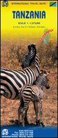
Tanzania ITMB
Tanzania at 1:1, 370, 000 on a double-sided, indexed, waterproof and tear-resistant road map from ITMB with bold altitude colouring to show the country’s topography, street plans of Dar Es Salaam, Arusha and Zanzibar Stone Town, plus notes about the country’s history and geography.The map divides the country north/south, with Dar Es Salaam and Zanzibar shown on both sides. The country’s topography is vividly presented by bold if unconventional altitude colouring in bands of 1000 feet, with peak heights shown both in feet and in metres. Additional graphics indicate wetlands/swamps and coral reef in coastal areas. National parks and game reserves are highlighted. Road network distinguishes between paved and unpaved roads and includes selected tracks. Railway lines and ferry
routes in Lake Tanganyika and Lake Malawi are included, and local airports are marked. The map also shows the country’s internal administrative boundaries with names of the provinces. Symbols highlight various places of interest, some annotated with brief descriptions. Also indicated are locations with tourist accommodation, medical facilities, fuel supplies, etc. Latitude and longitude lines are drawn at 1º intervals. Each side has a separate index. Large street plans of Dar Es Salaam, Arusha and Zanzibar Stone Town are all annotated with selected accommodation, other facilities, and places of interest. Also provided are notes on the country’s history and geography.
routes in Lake Tanganyika and Lake Malawi are included, and local airports are marked. The map also shows the country’s internal administrative boundaries with names of the provinces. Symbols highlight various places of interest, some annotated with brief descriptions. Also indicated are locations with tourist accommodation, medical facilities, fuel supplies, etc. Latitude and longitude lines are drawn at 1º intervals. Each side has a separate index. Large street plans of Dar Es Salaam, Arusha and Zanzibar Stone Town are all annotated with selected accommodation, other facilities, and places of interest. Also provided are notes on the country’s history and geography.

Product Description
Reviews/Comments
Add New
Vouchers
No voucher codes found.
Do you know a voucher code for this product or supplier? Add it to Insights for others to use.
Do you know a voucher code for this product or supplier? Add it to Insights for others to use.
 Denmark