More From Contributor

£11.99
One of the titles in a series of topographic maps covering much of north-west Africa, produced as part of the IMW* project in 1960’s. Each map covers an area spanning 6° in longitude & 4° in latitude. There is some variation in colouring & the depiction of terrain, but hill-shading, spot heights & contours are used to show the general relief. Additional graphics show features such as dunes, rock outcrops, cliffs, sand areas, escarpments, marshes, seasonal lakes & watercourses, & areas liable to flooding. Bathymetric contours are also included. Communications detail

Includes::
roads, major trails & railways, although there is some inconsistency in colouring & the extent of classification, e.g. not all maps distinguish seasonal roads. On most maps intermediate road distances are indicated on main routes. Symbols show airports, mosques, mines, oil & gas fields, lighthouses, ruins & significant isolated buildings. Administrative boundaries are marked & latitude & longitude lines are drawn at 1° intervals, with further margin ticks at 1’ intervals. The map legend is in French only on some sheets, & in English & French on others.* The International Map of the World was a project conceived in the early 20th century to compile a world map series at 1:1, 000, 000 through the efforts of participating nations. The value of the program has declined since 1970 & the IMW is no longer regarded as an active international series.

...
Archived Product
£12.99
One of the titles in a series of road maps of the administrative states of Mexico, highlighting places of interest. The maps show four different grades of roads, with intermediate driving distances on main routes, railways, local airports, ferry connections & administrative boundaries. Topographic information is limited to names of main mountain ranges, spot heights for main peaks, rivers & lakes. The maps have no geographical coordinates. Map legend is in Spanish only. On the reverse each title has a black & white version of the same map, highlighting places of interest with brief notes in Spanish only. ...
Archived Product
£13.99
Road maps of Mexico’s states from Ediciones Independencia highlighting numerous places of interest & tourist facilities, with each title also providing a large street plan of the provincial capital plus maps of other local towns, popular tourist resorts and/or archaeological sites. The state maps show the road & rail networks on a clear base, with topography indicated by rivers & areas liable to inundation, plus names of main mountain ranges & peaks (no heights). National parks & other protected areas are brightly highlighted. A range of symbols provides information for tourists: accommodation including campsites & trailer parks, historical & archaeological sites, beaches & spas, sport & leisure centres, natural curiosities, etc. The maps show latitude & longitude as margin ticks & crosshairs, mostly at 30’ or 1° intervals. Map legend

Includes::
English. Most maps have no index. Each title

Includes::
a large street plan of the provincial capital, plus plans of selected other towns. In addition to street names, the plans also show names of local districts. Plans of the state capital usually have a list of various locations, facilities and/or places on interest highlighted on it, & some include an enlargement showing the town centre in greater detail. Each title also has a table of distances, plus a table showing various facilities & places of interest in the main towns of the state.


...
Archived Product
£12.99
Tamba Kosi
- Likhu Khola region at 1:50, 000 in a series of detailed topographic maps of selected trekking areas of Nepal originally
...
Archived Product
£29.95
One of the maps in the topographic survey of Peru from the country’s national survey organization, Instituto Geográfico Nacional. Contours are at 25m intervals & colouring/symbols indicate different types of terrain & vegetation. Some of the maps may contain small blank spaces representing as yet unmapped areas. Each sheet covers 30’ latitude by 30’ longitude. The maps have a 1km UTM grid & margin ticks for latitude & longitude at intervals of 1’. Publication dates vary; most maps were published in 1960s to 1990s, with some sheets revised more recently. Map legend is in Spanish only, except in the more recent editions which also include English. ...
Archived Product
£14.95
When Indonesia`s Mount Tambora erupted in 1815, it unleashed the most destructive wave of extreme weather the world has witnessed in thousands of years. The volcano`s massive sulfate dust cloud enveloped the Earth, cooling temperatures & disrupting major weather systems for more than three years. Communities worldwide endured famine, disease, & civil unrest on a catastrophic scale. Here, Gillen D` Arcy Wood traces Tambora`s global & historical reach: how the volcano`s three-year climate change regime initiated the first worldwide cholera pandemic, expanded opium markets in China, & plunged the United States into its first economic depression. Bringing the history of this planetary emergency to life, Tambora sheds light on the fragile interdependence of climate & human societies to offer a cautionary tale about the potential tragic impacts of drastic climate change in our own century. ...
Archived Product
£3.50
Tame Bridge in 1901 in a fascinating series of reproductions of old Ordnance Survey plans in the Alan Godfrey Editions, ideal for anyone interested in the history of their neighbourhood or family. The map covers a largely rural area east of Wednesbury & north of West Bromwich. Tame Bridge is in the top left corner, Grove Vale in the bottom right corner. Features include the Tame Valley Canal, Rushall Canal, LNWR Grand Junction Line, Ray Hall & Charlemont Hall. About the Alan Godfrey Editions of the 25” OS Series: Selected towns in Great Britain & Ireland are covered by maps showing the extent of urban development in the last decades of the 19th & early 20th century. The plans have been taken from the Ordnance Survey mapping & reprinted at about 15 inches to one mile (1:4, 340). On the reverse most maps have historical notes & many also include extracts from contemporary directories. Most maps cover about one mile (1.6kms) north/south, one & a half miles (2.4kms) across; adjoining sheets can be combined to provide wider coverage.FOR MORE INFORMATION & A COMPLETE LIST OF ALL AVAILABLE TITLES PLEASE CLICK ON THE SERIES LINK. ...
Archived Product
£20.00
**`A masterpiece of evocative scientific storytelling.` BRIAN COX****` The best popular book on broad-sweep history since Guns, Germs & Steel` Peter Forbes** The extraordinary story of the species that became our allies. For hundreds of thousands of years, our ancestors depended on wild plants & animals for survival. They were hunter-gatherers, consummate foraging experts, taking the world as they found it. Then a revolution occurred
- our ancestors` interaction with other species changed. They began to tame them. The human population boomed; civilisation began. In Tamed, Alice Roberts uncovers the deep history of ten familiar species with incredible wild pasts: dogs, apples & wheat; cattle, potatoes & chickens; rice, maize & horses
- &, finally, humans. She reveals how becoming part of our world changed these animals & plants, & shows how they became our allies, essential to the survival & success of our own species. Enlightening, wide-ranging & endlessly fascinating, Tamed encompasses thousands of years of history & archaeology alongside cutting-edge genetics & anthropology. Yet it is also a deeply personal journey that changes how we see ourselves & the species on which we have left our mark.

...
Archived Product
£12.99
A powerful account of the life of Tamerlane the Great (1336-1405), the last master nomadic power, one of history`s most extreme tyrants, & the subject of Marlowe`s famous play. Marozzi travelled in the footsteps of the great Mogul Emperor of Samarkland to write this wonderful combination of history & travelogue. The name of the last great warlord conjures up images of mystery & romance: medieval warfare on desert plains; the clash of swords on snow-clad mountains; the charge of elephants across the steppes of Asia; the legendary opulence & cruelty of the illiterate, chess-playing nemesis of Asia. He ranks alongside Alexander as one of the world`s great conquerors, yet the details of his life are scarcely known in the West. He was not born to a distinguished family, nor did he find his apprenticeship easy
- at one point his mobile army consisted only of himself, his wife, seven companions & four horses
- but his dominion grew with astonishing rapidity. In the last two decades of the fourteenth century & the beginning of the fifteenth, he blazed through Asia. Cities were razed to the ground, inhabitants tortured without mercy, sometimes enemies were buried alive
- more commonly they were decapitated. On the ruins of Baghdad, Tamerlane had his princes erect a pyramid of 90, 000 heads. During his lifetime he sought to foster a personal myth, exaggerating the difficulties of his youth, laying claim to supernatural powers & a connection to Genghis Khan. This myth was maintained after his death in legend, folklore, poetry, drama & even opera, nowhere more powerfully than in Marlowe`s play
- he is now as much a literary construct as a historical figure. Justin Marozzi follows in his path & evokes his legacy in telling the tale of this fabulously cruel, magnificent & romantic warrior.


...
Archived Product
£27.99
Uzbekistan is a country of contradictions. Where legality meets torture & Islam meets a secular state, Uzbekistan is torn between its historical roots, Soviet rule, & modern consumerism. As a vital ally in the ` War on Terror`, yet retaining a deeply troubling record on human rights, even the West is uncertain about how to approach it. In this vibrant account, respected journalist Robert Rand draws on three years living & travelling in the region to carefully deconstruct the cultural allegiances & tensions that color Uzbek life. From the heritage of the country`s beloved hero, Tamerlane, to the clash of cultures in Uzbek pop music, this lively book will captivate the historian, the traveller, & anyone who wishes to understand modern life in the ex-Soviet bloc. ...
Archived Product

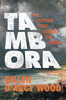
Tambopata Bird Checklist

Research has shown that the TRZ (now known as the Tambopata National Reserve) contains more bird and butterfly species than any other location of its size on Earth. Since its creation the reserve has attracted a great many ornithologists, and this list of species has been compiled on the basis of observations within an 8km radius of the Explorer`s Inn, although most are likeliy to be found in the vicinty of other lodges and in much of Amazonia.Each species in the list is accompanied by 5 columns of notes corresponding to habitats, foraging position, sociality (ie social nature of the bird when foraging, not nesting), abundance & page number where the bird can be found in A Field Guide to the Birds of Peru by Clements & Shany.Also listed are species which can be found around Puerto
Maldonado and along the Rio Tambopata.A list of references and internet resources is provided.Proceeds from the sale of this booklet go towards the Tambopata Reserve Society (TReeS) which is pressing for biodiversity conservation and sound environmental management in the rainforests of the Department of Madre de Dios.
RIP - This product is no longer available on our network. It was last seen on 25.09.2019

This page now acts as a permanent archive for this product. Add more information using the comments box below to ensure it can still be found by future generations.

Use our search facility to see if it is available from an alternative contributor.
  • Availability: Out Of Stock
  • Supplier: Stanfords
  • SKU: 9780952468769
Availability: In Stock
£6.00

Product Description

Research has shown that the TRZ (now known as the Tambopata National Reserve) contains more bird & butterfly species than any other location of its size on Earth. Since its creation the reserve has attracted a great many ornithologists, & this list of species has been compiled on the basis of observations within an 8km radius of the Explorer`s Inn, although most are likeliy to be found in the vicinty of other lodges & in much of Amazonia. Each species in the list is accompanied by 5 columns of notes corresponding to habitats, foraging position, sociality (ie social nature of the bird when foraging, not nesting), abundance & page number where the bird can be found in A Field Guide to the Birds of Peru by Clements & Shany. Also listed are species which can be found around Puerto Maldonado & along the Rio Tambopata.A list of references & internet resources is provided. Proceeds from the sale of this booklet go towards the Tambopata Reserve Society (TRee S) which is pressing for biodiversity conservation & sound environmental management in the rainforests of the Department of Madre de Dios.

Reviews/Comments

Add New

Intelligent Comparison

Oooops!
We couldn't find anything!
Perhaps this product's unique.... Or perhaps we are still looking for comparisons!
Click to bump this page and we'll hurry up.

Price History

Vouchers

No voucher codes found.
Do you know a voucher code for this product or supplier? Add it to Insights for others to use.

Facebook

Jargon Buster

Butterfly - A common garden flying insect
Earth - A planet third from the sun. Similar size to Venus but rich in water and complex life.
Size - is the measurement of how big an object is in space.

Supplier Information

Stanfords
Stanfords was established in 1853 and opened their iconic Covent Garden flagship store in 1901. They have become the top retailer of maps, travel books and accessories in the UK and arguably offer the largest selection of maps and travel books worldwide. Famous names such as Captain Robert Falcon Scott, Ranulph Fiennes and Michael Palin have purchased from Stanfords. They now have a shop in Bristol and both stores together with other venues operate a calendar of events including talks, book signings and exhibitions. As a specialist map retailer, the map selection is comprehensive and includes road maps, street maps and walking maps from worldwide destinations, as well as a selection of world atlases and wall maps. Books include travel guides and travel literature. Stanfords also stock globes, from miniatures made of blue marble to magnificent floor-standing globes. The website features a selection of interesting articles on travel topics.
Page Updated: 2023-11-12 20:15:36

Community Generated Product Tags

Oh No! The productWIKI community hasn't generated any tags for this product yet!
Menu