
 United Kingdom
 France
 Germany
 Netherlands
 Sweden
 USA
USA
 Italy
Italy
 Spain
Spain
More From Contributor


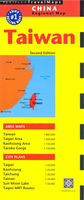
Taiwan
Taiwan on a double-side map from Periplus combining a map of the whole island with street plans of central Taipei, Taichung, Tainan and Kaohsiung, plus enlargements of popular regions and a diagram of the capital’s metro network.Taiwan itself is presented at 1:800, 000 on an overview map showing its road and rail networks and highlighing numerous places of interest. Ferry routes to the nearby islands, including the Penghu (Pescadores) Islands, are marked. The map shows Taiwan’s topography by relief shaing with names of main mountain ranges and also indicates internal administrative divisions with names of the provinces. Enlargements at more detailed scales present the Taipei area (1:200, 000) extending south to Hsinchu and Yilan; the environs of Kaohsiung (1:150, 000); the Taroko
Gorge with Hualien (1:150, 000); and Sun Moon Lake (1:50, 000).On the reverse are street plan of central areas in Taiwan’s four main cities: Taipei and Kaohsiung at 1:20, 000, plus Taichung and Tainan at 1:30, 000. All highlight various places of interest and show metro and/or railway lines. Also provided is a diagem of Taipei’s metro and a distance table for Taiwan.Map legend includes English. None of the maps or plan are indexed. On the city plans names of main streets and districts are also given in Chinese, otherwise all the place names are in Latin alphabet only.
Gorge with Hualien (1:150, 000); and Sun Moon Lake (1:50, 000).On the reverse are street plan of central areas in Taiwan’s four main cities: Taipei and Kaohsiung at 1:20, 000, plus Taichung and Tainan at 1:30, 000. All highlight various places of interest and show metro and/or railway lines. Also provided is a diagem of Taipei’s metro and a distance table for Taiwan.Map legend includes English. None of the maps or plan are indexed. On the city plans names of main streets and districts are also given in Chinese, otherwise all the place names are in Latin alphabet only.

Product Description
Reviews/Comments
Add New
Vouchers
No voucher codes found.
Do you know a voucher code for this product or supplier? Add it to Insights for others to use.
Do you know a voucher code for this product or supplier? Add it to Insights for others to use.
 Denmark