
 United Kingdom
 France
 Germany
 Netherlands
 Sweden
 USA
USA
 Italy
Italy
 Spain
Spain
More From Contributor


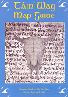
Tain Way Map/Guide
The Táin Way, a 41-km (25 miles) circular tour of the Cooley peninsula in County Louth, presented in a map/guide from EastWest Mapping, with a route map at 1:50, 000, mapping for additional local tours, plus descriptions of places of interest, etc.The route is highlighted on a detailed map at 1:50, 000 with contours at 20m intervals and altitude colouring. Symbols indicate accommodation including B&Bs, hostels and campsites, cafes and food shops, centres for traditional music and crafts, tombs and barrows, etc. Separate panels provide descriptions of places of interest along the route and in Carlingford Town (with a street plan), as well as general advice on signposting, safety, public transport; geology of the Cooley peninsula (with a small map), and local fauna and flora
(with drawings). Four separate panels with similar mapping at different scales show additional shorter tours from various points along the route, accompanied by detailed instructions. Neither the main map nor the extra panels have geographical coordinates for GPS.
(with drawings). Four separate panels with similar mapping at different scales show additional shorter tours from various points along the route, accompanied by detailed instructions. Neither the main map nor the extra panels have geographical coordinates for GPS.

Product Description
Reviews/Comments
Add New
Vouchers
No voucher codes found.
Do you know a voucher code for this product or supplier? Add it to Insights for others to use.
Do you know a voucher code for this product or supplier? Add it to Insights for others to use.
 Denmark