More From Contributor
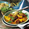
£3.50
Taff`s Well in 1875 in a fascinating series of reproductions of old Ordnance Survey plans in the Alan Godfrey Editions, ideal for anyone interested in the history of their neighbourhood or family. SThe map covers the area around & to the north of Taff`s Well, including Glan-y-llyn & Gwaclod-y-garth. Features include Taff Vale Railway & Rhymney Railway (Walnut Tree Bridge Branch) but no stations, Taffswell Ferry, River Taff, schools & chapels, Bryn-coch Colliery, Bryn-coch Brickworks, Glamorganshire Canal, Garth Hill, old quarries, etc. 1906 directories of Pentyrch & Eglwysilan are on the reverse. About the Alan Godfrey Editions of the 25” OS Series: Selected towns in Great Britain & Ireland are covered by maps showing the extent of urban development in the last decades of the 19th & early 20th century. The plans have been taken from the Ordnance Survey mapping & reprinted at about 15 inches to one mile (1:4, 340). On the reverse most maps have historical notes & many also include extracts from contemporary directories. Most maps cover about one mile (1.6kms) north/south, one & a half miles (2.4kms) across; adjoining sheets can be combined to provide wider coverage.FOR MORE INFORMATION & A COMPLETE LIST OF ALL AVAILABLE TITLES PLEASE CLICK ON THE SERIES LINK. ...
Archived Product
£10.00
Tafilalt
- Merzouga
- Erg Chebbi region in a series of GPS compatible maps at 1:160, 000 published by EWP & West Col Productions

...
Archived Product
£23.99
Map No. 10071, Tafjord, in the new topographic survey of Norway at 1:50, 000 covering the country on 195 double-sided sheets & first published by Nordeca in 2011
- 2012; fully GPS compatible, indicating waymarked footpaths, campsites, tourist huts, illuminated ski runs, etc. The maps, now published by Nordeca, the successors to Statens Kartverk & its subsequent owners the Ugland Group, are printed on light, waterproof & tear-resistant synthetic paper. Each map covers an area of 62x 45 kilometres (39 x 28 miles approx.), with a 2-km overlap between the sheets. The maps have contours at 20m intervals (10m glacier contours), plus colouring & graphics to show cultivated areas, bogs, forests, etc. In addition to all the information expected of topographic mapping at this scale the maps distinguish between waymarked & unmarked footpaths & show campsites, tourist huts (serviced/self service/no supplies), country hotels & restaurants, & illuminated ski trails. The series uses EUREF89 (WGS84) datum & the maps have a 1-km UTM grid. Map legend is in Norwegian & English. Each title comes in a sturdy protective card envelope.
...
Archived Product
£23.99
Tafjordfjella area in Norway in a series of GPS compatible recreational maps at 1:50, 000 with cartography from Norway’s topographic survey & additional tourist information. Contours lines are drawn at 20m intervals. The overprint varies from title to title, but

Includes::
local footpaths, in some cases distinguishing between easy & more difficult trails, as well as mountain huts & campsites. Many titles also indicate cycle or ski routes, other accommodation possibilities, sport & recreational facilities, including alpine skiing slopes, places of interest, etc. The maps have a UTM grid & margin ticks giving latitude & longitude. Map legend

Includes::
English. Several titles have on the reverse additional tourist information, although in most cases in Norwegian only. To see the list of Turkart maps at 1:50, 000 & links to Turkart series at 25K, 100K & Hiking Sets please click on the series link above.


...
Archived Product
£4.99
Bright, bold & instantly recognisable, these ultra slim luggage tags make any case easy to spot. Fun & colourful, they stand out on busy luggage carousels yet conceal personal details for security. Supplied in a set of two, these luggage tags attach easily to any suitcase or bag via a flexible clear plastic loop. Tag has a sleeve on the back side that contains a piece of paper inside for writing contact information. (Or insert your own paper, such as a business card, into the sleeve.) Available in multiple colours. ...
Archived Product
£12.95
Taga
- Serra Cavallera
- Sant Amand in an extensive & very popular series of walking maps from Editorial Alpina covering the

...
Archived Product
£14.99
Taga – Serra Cavalara area in the eastern part of the Spanish Pyrenees on a contoured & GPS compatible map at 1:25, 000 from Editorial Alpina, highlighting local & long-distance hiking trails, accommodation facilities, etc. The map has contour lines at 10m intervals enhanced by relief shading, plus colouring to indicate different types of terrain or vegetation. An overprint highlights local hiking trails, including PR & GR routes, the Ultatrail Trepitja Garrotxa, plus the Ruta del Ferro Cycleway. Symbols indicate various types of tourist accommodation (hotels, refuges, campsites, etc), tourist information & mountain biking centres, etc. Local roads show locations of petrol stations. The map has a 1-km UTM grid. Map legend

Includes::
English. The map is accompanied by a 36-page booklet, in Catalan only, with descriptions of several walks & contact details for local tourist accommodation facilities. To see the list of other titles in this series please click on the series link.

...
Archived Product
£9.99
Tagine: Spicy Stews from Morocco cookery book provides an excellent introduction to tagines, a dish which, like curry before it, is now rapidly becoming part of Britain’s everyday cuisine. Published in a handy-size format with one dish per page illustrated with a colour photo, the books offers a selection of meat, fish & vegetarian tagines, as well as recipes for essentials like the harissa paste or accompaniments such as couscous or salads. ...
Archived Product
£9.99
Tahiti & the Society Islands at 1:100, 000 on an indexed map from ITMB with a street plan of central Papeete. The map presents Tahiti & Moorea together, with other islands on separate panels: Bora Bora, Tahaa with Raiatea, Hu ahine, Tupai, Maiao & Maupiti. Topography of each island is shown by bright altitude colouring with contours at 50m intervals & peak heights. In coastal waters coral reefs are marked. The maps show roads & highlight tourist accommodation, beaches, diving/scubadiving & other watersport sites, harbours/marina, & various places of interest. Each panel has latitude & longitude lines at 5’ intervals & the index is arranged separately for each isl&. The street plan of Papeete is also annotated with selected accommodation, services & places of interest. ...
Archived Product
£12.79
Tahiti & French Polynesia in the Countries & Regions series from Lonely Planet, market-leading comprehensive guides aimed at independent travellers & serving a large range of international destinations. Frank & informal in style, the guides explore an extensive range of sights, activities, accommodation, restaurants & nightlife & are designed for practical use while travelling on the road. Written & researched by a team of experts, each book is independent in its recommendations & suggestions, often offering individual takes on individual destinations. Widely recognised for their reliability, each Lonely Planet country & region guide has the same layout. Introductory sections profile the destination with individual chapters on particular highlights, getting started, (including when to go) itineraries, history, culture, arts, food & drink & the environment. Each guide is organised geographically by region, with individual sections detailing an extensive range of sights, places of interest, attractions, restaurants, nightlife, accommodation & any local activities. The guides have detailed explanations of historical context where relevant. There is also practical guidance on ...
Archived Product

Tag Me Yellow

You know how it goes, standing at the luggage carousel you are itching to get to the hotel, dump your bags and kick back by the pool with a Pina Colada. The last thing you want is to be frantically scanning for your suitcase and have an argument with the guy who has the same bag! Get yourself a Tag Me Luggage Tag and pop it on your baggage.
RIP - This product is no longer available on our network. It was last seen on 18.11.2022

This page now acts as a permanent archive for this product. Add more information using the comments box below to ensure it can still be found by future generations.

Use our search facility to see if it is available from an alternative contributor.
  • External links may include paid for promotion
  • Availability: Out Of Stock
  • Supplier: Stanfords
  • SKU: 7290015168106
Availability: In Stock
£4.95

Product Description

You know how it goes, standing at the luggage carousel you are itching to get to the hotel, dump your bags & kick back by the pool with a Pina Colada. The last thing you want is to be frantically scanning for your suitcase & have an argument with the guy who has the same bag! Get yourself a Tag Me Luggage Tag & pop it on your baggage.

Reviews/Comments

Add New

Intelligent Comparison

Oooops!
We couldn't find anything!
Perhaps this product's unique.... Or perhaps we are still looking for comparisons!
Click to bump this page and we'll hurry up.

Price History

Vouchers

No voucher codes found.
Do you know a voucher code for this product or supplier? Add it to Insights for others to use.

Facebook

Jargon Buster

Hotel - An establishment which provides lodging for a fee
Yellow - A primary colour. The sun is often described as yellow

Supplier Information

Stanfords
Stanfords was established in 1853 and opened their iconic Covent Garden flagship store in 1901. They have become the top retailer of maps, travel books and accessories in the UK and arguably offer the largest selection of maps and travel books worldwide. Famous names such as Captain Robert Falcon Scott, Ranulph Fiennes and Michael Palin have purchased from Stanfords. They now have a shop in Bristol and both stores together with other venues operate a calendar of events including talks, book signings and exhibitions. As a specialist map retailer, the map selection is comprehensive and includes road maps, street maps and walking maps from worldwide destinations, as well as a selection of world atlases and wall maps. Books include travel guides and travel literature. Stanfords also stock globes, from miniatures made of blue marble to magnificent floor-standing globes. The website features a selection of interesting articles on travel topics.
Page Updated: 2023-11-12 20:15:36

Community Generated Product Tags

Oh No! The productWIKI community hasn't generated any tags for this product yet!
Menu