More From Contributor
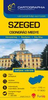
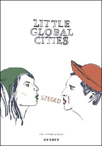
£5.99
Szczecin with its outer suburbs on an indexed, double-sided street plan at 1:22, 000 from Express Map with an enlargement showing the town centre in greater detail, plus a diagram of the city’s night bus lines. Coverage extends north along the Oder to include Police, & south-east beyond the S3 motorway. Separate panels provide a street plan of Swinoujscie, plus a road map of Szczecin’s environs including road access from Germany. Express Map street plans provide coverage of cities within their administrative boundary, spread across the two sides of the map. Bus & tram routes are shown with stops & line numbers. For drivers, main traffic arteries are highlighted, one way streets are marked & the plans also show traffic lights, petrol stations, car parks & restricted entry streets or zones. Streets are annotated with selected house numbers for easier identification of addresses. Names of suburbs & of larger housing estates are clearly marked. Symbols highlight various facilities & places of interest, including museums & other cultural institutions & historical sites, 24-hrs pharmacies, campsites & youth hostels, etc. Where more than one town is covered, each has a separate index. Map legend

Includes::
English.

...
Archived Product
£12.99
Szczecin & its environs in a series covering Poland’s best hiking areas on waterproof & tear-resistant, laminated maps, specially designed to withstand repeated re-folding & even the worst weather conditions. Each map is double-sided & has clear, well presented cartography with a contoured base (20m interval) &, where appropriate, relief shading, graphic relief in rocky areas, & spot heights. Extensive overprint highlights waymarked hiking trails & on many titles also cycling, skiing or canoeing routes. Symbols show accommodation facilities including hotels, campsites, youth hostels, mountain refuges, etc., restaurants & bars in more remote areas, local bus stops, petrol stations, medical facilities, etc. Many titles include street plans of holiday resorts. The maps have either a UTM or latitude/longitude grid. * Map legend

Includes::
English.** In this title:* the environs of Szczecin including Zalew Szczecinski (the Bay of the Oder), extending south to Gryfino, east to Stargard Szczecinski & west across the German border to Eggesin. Overprint also shows cycling routes. The map highlights examples of local peasant architecture & marks historical battle sites.

...
Archived Product
£6.99
Szczecin & environs in a series of recreational maps from Poland’s Army Cartographic Service. The maps use as their base the military topographic survey, with contours at intervals varying from 5m to 20m according to the terrain & contoured depths shown on lakes. An overprint highlights waymarked hiking, cycling & canoeing routes. A wide range of symbols indicate various sport & recreational facilities, places of interest, special natural features, etc. The maps have latitude & longitude grid at 1’ intervals.* Map legend

Includes::
English.* On the reverse there are useful addresses & description, in Polish only.

...
Archived Product
£17.50
Cycling atlases from Verlag Esterbauer have a map legend which

Includes::
English &, although ALL THE TEXT

...
Archived Product
£15.99
Szczecin on a street plan showing both current & old, pre-WWII German street & district names, with an enlargement for the town centre highlighting a sightseeing route & a double street index. The plan extends from the Oder to the Mierzyn district, with Dabie shown as an inset at 1:20, 000. Tram routes are shown with stops & line numbers. Main public buildings are identified & symbols mark locations of post offices, police stations, campsites, etc. The town centre is shown in greater detail at 1:10, 000, with a recommended sightseeing route & various buildings cross-referenced to a description of the city & its monuments, in German only. All three plans show both current & old pre-WWII German names of streets, districts, etc., & indicate no longer existing streets. On the reverse the index has two lists: current & old names, cross-referenced. ...
Archived Product
£4.99
Szeged in a series of street plans of Hungary’s main towns from Cartographia in Budapest. The plans cover the whole town with its outer suburbs &, where appropriate, have an enlargement for the central area. All the plans have a street index. Map legend varies; in plans of larger towns or popular tourist destinations it usually

Includes::
English. Many plans also include additional

Features:
insets with plans of larger satellite developments or villages, lists of sights and/or various municipal offices & facilities, etc. Some titles include on the reverse a road map of the town’s environs or the administrative province.* In this title:* English map legend for the plan, an enlargement for the city centre at 1:10, 000, a plan of Algyo, plus a road map of the Csongrád province at 1:200, 000 (map legend in Hungarian only).


...
Archived Product
£6.95
Szekszard Hills & Gemenc Forestin a series of contoured hiking & recreational maps from the Budapest based Cartographia, with hiking routes & other tourist information, including in many titles street plans, cycling trails, etc. The maps have contours at 10m intervals with relief shading & spot heights, plus colouring and/or graphics to indicate different types of vegetation. An overprint highlights local hiking paths, with cycling routes also included in some titles. Symbols mark various places of interest, sport & recreational facilities, including campsites & other tourist accommodation, locations of petrol stations, etc. The maps show 1km lines of the country ...
Archived Product
£12.99
Cserhátin a series of contoured hiking & recreational maps from the Budapest based Cartographia, with hiking routes & other tourist information, including in many titles street plans, cycling trails, etc. The maps have contours at 10m intervals with relief shading & spot heights, plus colouring and/or graphics to indicate different types of vegetation. An overprint highlights local hiking paths, with cycling routes also included in some titles. Symbols mark various places of interest, sport & recreational facilities, including campsites & other tourist accommodation, locations of petrol stations, etc. The maps show 1km lines of the country’s national grid. Map legends are in Hungarian & German only. On the reverse many titles include street plans of holiday centres & further information on the area, in Hungarian only. ...
Archived Product
£4.99
Szolnok in a series of street plans of Hungary’s main towns from Cartographia in Budapest. The plans cover the whole town with its outer suburbs &, where appropriate, have an enlargement for the central area. All the plans have a street index. Map legend varies; in plans of larger towns or popular tourist destinations it usually

Includes::
English. Many plans also include additional

Features:
insets with plans of larger satellite developments or villages, lists of sights and/or various municipal offices & facilities, etc. Some titles include on the reverse a road map of the town’s environs or the administrative province..


...
Archived Product
£6.50
Topographic coverage of the Balearic Islands at 1:25, 000 published by the Instituto Geográfico Nacional – Centro Nacional de Información Geografica, the country’s civilian survey organization. The maps have contours at 10m intervals & colouring and/or graphics to show different types of vegetation or land use. Boundaries of national parks & other protected areas are marked. In addition to all the usual information shown on topographic mapping at this scale: detailed presentation of the road & rail networks, rural tracks & paths, etc, the maps also show campsites. The maps have a 1-km UTM grid, plus margin ticks for latitude & longitude at 1` intervals. The majority of the titles have been published since late 1990s. Map legend is in Spanish only. COVERAGE: each 25K map covers one quarter of the corresponding 1:50, 000 map, with the numbering system: I = NW quarter, II = NE quarter, III = SW quarter, & IV = SE quarter. To see other titles in this ser 25K Spain CNIG Topographic Survey Map No. ies please click on the series link. ...
Archived Product

Szeged

Szeged in south-eastern Hungary in a series of guides to “Little Global Cities” from Kerber Verlag. All the text is in English, German and Hungarian. Little Global Cities series is designed to provide informative and interesting guidebooks to smaller cities of Eastern Europe and the Balkans, aimed at tourist who like to venture off the beaten track and explore old and new city quarters, meet the locals, etc. All the text is presented in three languages: English, German plus the language of the relevant country. The guides describe not only each city’s main sites but also more out of the way corners, many chosen by the locals to provide a better idea of the flavour and the history of their town. The guides include recommendations of restaurants and cafes, as well as ideas for
exploring the surrounding environs. Each title includes a pull out street plan cross-referenced to the guide.
RIP - This product is no longer available on our network. It was last seen on 25.09.2019

This page now acts as a permanent archive for this product. Add more information using the comments box below to ensure it can still be found by future generations.

Use our search facility to see if it is available from an alternative contributor.
  • External links may include paid for promotion
  • Availability: Out Of Stock
  • Supplier: Stanfords
  • SKU: 9783866786134
Availability: In Stock
£17.95

Product Description

Szeged in south-eastern Hungary in a series of guides to “ Little Global Cities” from Kerber Verlag. All the text is in English, German & Hungarian. Little Global Cities series is designed to provide informative & interesting guidebooks to smaller cities of Eastern Europe & the Balkans, aimed at tourist who like to venture off the beaten track & explore old & new city quarters, meet the locals, etc. All the text is presented in three languages: English, German plus the language of the relevant country. The guides describe not only each city’s main sites but also more out of the way corners, many chosen by the locals to provide a better idea of the flavour & the history of their town. The guides include recommendations of restaurants & cafes, as well as ideas for exploring the surrounding environs. Each title

Includes::
a pull out street plan cross-referenced to the guide.

Reviews/Comments

Add New

Intelligent Comparison

Oooops!
We couldn't find anything!
Perhaps this product's unique.... Or perhaps we are still looking for comparisons!
Click to bump this page and we'll hurry up.

Price History

Vouchers

No voucher codes found.
Do you know a voucher code for this product or supplier? Add it to Insights for others to use.

Facebook

Jargon Buster

History - Anything that happens in the past. An acedemic subject.
Language - the method of communication used in different areas. Humans and computers have many different languages.
Flavour - The taste of a food product.
Language - The way humans communicate either written and spoken.

Supplier Information

Stanfords
Stanfords was established in 1853 and opened their iconic Covent Garden flagship store in 1901. They have become the top retailer of maps, travel books and accessories in the UK and arguably offer the largest selection of maps and travel books worldwide. Famous names such as Captain Robert Falcon Scott, Ranulph Fiennes and Michael Palin have purchased from Stanfords. They now have a shop in Bristol and both stores together with other venues operate a calendar of events including talks, book signings and exhibitions. As a specialist map retailer, the map selection is comprehensive and includes road maps, street maps and walking maps from worldwide destinations, as well as a selection of world atlases and wall maps. Books include travel guides and travel literature. Stanfords also stock globes, from miniatures made of blue marble to magnificent floor-standing globes. The website features a selection of interesting articles on travel topics.
Page Updated: 2023-11-12 20:15:36

Community Generated Product Tags

Oh No! The productWIKI community hasn't generated any tags for this product yet!
Menu