More From Contributor

£8.99
Since the upsurge of the Arab Spring in 2011, the Syrian civil war has claimed in excess of 200, 000 lives, with an estimated 8 million Syrians, more than a third of the country`s population, forced to flee their homes. Militant Sunni groups, such as ISIS, have taken control of large swathes of the nation. The impact of this catastrophe is now being felt on the streets of Europe & the United States. Veteran Middle East expert Charles Glass combines reportage, analysis, & history to provide an accessible overview of the origins & permutations defining the conflict. He also gives a powerful argument for why the West has failed to get to grips with the consequences of the crisis. ...
Archived Product
£12.99
Syria in Marshall Cavendish's Culture Shock! Series; comprising a range of guides that inform visitors of the finer points & details relating to social etiquette, traditions & customs; bringing visitors to a sensitive yet substantial understanding of the country or city in question. The series targets those who are planning long stays in the destination or extended periods of residence. The guides are written by authors who have experienced the joys & pitfalls of cultural adaptation, & so are ideally placed to provide informative & relevant advice. Each title contains insights into local culture & traditions, guidance on adapting to the local environment, linguistic help & lots of general advice about local culture & idiosyncrasies to help prepare readers for their visit. Each title is structured similarly, beginning with the first impressions a visitor might expect to have. The guides aim to help readers understand the local culture through first appreciating the motivations, beliefs & attitudes of the local people. Practical advice on settling in is provided, with focused sections on accommodation, utilities, health, education & telecommunications. There is also extensive information on the destination ...
Archived Product
£9.99
Syria at 1:750, 000 on an indexed map from Gizi Map, with excellent presentation of the country’s topography, road infrastructure & oil/gas pipelines, enlargements for the environs of Damascus & Aleppo, street plans of these two cities
- each with a more detailed plan of its Old City district, plus a plan of the archaeological site at Palmyra. Coverage

Includes::
Lebanon & the border areas of the neighbouring countries, extending south to Jerusalem & Amman. The map, with the bold altitude colouring characteristic of Gizi Maps plus numerous spot heights & graphics for swamps salt flats, deserts, etc, provides an excellent picture of the country’s topography. Road network

Includes::
local tracks & desert routes. Railway lines are included, local airports are marked, & the map also shows oil or gas wells & pipelines. Symbols highlight World Heritage sites, interesting natural sites, etc. Names of Syria’s provinces & larger cities are also shown in the Arabic alphabet. Latitude & longitude lines are drawn at 30’ intervals. The index is on the reverse. Multilingual map legend

Includes::
English & Arabic. Enlargements at 1:250, 000 present in greater detail & clarity the environs of Damascus & Aleppo. Both cities have street plans, each with an enlargement for the historic Old City area, highlighting important administrative, religious, cultural, etc, buildings, selected hotels, car parks, etc. Also provided is a plan of the archaeological site at Palmyra. The map, also available as a wall map, was published in 2013.


...
Archived Product
£15.99
Syria Handbook in the Handbooks series from Footprint; comprehensive & leading guides designed & written for independent travellers who enjoy exploring off the beaten track. Footprint guides have an established reputation, built up since 1921, for catering for more adventurous & individual travellers. An unrestrictive editorial style also gives authors the freedom to capture & explore local cultures, sights & areas that are often not covered in other guides. Widely recognised for their reliability & independent writing style, Footprint guides all have the same layout. Introductory sections introduce the reader to the destination, with chapters on planning on your trip & essentials, including practical information & guidance on subjects such as when & where to go, itineraries, sport & activities, arts, getting there & around, eating & drinks, sleeping & a dedicated section on the anticipated carbon footprint involved in travelling to the destination. Each guide is organised geographically by region or country, with individual sections having a particular focus on an extensive range of sights & places of interest. Further, there are also details of accommodation, nightlife, restaurants & any notable local activities. Information boxes throughout the text give readers an insight into local customs, stories & sights of particular interest.A ...
Archived Product
£15.99
This ambitious new Bradt guide aims to promote a responsible, non-intrusive kind of tourism by offering visitors more than mere descriptions of sites, hotels & restaurants, stimulating a genuine interest & understanding of the people & their role in modern day Syria. The country possesses some of the most impressive historical sites in the Mediterranean. Damascus & the surrounding area are covered in detail with the Roman caravan city of Palmyra & the Crusader castle of Crac des Chevaliers being just two of the attractions featured in the guide. ...
Archived Product
£10.99
Syria`s descent into civil war has already claimed an estimated 200, 000 lives while more than nine million people have fled their homes. This is now the greatest humanitarian & political crisis of the twenty-first century. In this timely account, John Mc Hugo charts the history of Syria from the First World War to the present & considers why Syria`s foundations as a nation have proved so fragile. He examines the country`s thwarted attempts at independence under French rule before turning to more recent events: religious & sectarian tensions that have riven Syria, the pressures of international conflicts, two generations of rule by the Assads & the rise of ISIS. As the conflict in Syria rages on, Mc Hugo provides a rare & authoritative guide to a complex nation that demands our attention. ...
Archived Product
£6.99
Syros in the Cyclades on light, a waterproof & tear-resistant, contoured & GPS compatible map at 1:20, 000 from Anavasi for exploring the island on foot or by car. On the reverse is a street plan of Ermoupoli / Hermoupolis showing various facilities & places of interest, plus contact details for various accommodation options. Landscape of the island is vividly shown by contours at 10m with altitude colouring, hill shading & spot heights. The map indicates dirt roads in poor condition & difficult tracks, with distances marked on many local routes, plus locations of petrol stations. Country paths distinguish between wide & well defined or narrow and/or poorly defined routes. Recommended hiking trails indicate their approximate duration. Symbols show campsites & places of interest including beaches, archaeological sites, etc. All place names are in both Greek & Latin alphabets. The map has a 1km UTM grid plus latitude/longitude margin ticks & crosshairs at 1’. The whole of the reverse side is taken by a street plan of Ermoupoli / Hermoupolis. Names of larger streets are in both Greek & Latin alphabets. The plan is accompanied by contact details for hotels or appartments across the whole isl&. Map legend & the text include English. To see which other Greek islands are covered by maps from Anavasi, please click on the series link. ...
Archived Product
£9.99
Syros at 1:20, 000 on a contoured, GPS compatible hiking map published by Terrain Cartography group together with Skai Maps, & printed on light, waterproof & tear-resistant Polyart plastic paper, with extensive tourist information. Topography is very well presented by contours, enhanced by spot heights, subtle relief shading & additional altitude colouring. Contour interval, unless indicated below to the contrary, is 20m. National parks & other protected areas are marked. All place names are shown in both Greek & Latin alphabet. The maps have a UTM grid, plus latitude & longitude margin ticks. Hiking trails are graded between main routes & narrow trails. A wide range of symbols indicate various places of interest & recreational facilities, with main sights clearly highlighted. Most titles distinguish between sandy & pebble beaches; some also indicate beaches with natural shade and/or the type of sea bed. Road network is very clearly graded according to width & the type of surface, distinguishing between good & rough dirt roads. Distances are marked on most small local roads, as well as locations of petrol stations and/or tyre repair workshops. Scenic routes are highlighted. Each map also shows which ports are served by ferry services. Many titles include a street plan of the island’s main town, with colouring clearly showing various tourist facilities. The reverse side of each title is covered by general information about the isl&, illustrated with colour photos. Many titles also include brief descriptions of recommended hiking trails.* Map legend & all the text include English.** In this title:* descriptions of 12 selected hiking trails. ...
Archived Product
£17.99
The 1:50, 000 topographic map gives a more general picture of the ground features than a basic map. It shows settlements, houses, roads, cultivated areas, waterways, cutting areas, mires, rock exposures, & relief. One map sheet covers an area of 30 x 40 km & one centimetre corresponds to 500 metres on the ground. The 1:50, 000 topographic map is also an ideal complement to nautical charts as it provides useful information about the land areas adjacent to waterways. For example, all Finnish sea areas are covered by 1:50, 000 topographic map sheets. ...
Archived Product
£16.99
Sverigeserien is an outdoor map series consisting of 116 sheets with coverage of southern & central Sweden & the northern coastline. The map is suitable for outdoor activities such as hiking, excursions, trail running, hunting, fishing, riding, cycling, mountain biking, paddling, skating & much more. Every sheet covers an area of 45x 68km. These topographical maps in scale 1:50 000 contain all the information needed for outdoor activities: Terrain information, hiking trails, illuminated tracks, camping, shelters, golf courses, leisure baths, historical remains, roads in different categories, railway lines & much more. Easy to read topography with contour lines, vertical interval 5 m. Sverigeserien is a high-quality map series & is durable for frequent use! Updated content with map data from Lantmäteriet (National Land Survey of Sweden) & printed on Polyart which is water & tear resistant. This means that the map can be folded repeatedly without breaking & can withstand the challenging weather in Sweden during both winter & summer. Legend is in Swedish, English & German. ...
Archived Product

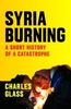
Syria, The Fall Of The House Of Assad

When Syrian President Bashar al-Assad came to power upon his father's death in 2000, many in and outside Syria held high hopes that the popular young doctor would bring long-awaited reform, that he would be a new kind of Middle East leader capable of guiding his country toward genuine democracy. David Lesch was one of those who saw this promise in Assad. A widely respected Middle East scholar and consultant, Lesch came to know the president better than anyone in the West, in part through a remarkable series of meetings with Assad between 2004 and 2009. Yet for Lesch, like millions of others, Assad was destined to disappoint. In this timely book, the author explores Assad's failed leadership, his transformation from bearer of hope to reactionary tyrant, and his regime's violent
response to the uprising of his people in the wake of the Arab Spring. Lesch charts Assad's turn toward repression and the inexorable steps toward the violence of 2011 and 2012. The book recounts the causes of the Syrian uprising, the regime's tactics to remain in power, the responses of other nations to the bloodshed, and the determined efforts of regime opponents.In a thoughtful conclusion, the author suggests scenarios that could unfold in Syria's uncertain future.
RIP - This product is no longer available on our network. It was last seen on 25.09.2019

This page now acts as a permanent archive for this product. Add more information using the comments box below to ensure it can still be found by future generations.

Use our search facility to see if it is available from an alternative contributor.
  • External links may include paid for promotion
  • Availability: Out Of Stock
  • Supplier: Stanfords
  • SKU: 9780300186512
Availability: In Stock
£18.99

Product Description

When Syrian President Bashar al-Assad came to power upon his father's death in 2000, many in & outside Syria held high hopes that the popular young doctor would bring long-awaited reform, that he would be a new kind of Middle East leader capable of guiding his country toward genuine democracy. David Lesch was one of those who saw this promise in Assad. A widely respected Middle East scholar & consultant, Lesch came to know the president better than anyone in the West, in part through a remarkable series of meetings with Assad between 2004 & 2009. Yet for Lesch, like millions of others, Assad was destined to disappoint. In this timely book, the author explores Assad's failed leadership, his transformation from bearer of hope to reactionary tyrant, & his regime's violent response to the uprising of his people in the wake of the Arab Spring. Lesch charts Assad's turn toward repression & the inexorable steps toward the violence of 2011 & 2012. The book recounts the causes of the Syrian uprising, the regime's tactics to remain in power, the responses of other nations to the bloodshed, & the determined efforts of regime opponents. In a thoughtful conclusion, the author suggests scenarios that could unfold in Syria's uncertain future.

Reviews/Comments

Add New

Intelligent Comparison

Oooops!
We couldn't find anything!
Perhaps this product's unique.... Or perhaps we are still looking for comparisons!
Click to bump this page and we'll hurry up.

Price History

Vouchers

No voucher codes found.
Do you know a voucher code for this product or supplier? Add it to Insights for others to use.

Facebook

Jargon Buster

Genuine - A product that is "real", from the manufactuer, not a fake.
Thoughtful - When someone is thinking and absorbed in what they are thinking
Popular - Something that is admired and liked by many people.
Disappoint - When expectations are not met.

Supplier Information

Stanfords
Stanfords was established in 1853 and opened their iconic Covent Garden flagship store in 1901. They have become the top retailer of maps, travel books and accessories in the UK and arguably offer the largest selection of maps and travel books worldwide. Famous names such as Captain Robert Falcon Scott, Ranulph Fiennes and Michael Palin have purchased from Stanfords. They now have a shop in Bristol and both stores together with other venues operate a calendar of events including talks, book signings and exhibitions. As a specialist map retailer, the map selection is comprehensive and includes road maps, street maps and walking maps from worldwide destinations, as well as a selection of world atlases and wall maps. Books include travel guides and travel literature. Stanfords also stock globes, from miniatures made of blue marble to magnificent floor-standing globes. The website features a selection of interesting articles on travel topics.
Page Updated: 2023-11-12 20:15:36

Community Generated Product Tags

Oh No! The productWIKI community hasn't generated any tags for this product yet!
Menu