More From Contributor
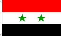
£159.00
For V.2 owners wanting to upgrade, the V.4 Syn Scan TM hand control

Includes::
new features such as: Firmware-updateability

...
Archived Product
£7.99
Syracuse in New York State on an indexed street plan from Rand Mc Nally in their extensive range of maps covering cities in the United States. Communities covered by this map include Baldwinsville, Camillus, East Syracuse, Fayetteville, Liverpool, Manlius, Marcellus, Minoa, North Syracuse & Solvay. Rand Mc Nally street plans provide coverage of cities with their outer suburbs, clearly indicating main traffic arteries: highways (distinguishing between free & toll access), plus primary & secondary routes. Road numbers and/or names are clearly displayed & exit numbers are indicated. Locations of service & rest areas are marked & one way streets are shown. Longer streets are annotated with block numbers for easier identification of addresses. The maps show railway, bus &, where appropriate, metro stations. A range of symbols indicate various places of interest including cultural & academic institutions, various municipal facilities, golf courses, etc. The plans have extensive street indexes, supplemented by lists of points of interest, parks & recreational areas, shopping malls, stations, schools, etc. ...
Archived Product
£20.00
Dubbed `the greatest Greek city & the most beautiful of them all` by Cicero, Syracuse also boasts the richest history of anywhere in Sicily. ” Syracuse, City of Legends”
- the first modern historical guide to the city
- explores Syracuse`s place within the island & the wider Mediterranean & reveals why it continues to captivate visitors today, more than two & a half millennia after its foundation. Over its long & colorful life, Syracuse has been home to many creative figures, including Archimedes, the greatest mathematician of the ancient world, as well as host to Sappho, Plato, Scipio Africanus, conqueror of Hannibal, & Caravaggio, who have all contributed to the rich history & atmosphere of this beguiling & distinctive Sicilian city. Generously illustrated, ” Syracuse, City of Legends” also offers detailed descriptions of the principal monuments from each period in the city`s life, explaining their physical location as well as their historical context. This vivid & engaging history weaves together the history, architecture & archeology of Syracuse & will be an invaluable companion for anyone visiting the city as well as a compelling introduction to its ancient & modern history.

...
Archived Product
£6.50
Syracuse in New York State on an indexed street plan from Rand Mc Nally in their extensive range of maps covering cities in the United States. Communities covered by this map include Baldwinsville, Camillus, East Syracuse, Fayetteville, Liverpool, Manlius, Marcellus, Minoa, North Syracuse & Solvay. Rand Mc Nally street plans provide coverage of cities with their outer suburbs, clearly indicating main traffic arteries: highways (distinguishing between free & toll access), plus primary & secondary routes. Road numbers and/or names are clearly displayed & exit numbers are indicated. Locations of service & rest areas are marked & one way streets are shown. Longer streets are annotated with block numbers for easier identification of addresses. The maps show railway, bus &, where appropriate, metro stations. A range of symbols indicate various places of interest including cultural & academic institutions, various municipal facilities, golf courses, etc. The plans have extensive street indexes, supplemented by lists of points of interest, parks & recreational areas, shopping malls, stations, schools, etc. ...
Archived Product
£11.99
Syria & Lebanon in the Countries & Regions series from Lonely Planet, market-leading comprehensive guides aimed at independent travellers & serving a large range of international destinations. Frank & informal in style, the guides explore an extensive range of sights, activities, accommodation, restaurants & nightlife & are designed for practical use while travelling on the road. Written & researched by a team of experts, each book is independent in its recommendations & suggestions, often offering individual takes on individual destinations. Widely recognised for their reliability, each Lonely Planet country & region guide has the same layout. Introductory sections profile the destination with individual chapters on particular highlights, getting started, (including when to go) itineraries, history, culture, arts, food & drink & the environment. Each guide is organised geographically by region, with individual sections detailing an extensive range of sights, places of interest, attractions, restaurants, nightlife, accommodation & any local activities. The guides have detailed explanations of historical context where relevant. There is also practical guidance on ...
Archived Product
£6.95
Syria in the Culture Smart range of pocket-sized guide books; providing detailed information on local customs, culture, etiquette & manners & ensuring that visitors are prepared for a diverse range of social environments. The series covers an extensive number of countries worldwide & are designed both for those working & living abroad, as well as for visitors who do not want to offend, either intentionally or inadvertently. Their aim is to prevent readers from making embarrassing mistakes & feel confident in unfamiliar situations, while preparing them before arrival on what to expect & how to behave. Each guide is arranged thematically, with dedicated individual chapters on land & people, values & attitudes, customs & traditions, making friends, people at home, ...
Archived Product
£8.99
Syria & Lebanon on an indexed road map with large insets with street plans of Damascus, Aleppo & Beirut, a plan of the archaeological remains at Palmyra, plus an administrative map of both countries. Road & rail networks are presented on a base with plenty of topographic information: sandy & rocky deserts, lava fields, salt pans, seasonal rivers, names of mountain ranges & valleys, etc. Many cross-desert tracks are included. Driving distances are marked on main routes & border crossings to the neighbouring countries are shown, as well as internal administrative boundaries, with a separate inset showing administrative provinces with their names. Both countries’ main historical sites are highlighted. Golan Heights are shown with pre-1967 boundary & both the ceasefire line & the demilitarized zone are marked. The map has latitude & longitude lines at intervals of 1° & an index on the reverse side. Map legend

Includes::
English. Insets with street plans of Damascus, Aleppo & Beirut cover more than just the very central part of each city & indicate locations of selected hotels. Also included is a plan of the archaeological site at Palmyra.

...
Archived Product
£10.50
Indexed, waterproof & tear-resistant road map of Syria & Lebanon with topographic & tourist information & plans of central Damascus, Aleppo & the archaeological site at Palmyra. The map, published by Reise Know-How as part of their highly acclaimed World Mapping Project is double-sided to provide the best balance between a good scale & a convenient size sheet. Coverage extends south to include Amman & Jerusalem. Names of main towns are also shown in Arabic, with all other place names only in Latin alphabet. Clear topographic base has altitude colouring with contours, spot heights, names of mountain ranges. Seasonal rivers & lakes, springs & hot springs are marked. Road network

Includes::
seasonal local tracks, gives driving distances on main roads & shows locations of border crossings. Railway lines, local airfields & oil or gas pipelines are also marked. Internal administrative boundaries are shown with names of the provinces. National parks & protected areas are marked & symbols highlight various places of interest, including UNESCO world heritage sites, archaeological remains, mosques & churches, castles, etc. Campsites & locations with hotel accommodations are indicated. The map has a grid with latitude & longitude at intervals of 30’, & an extensive index of localities. Map legend

Includes::
English. Street plans of central Damascus, with an enlargement for the Old Town, & Aleppo highlight numerous places of interest. Also included is a plan of the Roman remains at Palmyra.PLEASE NOTE: In the Golan Heights the map shows the pre-1967 border as the current boundary between Syria & Israel. Although the two demarcation lines with the UNDOF zone are marked, there is no indication on the map that the area west of the zone is currently under the Israeli control. *” World Mapping Project”* is an extensive series of maps at varying scales, aiming to provide coverage of countries & regions worldwide using clear, well presented cartography with both topographic & tourist information.


...
Archived Product
£12.99
Syria: Through Writers` Eyes is a carefully chosen selection of literary extracts that capture the allure, culture & history of Syria. The historical wealth of Syria is triumphantly visible & diverse. It is one of the best-kept secrets of the passionate Mediterranean traveller. That it is also a remarkably hospitable country, where the way of life is still intimately engaged with its own history, only serves to increase the pleasure. For centuries, visitors have responded to the country with fascination. Here you will eavesdrop on William Dalrymple talking to hermits, hear Robin Fedden on Crusader Castles, follow T E Lawrence through Aleppo as well as reading the thoughts of Edward Gibbon, Hester Stanhope & Gertrude Bell amongst the ruins of Palmyra. Poet, travel-writer & antiquarian book-dealer Marius Kociejowski has poured his deep love, experience & absorption with Syria into this wide-ranging but exquisitely discriminating collection. ...
Archived Product
£8.99
Since the upsurge of the Arab Spring in 2011, the Syrian civil war has claimed in excess of 200, 000 lives, with an estimated 8 million Syrians, more than a third of the country`s population, forced to flee their homes. Militant Sunni groups, such as ISIS, have taken control of large swathes of the nation. The impact of this catastrophe is now being felt on the streets of Europe & the United States. Veteran Middle East expert Charles Glass combines reportage, analysis, & history to provide an accessible overview of the origins & permutations defining the conflict. He also gives a powerful argument for why the West has failed to get to grips with the consequences of the crisis. ...
Archived Product

Syria (Flag)

Flags are a great way to show some national pride, pay homage to a fondly remembered visit abroad, celebrate a special occasion, or simply decorate the wall of your room.Flags measure 5’x 3’ (152.4 x 91.44cm), are made from 100% polyester and come with two brass eyelets for fastening.
RIP - This product is no longer available on our network. It was last seen on 25.09.2019

This page now acts as a permanent archive for this product. Add more information using the comments box below to ensure it can still be found by future generations.

Use our search facility to see if it is available from an alternative contributor.
  • Availability: Out Of Stock
  • Supplier: Stanfords
  • SKU: XL194307
Availability: In Stock
£8.99

Product Description

Flags are a great way to show some national pride, pay homage to a fondly remembered visit abroad, celebrate a special occasion, or simply decorate the wall of your room. Flags measure 5’x 3’ (152.4 x 91.44cm), are made from 100% polyester & come with two brass eyelets for fastening.

Reviews/Comments

Add New

Intelligent Comparison

Oooops!
We couldn't find anything!
Perhaps this product's unique.... Or perhaps we are still looking for comparisons!
Click to bump this page and we'll hurry up.

Price History

Vouchers

No voucher codes found.
Do you know a voucher code for this product or supplier? Add it to Insights for others to use.

Facebook

Jargon Buster

Polyester - A synthetic fibre with improved wrinkle resistance
Brass - A copper and Zinc Alloy
flag - A piece of material flown from a mast used symbolically for identification.
Wall - A physical barrier between two areas
Polyester - A man made fibre from chemicals. Often refers to polyethylene terephthalate.
Fastening - A component hat closes or secures, e.g. a coat zip.
Occasion - A particular time which an event occurs e.g. a birthday

Supplier Information

Stanfords
Stanfords was established in 1853 and opened their iconic Covent Garden flagship store in 1901. They have become the top retailer of maps, travel books and accessories in the UK and arguably offer the largest selection of maps and travel books worldwide. Famous names such as Captain Robert Falcon Scott, Ranulph Fiennes and Michael Palin have purchased from Stanfords. They now have a shop in Bristol and both stores together with other venues operate a calendar of events including talks, book signings and exhibitions. As a specialist map retailer, the map selection is comprehensive and includes road maps, street maps and walking maps from worldwide destinations, as well as a selection of world atlases and wall maps. Books include travel guides and travel literature. Stanfords also stock globes, from miniatures made of blue marble to magnificent floor-standing globes. The website features a selection of interesting articles on travel topics.
Page Updated: 2023-11-12 20:15:36

Community Generated Product Tags

Oh No! The productWIKI community hasn't generated any tags for this product yet!
Menu