
 United Kingdom
 France
 Germany
 Netherlands
 Sweden
 USA
USA
 Italy
Italy
 Spain
Spain
More From Contributor


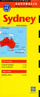
Sydney
Sydney three-in-one map from Periplus, combining a street plan of the city’s central area at 1:10, 000, a plan of its inner suburbs at 1;35, 000 and a map of the Sydney area including the outer suburbs at 1:120, 000.The plan of the city’s central area extends from the northern side of the Sydney Harbour Bridge to the Aussie Stadium and the Sydney Cricket Ground, and east/west from the Rushcutters Bay to Darling Harbour and Cockle Bay.The inner suburbs map extends inland well beyond the Sydney Olympic Park and south to include the Sydney Airport. Both plans highlight numerous places of interest and facilities such as petrol stations, and indicate main traffic arteries. The city centre map also shows one way streets. One overall street index is provided for them.The Sydney area map
names numerous suburbs and districts and highlights main traffic routes across them.
names numerous suburbs and districts and highlights main traffic routes across them.

Product Description
Reviews/Comments
Add New
Vouchers
No voucher codes found.
Do you know a voucher code for this product or supplier? Add it to Insights for others to use.
Do you know a voucher code for this product or supplier? Add it to Insights for others to use.
 Denmark