More From Contributor

£5.95
Sydney in the Wallpaper City Guide series, published by Phaidon & encompassing a collection of pocket-size guides dedicated to the best design elements in major cities. Compiled by experts at the Wallpaper magazine, the guides are widely recognized for appealing to design-conscious travellers & are aimed at those interested in art, design & architecture. Each guide identifies the best bars, restaurants, hotels, places to shop, leisure activities & excursions with a unique emphasis on the finest examples of unusual architecture & design. Each Wallpaper City Guide has the same layout, with separate tabs allowing readers & travellers to access individual sections easily. The tabs consist of Landmarks, Hotels, 24 Hours, Urban Life, Architour, Shopping, Sports & Escapes. High quality colour photographs appear alongside brief descriptions of each hotel, bar or attraction, highlighting distinctive & unusual styles of architecture & design. Extra pages are provided at the back of each guide, allowing readers to record their own notes & sketches. ...
Archived Product
£24.50
Sydney & the towns of the Blue Mountains in a paperback, A4 format directory, covering the city & its suburbs at three different scales, with an extensive index of streets plus various services & places of interest, transport diagrams, etc. The atlas covers the city centre & North Sydney on highly detailed maps at 1:4, 450, the inner suburbs at 1:8, 900, plus the outer suburbs mostly at 1:17, 800. The maps clearly indicate different types of the road & street network, from freeways & motorways to individual local streets annotated with selected house numbers for easier identification of addresses. The maps show one way streets, traffic lights & roundabouts, locations of red light cameras, clearance on bridges, etc. Public transport lines: bus Transitway, Monorail & tramway routes are shown with names of stops. Also shown are postal codes. Each map has an arrow indicating direction from its area towards the city centre & main highways are annotated with distances from the GPO. Extensive index in addition to streets contains lists of various services, facilities & places of interest, from Aged Care to Wineries. There is also a list of fixed speed cameras. Additional plates provide maps of Sydney ...
Archived Product
£7.95
Sydney & Region from Hema with three map panels: a detailed street plan of central Sydney, a map of the city with its outer suburbs & a regional map including the Blue Mountains National Park; plus diagrams of the public transport networks.CITY CENTRE STREET PLAN: Locations of 34 places of interest & 54 hotels are highlighted & cross-referenced to lists in the street index. The plan shows one way streets & indicates shopping centres, & other major buildings or facilities. GREATER SYDNEY MAP (1:100, 000): Parks/national parks & special use areas area are highlighted. Roads are shown with names & where appropriatewith road numbers, railway lines with station names. Symbols show picnic & rest areas, petrol stations, plus camping areas & caravan parks. The map is index & indicates postcodes plus the radius from the city centre in 10-km stages.REGIONAL MAP (1:241, 000): Coverage extends inland to Lithgow to include the Blue Mountains National park, plus along the coast north past Newcastle & south to Wollongong. The map ndicates unsealed roads & give distances on main & selected secondary routes. As on the map of the suburbs, colouring shows national parks & other protected areas & symbols indicate rest areas, camping sites & caravan parks, 24h fuel stations, plus information centres. The map is index & indicates the radius from the city centre in 20-km stages.TRANSPORT DIAGRAMS:A large diagram shows the network of both suburban & intercity rail connections, plus bus & tram services. Also provided is a diagram of the Sydney ferries services.PLEASE NOTE: this title is part of Hema ...
Archived Product
£9.99
Sydney & Region in a series of maps from Hema presenting Australia’s main cities with three maps: a detailed street plan of the central area, a road map of the city with its outer suburbs, plus a map of the wider surrounding region for out-of-town excursions. The Sydney map
Includes::
- An indexed street plan of city centre highlighting locations of 32 places of interest & over 50 hotels.- An indexed road map of Greater Sydney at 1:100, 000, with an index listing locations with their postcodes. Coverage extends inland to Penrith, north beyond Gosford, plus south to include the Royal National Park.- An indexed regional map at 1:241, 000 extending inland to Lithgow to include the Blue Mountain National Park, north beyond Newcastle & south to Wollongong. Plus a smaller regional maps at 1:180, 000 approx. covering the environs of the city inland to Liverpool, north beyond Bona Vale, & south to Cronulla. Both the suburban & the regional maps are indexed & show the road network indicating unsurfaced roads & tracks. Symbols mark roadside rest areas, campsites, accredited information centres, various places of interest, etc. Topography is indicates by names of mountain ranges & selected peaks, plus rivers & lakes; national & state parks, conservation areas & reserves are all highlighted. To see other titles in this series please click on the series link.

...
Archived Product
£4.95
The Sydney Bookplates from Mac & Ninny are fun stickers to label the books, cds & dvds you lend to family & friends, so that they can safely & surely find their way back to you. Sharing your taste in literature, music & film will be easier & a more enjoyable experience. We have all been there, feeling disappointed & wondering who borrowed our favourite book or dvd. From now on, with these bookplates, you can keep track of what you lend & to whom. The packaging contains 12 colourful badges measuring 7.5x 10.5 cm. Write your name & contact details on it & then stick it to the book, cd or film that you want to lend. in addition, the thick card wrapping doubles up as a library record sheet, where you can note who borrowed what & when. The Bookplates from Mac & Ninny are a wonderful idea for book lovers & anyone who likes sharing. Leave your name with fun, colourful & noticeable pictures to remind your friends or family the book is yours &, when they finished with it, you would like to have it back! ...
Archived Product
£7.50
Double-sided with a road & rail map of the whole city & suburbs on one side (1:110, 000, indexed for suburbs), & a more detailed plan of the city centre at 1:10, 000 on the other (see illustration). The central area street map shows one-way routes, post offices, places of worship, car parks, cycling routes, monuments, libraries, accommodation, & many other facilities & places of tourist interest. Indexed for streets. There is also a 1:5, 000 plan of the CBD which identifies buildings. Advice for tourists, information about selected popular sights, accommodation & entertainment listings is also included. ...
Archived Product
£13.99
Sydney in the City Guide Series from Lonely Planet, profiling in comprehensive detail the history, major sights, best places to eat, nightlife, accommodation & shopping possibilities of an extensive range of cities worldwide. Frank & informal in style, the guides are renowned for their appeal to independent travellers & are written & researched by local authors. Each guide is divided into 11 main sections
- Getting Started, Background, Neighbourhoods, Shopping, Eating, Drinking & Nightlife, The Arts, Sports & Activities, Gay & Lesbian, Sleeping & Day Trips & Excursions. The Background section details the history, arts, architecture, environment, media, fashion & government & politics of the city. An
...
Archived Product
£2.99
The Sydney Street Map Wrapping Paper by Lagom Design in orange is an artistic reproduction of the city centre. This is a stylish design which will add an original touch to your gifts. Wrap them with the streets of Sydney! Eco-friendly printed, in England & on FCS approved paper stock. ...
Archived Product
£6.99
Sydney in the City Pack series from AA Publishing; covering an extensive selection of world-wide cities in a handy, pocket-sized laminated format. The guides provde a detailed overview of each destination, with each city organised by district to allow for practical use on the city streets. An introductory section introduces readers to the city, with individual features on a short stay in the city, the Top 25 attractions, shopping by theme, the city by night, eating out & restaurants by cuisine. Each guide is presented in a similar format, exploring the city by geographical area & district. A basic overview map is provided at the start of each section & there is detailed listings information on the principal sights, walks, shops, entertainment & nightlife & restaurants for each area of the city. A Farther Afield section explores the area outside the city limits, with suggestions for possible excursions & day trips. A dedicated accommodation chapter provides information about a range of budget, mid-range & luxury hotels to suit for individual tastes. There is also a Need to Know chapter with practical information on getting there & around, essential facts, language & a timeline of the city. ...
Archived Product

Sydney Borch

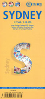
Sydney on a laminated and waterproof tourist map from Borch, combining a selection of street plans at various scales and a road map to cover the environs of the city including the Blue Mountains National Park. The main plan at 1:15, 000 covers the inner districts of the city, extending south and east to include the Centennial Park and Bondi Bay. The plan highlights places of interest, museums, theatres, selected hotels, public transport connections, car parks, one way streets, etc. On the reverse, the city centre (CBD) is shown in even greater detail at 1:7, 500, with prominent individual building named. Top 30 sights in the city are listed and marked on both plans. The map also includes plans of the city with its outer suburbs (1:120, 000), the Homebush Bay Olympic Park area,
and the international airport. A road map of the city’s environs at 1:450, 000 extends eastwards to cover the main sights in the Blue Mountains National Park around Katoomba and Lawson. All the plans and the road map are indexed with lists of streets/localities, parks, sights, etc. Also included is a diagram of the city’s public transport lines, a small map of Australia showing its administrative divisions and time zones, and information on the city’s climate.
RIP - This product is no longer available on our network. It was last seen on 25.09.2019

This page now acts as a permanent archive for this product. Add more information using the comments box below to ensure it can still be found by future generations.

Use our search facility to see if it is available from an alternative contributor.
  • External links may include paid for promotion
  • Availability: Out Of Stock
  • Supplier: Stanfords
  • SKU: 9783866093133
Availability: In Stock
£8.99

Product Description

Sydney on a laminated & waterproof tourist map from Borch, combining a selection of street plans at various scales & a road map to cover the environs of the city including the Blue Mountains National Park. The main plan at 1:15, 000 covers the inner districts of the city, extending south & east to include the Centennial Park & Bondi Bay. The plan highlights places of interest, museums, theatres, selected hotels, public transport connections, car parks, one way streets, etc. On the reverse, the city centre (CBD) is shown in even greater detail at 1:7, 500, with prominent individual building named. Top 30 sights in the city are listed & marked on both plans. The map also

Includes::
plans of the city with its outer suburbs (1:120, 000), the Homebush Bay Olympic Park area, & the international airport. A road map of the city’s environs at 1:450, 000 extends eastwards to cover the main sights in the Blue Mountains National Park around Katoomba & Lawson. All the plans & the road map are indexed with lists of streets/localities, parks, sights, etc. Also included is a diagram of the city’s public transport lines, a small map of Australia showing its administrative divisions & time zones, & information on the city’s climate.

Reviews/Comments

Add New

Intelligent Comparison

Oooops!
We couldn't find anything!
Perhaps this product's unique.... Or perhaps we are still looking for comparisons!
Click to bump this page and we'll hurry up.

Price History

Vouchers

No voucher codes found.
Do you know a voucher code for this product or supplier? Add it to Insights for others to use.

Facebook

Jargon Buster

Blue - A primary colour
Waterproof - Resistant to water, usualy specified by depth in metres
Car - A machine used for transport which runs on roads
Small - something that takes up less space than normal.
Road - a manmade lane or a path that is used to speed up travel.
Laminated - A thin layer of plastic that gives a coating and shine to a material.
Individual - A single separate item or person.
Transport - Something that carries people or goods.

Supplier Information

Stanfords
Stanfords was established in 1853 and opened their iconic Covent Garden flagship store in 1901. They have become the top retailer of maps, travel books and accessories in the UK and arguably offer the largest selection of maps and travel books worldwide. Famous names such as Captain Robert Falcon Scott, Ranulph Fiennes and Michael Palin have purchased from Stanfords. They now have a shop in Bristol and both stores together with other venues operate a calendar of events including talks, book signings and exhibitions. As a specialist map retailer, the map selection is comprehensive and includes road maps, street maps and walking maps from worldwide destinations, as well as a selection of world atlases and wall maps. Books include travel guides and travel literature. Stanfords also stock globes, from miniatures made of blue marble to magnificent floor-standing globes. The website features a selection of interesting articles on travel topics.
Page Updated: 2023-11-12 20:15:36

Community Generated Product Tags

Oh No! The productWIKI community hasn't generated any tags for this product yet!
Menu