
 United Kingdom
 France
 Germany
 Netherlands
 Sweden
 USA
USA
 Italy
Italy
 Spain
Spain
More From Contributor

Swansea And Gower / Abertawe A Gwyr
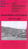
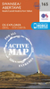
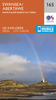
Map No. 159, Swansea and Gower / Abertawe a Gwyr, in the Ordnance Survey Landranger series at 1:50, 000, including Carmarthen/Caerfyrddin, Llandeilo, Kidwelly/Cydweli, Ammanford/Rhydaman, Burry Port/Porth Tywyn, Llanelli, Groseinon, Ty-hen, Drefach, Llanllwch, Morfa Bach, Laugharne, Llansteffan, Mainciau, LLangyndeyrn, Cwrnffrwd, Nantgaredig, Felingwmuchaf, Trapp, Glanaman, Cross Hands, Drefach, Tumble, Five Roads, Carway, Llannon, Cwmcerdinen, Pontarddulais, Clydach, Pinged, Pembrey, Loughor, Pen-clawdd, Upper Killay, Landimore, llangennith, Middleton, Port-Eynon, Penmaen and Southgate, with the western tip of the Brecon Beacons National Park/Parc Cenedlaethol Banncu Brycheiniog, Worms Head/Penrhyn-Gwyr, Mumbles Head and River Loughor/Afon
LLwchwr estuary. Edition C4; Publication date August 2010 This title is also available on our website in a waterproof and tear-resistant version.Maps in this series are only published folded. Stanfords can also print flat versions of Ordnance Survey maps through the OS Select system, centring the map on a location of your choice and with a picture provided by you on the cover. For more information please click on the link at the bottom of this description.About Ordnance Survey
LLwchwr estuary. Edition C4; Publication date August 2010 This title is also available on our website in a waterproof and tear-resistant version.Maps in this series are only published folded. Stanfords can also print flat versions of Ordnance Survey maps through the OS Select system, centring the map on a location of your choice and with a picture provided by you on the cover. For more information please click on the link at the bottom of this description.About Ordnance Survey
Product Description
Reviews/Comments
Add New
Intelligent Comparison
Archived Product
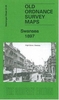
Swansea And Gower / Abertawe A Gwyr 1923 Stanfords
£7.99
Archived Product
Swansea And Gower / Abertawe A Gwyr 1901 Stanfords
£7.99
Archived Product
Swansea And Gower / Abertawe A Gwyr 1830-1831 Stanfords
£7.99
Archived Product
Swansea And Gower / Abertawe A Gwyr WATERPROOF Stanfords
£10.39
Archived Product
Swansea And Gower / Abertawe A Gwyr 1830-1923 (3-map Set) Stanfords
£14.99
Vouchers
No voucher codes found.
Do you know a voucher code for this product or supplier? Add it to Insights for others to use.
Do you know a voucher code for this product or supplier? Add it to Insights for others to use.
 Denmark