
 United Kingdom
 France
 Germany
 Netherlands
 Sweden
 USA
USA
 Italy
Italy
 Spain
Spain
More From Contributor


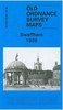


Swaffham 1926
Swaffham in 1926 in a fascinating series of reproductions of old Ordnance Survey plans in the Alan Godfrey Editions, ideal for anyone interested in the history of their neighbourhood or family. Selected towns in Great Britain and Ireland are covered by maps showing the extent of urban development in the last decades of the 19th and early 20th century.In this title: the map is double-sided to give maximum coverage of Swaffham, once known as The Montpelier of England and one of Norfolk's most fashionable centres in the 18th century. The Assembly Rooms in the Market Place, built in 1817, reflect this. Most of the town is covered on this map and features include The Shambles, St Peter & St Paul church, Market Place, London Street, Manor House, Rookery Farm, Ash Close, Lynn Street,
railway and station, Tumbler Hill, Dovehouse Row, cemetery, Shire Hall, Wood Farm. A list of private residents from a 1929 directory is included. About the Alan Godfrey Editions of the 25
railway and station, Tumbler Hill, Dovehouse Row, cemetery, Shire Hall, Wood Farm. A list of private residents from a 1929 directory is included. About the Alan Godfrey Editions of the 25
Product Description
Reviews/Comments
Add New
Intelligent Comparison
Archived Product

Swaffham 1926 Stanfords
£3.50
Vouchers
No voucher codes found.
Do you know a voucher code for this product or supplier? Add it to Insights for others to use.
Do you know a voucher code for this product or supplier? Add it to Insights for others to use.
 Denmark