
 United Kingdom
 France
 Germany
 Netherlands
 Sweden
 USA
USA
 Italy
Italy
 Spain
Spain
More From Contributor
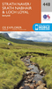


Strathcona Plateau - Buttle Lake ITMB
Strathcona Plateau - Buttle Lake at 1:250, 000 and 1:50, 000 in a series of topographic survey maps of selected areas of British Columbia and the Canadian Rockies from ITMB with cartography from Canada’s national survey organization. Most sheets are printed on light, waterproof and tear- resistant plastic paper.Whilst the Canadian Department of Natural Resources (previously Canada Map Office) decides whether to provide updated pre-printed editions of its survey mapping or switch to print-on-demand only, in 2007 it began co-operating with ITMB on this new series of maps with cartography of the Canadian topographic survey and additional tourist and recreational information provided by ITMB. The maps are double-sided, with either two 1:50, 000 maps combined in one title, or a 1:250, 000
map supplemented by more detailed coverage at 1:50, 000. *In this title:* legend includes points of interests, airports, mines, lodges, camping and recreation sites, wilderness camps, picnic areas, shelters, viewpoints, lighthouses, snowmobiling, swimming, diving, horseback riding, parking, hiking, mountain climbing, mountain biking, tourist information, and more. The map is printed in light, waterproof and tear-resistant plastic paper.
map supplemented by more detailed coverage at 1:50, 000. *In this title:* legend includes points of interests, airports, mines, lodges, camping and recreation sites, wilderness camps, picnic areas, shelters, viewpoints, lighthouses, snowmobiling, swimming, diving, horseback riding, parking, hiking, mountain climbing, mountain biking, tourist information, and more. The map is printed in light, waterproof and tear-resistant plastic paper.
Product Description
Reviews/Comments
Add New
Vouchers
No voucher codes found.
Do you know a voucher code for this product or supplier? Add it to Insights for others to use.
Do you know a voucher code for this product or supplier? Add it to Insights for others to use.
 Denmark