
 United Kingdom
 France
 Germany
 Netherlands
 Sweden
 USA
USA
 Italy
Italy
 Spain
Spain
More From Contributor


Strand
The Strand is a visually appealing 30cm (12) desktop globe mounted on a stylish chrome spindle and full ring maple wood base. The physical topography of the world is beautifully presented and remarkably detailed, whilst political boundaries and place names are subtly outlined in black, allowing for the straightforward identification of locations. A distinctive addition to the home and workplace.
Product Description
Reviews/Comments
Add New
Intelligent Comparison
Archived Product
Strand Stanfords
£99.95
Archived Product
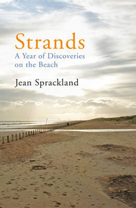
Strands Stanfords
£9.99
Archived Product
Strands Stanfords
£16.99
Archived Product
Scotland Stanfords
£3.99
Archived Product
Scotland Stanfords
£4.99
Archived Product
Scotland Stanfords
£10.39
Archived Product
Strabane Stanfords
£6.50
Archived Product
Scotland Stanfords
£9.50
Vouchers
No voucher codes found.
Do you know a voucher code for this product or supplier? Add it to Insights for others to use.
Do you know a voucher code for this product or supplier? Add it to Insights for others to use.
 Denmark