More From Contributor
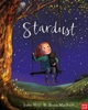
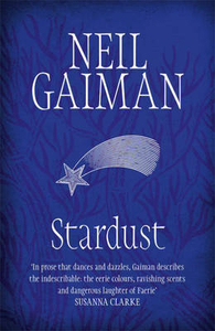
£7.99
Stara Planina Central: Zlatitsa to Kalofer map at 1:50, 000 from Bulgarian publishers Domino, contoured & GPS compatible, with hiking trails, accommodation options including a list of local mountain refuges, etc. The map is double-sided & covers the mountains from just west of Ribaritsa & Zlatitsa eastwards beyond Kalofer to the peak of Zli Vrah. Maps in the Domino series have contours (interval in most titles is 20m or 50m), enhanced by relief shading plus plenty of peak names & additional spot heights. Boundaries of national parks & other protected areas are marked. An overprint highlights both waymarked routes & unmaintained hiking trails. Although not specifically named on them, the maps can be used to follow local sections of the E3, E4 & E8 trans-European long-distance routes. Road network is graded according to width, indicates locations of petrol stations, &

Includes::
local country tracks & paths. Railway lines are shown with stations. Symbols mark locations of hotels & holiday homes, campsites, mountain refuges, shepherd’s huts & hunting lodges, as well as various places of interest & natural sites. Names of towns, villages & main topographic features are in both Cyrillic & Latin alphabet; smaller peaks or rivers & streams are in Cyrillic only. The maps have latitude & longitude grid at intervals of 5’. Map legend

Includes::
English. Most titles also include a list of local mountain refuges with contact details. To see other titles in this series please click on the series link.


...
Archived Product
£7.99
Stara Planina Western: Belogradchik to Berkovita map at 1:50, 000 from Bulgarian publishers Domino, contoured & GPS compatible, with hiking trails, accommodation options including a list of local mountain refuges, etc. The map is double-sided & covers the mountains from the peak of Byala Voda near Belogradchik eastwards to just beyond Berkovita. Maps in the Domino series have contours (interval in most titles is 20m or 50m), enhanced by relief shading plus plenty of peak names & additional spot heights. Boundaries of national parks & other protected areas are marked. An overprint highlights both waymarked routes & unmaintained hiking trails. Although not specifically named on them, the maps can be used to follow local sections of the E3, E4 & E8 trans-European long-distance routes. Road network is graded according to width, indicates locations of petrol stations, &

Includes::
local country tracks & paths. Railway lines are shown with stations. Symbols mark locations of hotels & holiday homes, campsites, mountain refuges, shepherd’s huts & hunting lodges, as well as various places of interest & natural sites. Names of towns, villages & main topographic features are in both Cyrillic & Latin alphabet; smaller peaks or rivers & streams are in Cyrillic only. The maps have latitude & longitude grid at intervals of 5’. Map legend

Includes::
English. Most titles also include a list of local mountain refuges with contact details. To see other titles in this series please click on the series link.


...
Archived Product
£7.99
Stara Planina Western: Berkovita to Zlatitsa map at 1:50, 000 from Bulgarian publishers Domino, contoured & GPS compatible, with hiking trails, accommodation options including a list of local mountain refuges, etc. The map is double-sided & covers the mountains from Varshets (directly north of Sofia) to just beyond Etrepole. Maps in the Domino series have contours (interval in most titles is 20m or 50m), enhanced by relief shading plus plenty of peak names & additional spot heights. Boundaries of national parks & other protected areas are marked. An overprint highlights both waymarked routes & unmaintained hiking trails. Although not specifically named on them, the maps can be used to follow local sections of the E3, E4 & E8 trans-European long-distance routes. Road network is graded according to width, indicates locations of petrol stations, &

Includes::
local country tracks & paths. Railway lines are shown with stations. Symbols mark locations of hotels & holiday homes, campsites, mountain refuges, shepherd’s huts & hunting lodges, as well as various places of interest & natural sites. Names of towns, villages & main topographic features are in both Cyrillic & Latin alphabet; smaller peaks or rivers & streams are in Cyrillic only. The maps have latitude & longitude grid at intervals of 5’. Map legend

Includes::
English. Most titles also include a list of local mountain refuges with contact details. To see other titles in this series please click on the series link.


...
Archived Product
£5.99
Stara Zagora street plan at 1:8, 000 from the Sofia-based publishers Domino, with public transport lines shown with stops, plus on the reverse English language notes about the city & lists of various facilities. On one side is a street plan of Stara Zagora with main street & district names shows in both Cyrillic & Latin alphabet. Smaller streets & names of various important buildings & facilities are in Cyrillic only. The plan shows trolleybus & bus routes with stops & line numbers. Streets are annotated with selected house numbers for easier identification of addresses. Street index is in Cyrillic only. Map legend

Includes::
English. On the reverse are bilingual Bulgarian/ English notes & extensive lists of various facilities in the town, including hotels, banks, shopping centres, car services, etc. Also provided is a street plan of the Starozagorski Mineralni Bani spa 15km north-west of Stara Zagora, plus a regional road map at 1:400, 000.

...
Archived Product
£20.00
We are able to source a wide range flags in many sizes, sewn or printed on 100% Ministry Of Defence Standard Woven & Knitted Polyester. Flags are supplied with rope & toggle. If you would like more information, have a custom size request or cannot find a desired product, please email us at maritime@stanfords.co.uk. We will be glad to help! ...
Archived Product
£11.99
One little girl dreams of being a star. But whether it`s finding Mum`s lost wedding ring or winning the fancy-dress prize, her big sister always shines brighter. Yet for her grandad she is a star &, as he dries her eyes & they both gaze up at the night sky, he tells a story, the story of the beginning of the world. Everything & everyone is made from stardust, & we all shine in different ways. It`s a lesson this little girl will never forget... & one day her dream comes true, & she finally realises her ambition to become an astronaut & fly up to the stars. ...
Archived Product
£11.99
Look up at the night sky, away from city lights, & watch as the stars appear. These pinpricks of light are giant balls of burning gas, millions & millions & millions of kilometres away. So far away that it takes the light thousands of years to reach us. This book, published in collaboration with the Natural History Museum, looks at stardust in space
- the substance that made the planets, that built the Moon, the stars, the comets, the meteorites & the asteroids
- & asks what this dust is & where its journey started.

...
Archived Product
£12.99
With a foreword by Maggie Aderin-Pocock, budding astronomers will love this stunning, new approach to stargazing, featuring ...
Archived Product
£6.98
This 10cm (4) Stargazer Globe comes from the renowned makers of Insight Guides, & now they bring their expertise to mapping the stars! Small in size, big in detail, these tactile mini globes are both fun & educational. The wonderful little globe can be rotated in all directions, with a high-quality metal globe construction, stylish & stable weighted base & the most up-to-date mapping this side of the ozone layer, this wonderful globe makes a perfect addition to any desk, be it office or school. ...
Archived Product
£10.99
Philip`s Stargazer is an excellent starter pack suitable for use in the northern hemisphere, containing three essential items to get the beginner started on the fascinating hobby of astronomy: Philip`s Star Chart: A large attractive wall chart showing the stars & constellations in three superb colour maps. Philip`s Planisphere: A practical starfinder for locating the stars, constellations & planets visible on any night of the year from the UK, Northern Europe & Canada (51.5 degrees North); the star map is drawn by the well-known celestial cartographer Wil Tirion. Philip`s Guide to the Northern Constellations: A 32-page beginner`s guide to the major stars & constellations visible with the naked eye in the northern hemisphere, illustrated with simple `signpost` maps to guide the reader around the night sky, for each season. Additional highlights include information on our Solar System, as well as facts about comets, meteors & the Universe. Written by Robin Scagell (Vice-President of Britain`s Society for Popular Astronomy), this is the perfect introduction to the night sky for beginners. ...
Archived Product

Stardust

A breathtaking and magical novel from master storyteller Neil Gaiman. Life moves at a leisurely pace in the tiny town of Wall - named after the imposing stone barrier which separates the town from a grassy meadow. Here, young Tristran Thorn has lost his heart to the beautiful Victoria Forester and for the coveted prize of her hand, Tristran vows to retrieve a fallen star and deliver it to his beloved. It is an oath that sends him over the ancient wall and into a world that is dangerous and strange beyond imagining...Includes extra material exclusive to this Headline Review edition.
RIP - This product is no longer available on our network. It was last seen on 25.09.2019

This page now acts as a permanent archive for this product. Add more information using the comments box below to ensure it can still be found by future generations.

Use our search facility to see if it is available from an alternative contributor.
  • External links may include paid for promotion
  • Availability: Out Of Stock
  • Supplier: Stanfords
  • SKU: 9780755322824
Availability: In Stock
£8.99

Product Description

A breathtaking & magical novel from master storyteller Neil Gaiman. Life moves at a leisurely pace in the tiny town of Wall
- named after the imposing stone barrier which separates the town from a grassy meadow. Here, young Tristran Thorn has lost his heart to the beautiful Victoria Forester & for the coveted prize of her h&, Tristran vows to retrieve a fallen star & deliver it to his beloved. It is an oath that sends him over the ancient wall & into a world that is dangerous & strange beyond imagining...
Includes: extra material exclusive to this Headline Review edition.

Reviews/Comments

Add New

Intelligent Comparison

Oooops!
We couldn't find anything!
Perhaps this product's unique.... Or perhaps we are still looking for comparisons!
Click to bump this page and we'll hurry up.

Price History

Vouchers

No voucher codes found.
Do you know a voucher code for this product or supplier? Add it to Insights for others to use.

Facebook

Jargon Buster

Hand - A part of the body at the end of the arm
Hand - A pointer which indicates time on a clock face
star - A giant ball of plasma held together by gravity.
deliver - The method by which something is delivered fomr one location to another
Wall - A physical barrier between two areas
World - A physical grouping, commonly used to describe earth and everything associated with ti
Stone - Or Rock is a naturally occuring mineral categorised into three types, Igneous, Sedimentary and Metamorphic
Heart - An organ that pumps blood around the body. Usually related to love.
Exclusive - Something that is not including other things.

Supplier Information

Stanfords
Stanfords was established in 1853 and opened their iconic Covent Garden flagship store in 1901. They have become the top retailer of maps, travel books and accessories in the UK and arguably offer the largest selection of maps and travel books worldwide. Famous names such as Captain Robert Falcon Scott, Ranulph Fiennes and Michael Palin have purchased from Stanfords. They now have a shop in Bristol and both stores together with other venues operate a calendar of events including talks, book signings and exhibitions. As a specialist map retailer, the map selection is comprehensive and includes road maps, street maps and walking maps from worldwide destinations, as well as a selection of world atlases and wall maps. Books include travel guides and travel literature. Stanfords also stock globes, from miniatures made of blue marble to magnificent floor-standing globes. The website features a selection of interesting articles on travel topics.
Page Updated: 2023-11-12 20:15:36

Community Generated Product Tags

Oh No! The productWIKI community hasn't generated any tags for this product yet!
Menu